Category:Old maps of the Gulf of Naples
Media in category "Old maps of the Gulf of Naples"
The following 20 files are in this category, out of 20 total.
-
 Carta Geografica Della Sicilia Prima o sia Regno Di Napoli 04.jpg 6,185 × 9,493; 17.38 MB
-
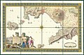 1794 map of the Gulf of Naples.jpg 20,875 × 13,723; 68.42 MB
-
 Golfe de Naples - Roux Joseph - 1804.jpg 1,500 × 1,035; 837 KB
-
 Admiralty Chart No 1728 Italy west coast Gulf of Naples, Published 1867.jpg 11,971 × 8,259; 8.83 MB
-
 Admiralty Chart No 1842 Italy west coast Naples to Cape Bonifati, Published 1894.jpg 12,412 × 8,364; 12.75 MB
-

-

-
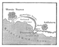
 Die Gartenlaube (1883) b 537 1.jpg 738 × 745; 389 KB
-
 Golfe de Naples Joseph Roux.jpg 700 × 492; 426 KB
-
 Indicazione del piu rimarcabile in Napoli e contorni (5375432737).jpg 1,024 × 605; 413 KB
-
 Lange diercke sachsen europaeische landschaften neapel.jpg 1,258 × 932; 528 KB
-
 Map around Vesuvius 1770 plate6 from William Hamilton.jpg 3,000 × 3,201; 989 KB
-
 Meyers b8 s0263 b2.png 388 × 307; 45 KB
-
 Meyer‘s Zeitungsatlas 004 – Italien mit der dalmatinisch-albanesischen Küste.jpg 7,358 × 6,217; 15.03 MB
-
 Meyer‘s Zeitungsatlas 063 – Das Königreich beider Sicilien, Nördliche Hälfte.jpg 7,386 × 6,217; 17.34 MB
-

-

-
 Tabula Peutingeriana Golfo di Napoli.jpg 796 × 301; 343 KB
-
 The antiquities of Herculaneum (1773) (14590750499).jpg 2,826 × 3,483; 1.89 MB
-
 Vincenzo Bove - Il Vesvvio Acceso. Napoli 1632.jpg 1,300 × 1,000; 302 KB


.jpg)
_b_537_1.jpg)

.jpg)


_(14590750499).jpg)
