Category:Old maps of the Isles of Scilly
Media in category "Old maps of the Isles of Scilly"
The following 18 files are in this category, out of 18 total.
-
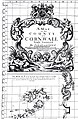 Gascoyne's Map of Cornwall (cartouche and inset).jpg 1,822 × 2,789; 1.22 MB
-
-
 Admiralty Chart No 2565 Trevose Head to Dodman Point, Published 1888.jpg 16,206 × 11,112; 47.24 MB
-
 Ordnance Survey One-Inch Map Sheet 189 Land's End (1946).jpg 8,220 × 9,605; 7.51 MB
-

-
 A new chart of the islands of Scilly... - btv1b53010681j.jpg 8,550 × 6,371; 7.87 MB
-
 Admiralty Chart 34 The Scilly Isles published 1911.jpg 15,950 × 10,918; 15.89 MB
-
 Admiralty Chart No 883 Scilly Isles St. Mary's Road and Crow Sound, Published 1900.jpg 16,464 × 11,345; 56.82 MB
-
 Heathers New and Improved Chart of the Isles of Scilly (8249819881).jpg 2,000 × 1,622; 2.89 MB
-
 Isles of Scilly Ancient Monuments Map O'Neil 1949.jpg 4,604 × 4,025; 2.42 MB
-
 Isles of Scillymap 1946 unedited.png 3,444 × 2,500; 18 MB
-
 Isles of Scillymap 1946.png 4,293 × 3,316; 18.74 MB
-
 Isles of Scillymap1946 sub12,5 million pixels.png 3,833 × 2,961; 15.28 MB
-
 MPH1-368 Scilly Isles, 1707 (11051540513).jpg 4,765 × 3,750; 3.72 MB
-
 Rennell Current map 1793.jpg 5,586 × 4,225; 2.94 MB
-
 Scilly 1753 Thomas Kitchin.jpg 2,445 × 2,112; 1.29 MB
-
 Scilly-bartholomew02 large.jpg 2,017 × 1,536; 2.41 MB
-
 The earth and its inhabitants (1881) (14597736167).jpg 1,930 × 1,654; 625 KB
.jpg)


.jpg)
.jpg)


.jpg)


.jpg)


_(14597736167).jpg)