Category:Old maps of the Red Sea
Subcategories
This category has the following 6 subcategories, out of 6 total.
- 17th-century maps of the Red Sea (10 F)
- 18th-century maps of the Red Sea (22 F)
- 19th-century maps of the Red Sea (58 F)
M
Media in category "Old maps of the Red Sea"
The following 40 files are in this category, out of 40 total.
-
 Chart of Port Mornington, and the adjacent Islands, pub. 1809.JPG 1,303 × 785; 126 KB
-
 1534 Portolan chart of the Mediterranean Sea, Red Sea and the Black Sea by Gaspar Luis Viegas.jpg 11,153 × 8,197; 12.17 MB
-
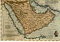
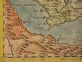 Arabia Felice Nuova Tavola (Arabia), southwest.jpg 800 × 600; 126 KB
-
 Daniel Keller. Asiae nova descriptio (Antwerpen, 1590).L1.jpg 2,327 × 1,861; 610 KB
-

-

-
 Elcatif.jpg 711 × 500; 127 KB
-
 Assab e il basso Mar Rosso.jpg 945 × 1,130; 190 KB
-
 Carta della baia d'Assab e regioni adiacenti (Torino, Guido Cora).jpg 945 × 775; 130 KB
-
 خرائط الدولة السعودية التاريخية 14.jpg 1,972 × 2,876; 181 KB
-
 28-Ägypten und Sueskanal mit Übersichten des mohammedanischen Orients (1915).png 12,387 × 9,917; 167.77 MB
-

-
 A chart of the straits of BABELMANDELL and MOHA NYPL1640652.tiff 7,230 × 5,428; 112.28 MB
-

-
 Admiralty Chart Catalogue 1967 Page 055 Index H3.jpg 8,578 × 6,893; 8.82 MB
-

-
 Admiralty Chart No 923 Harbours and Anchorages in the Red Sea, Published 1886, New Edition 1919.jpg 8,166 × 10,969; 30.76 MB
-

-
 Chart of the environs of Valentia Island, pub. 1809.jpg 1,374 × 893; 120 KB
-
 Chart of the Red Sea from Salaka to Suez, 1804-1805.jpg 920 × 1,179; 121 KB
-

-

-
 Dom João de Castro - Roteiro do Mar Roxo - Bab-El-Mandeb.jpg 1,571 × 1,184; 289 KB
-
 Dom João de Castro - Roteiro do Mar Roxo - Suakin.jpg 1,192 × 1,571; 367 KB
-
 FMIB 43951 Red Sea and its Coral Reefs.jpeg 877 × 1,218; 468 KB
-
 General chart of the East Coast of Africa (Plate 2).jpg 1,047 × 1,489; 234 KB
-
 General chart of the East Coast of Africa (Plate 2, page 12).jpg 4,830 × 6,908; 3.11 MB
-
 Gulf11..JPG 3,072 × 2,304; 2.8 MB
-
 Gulf20..JPG 3,072 × 2,304; 2.95 MB
-
 Italian Eritrea 1922.jpg 2,816 × 2,112; 1.64 MB
-
 Khalili Collection Hajj and Arts of Pilgrimage arc.pt 0454.1.jpg 2,500 × 3,333; 694 KB
-
 Khalili Collection Hajj and Arts of Pilgrimage arc.pt 0454.2.jpg 2,500 × 3,333; 534 KB
-
 Map - Special Collections University of Amsterdam - OTM- HB-KZL 33.11.02.tif 6,372 × 7,434; 135.53 MB
-

-
 Port of Massawa ( Maçua ) in 1541.jpg 457 × 292; 147 KB
-
 Sinai-peninsula-map-ar.jpg 941 × 1,168; 624 KB
-
 Sinai-peninsula-map.jpg 941 × 1,168; 665 KB
-
 Southern Red Sea and Gulf of Aden.jpg 1,957 × 2,809; 1.43 MB
-
 Southern Red Sea Arabian Sea 1922.jpg 2,068 × 2,801; 1.5 MB
-


,_southwest.jpg)
.L1.jpg)
%27_(11001401314).jpg)
%27_(11001228745).jpg)


.jpg)

.png)
)%27_(11217254023).jpg)


.jpg)


.jpg)
.jpg)


_in_1541.jpg)


.jpg)