Category:Old maps of the Sahara
Media in category "Old maps of the Sahara"
The following 25 files are in this category, out of 25 total.
-
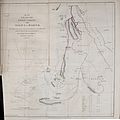 Map of the route of the Soudan Caravan from Assiut to Darfur.jpg 3,342 × 3,354; 3.53 MB
-
 1800 map Afrique by Arrowsmith BPL 15210 detail.png 1,221 × 593; 1.49 MB
-

-

-

-

-

-

-
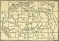
 929 of 'The International Geography. ... Edited by H. R. Mill' (11288760445).jpg 1,400 × 703; 240 KB
-
 Africa, or Greater Libya WDL142.png 1,576 × 1,024; 2.89 MB
-
 Bulletin. 1901-13 (20235835010).jpg 2,150 × 3,646; 1.5 MB
-
 Compte rendu (20663721502).jpg 3,152 × 1,910; 863 KB
-
 Die Sahara und die ihr angrenzenden Gebiete.jpg 1,500 × 1,091; 442 KB
-
 Grandes routes commerciales du Sahara par E Blanc 1889.JPG 5,963 × 3,999; 5.99 MB
-
 Great Trading Routes of the Sahara WDL100.png 1,436 × 1,024; 2.32 MB
-
 Map of the Western Sahara by Ernest George Ravenstein (1834-1913).png 1,366 × 641; 1.39 MB
-
 Map of the Western Sahara WDL479.png 1,192 × 1,024; 2.1 MB
-

-

-

-
 Sahara occidental et central - dressé par A. Meunier... - btv1b53213236s.jpg 12,703 × 9,314; 23.99 MB
-
 Sahara western 1876 map by Ravenstein.jpg 4,930 × 4,233; 5.67 MB
-
 Schizzo Oro-Idrografico del Sahara - DPLA - 833ef29679df6f2efd0166a8b3ff0811.jpg 1,000 × 710; 240 KB
-
-
 Trade routes of the Sahara 1890.png 1,436 × 1,024; 2.32 MB


.jpg)
.jpg)
.jpg)

.jpg)
.jpg)


.png)

_-_DPLA_-_86490754cd79638aa4925fea94a7cfe5.jpg)
_-_DPLA_-_936e4119ee264a6776ed3381cf7c6d41.jpg)


_(14761868186).jpg)
