Category:Old maps of the South Orkney Islands
Media in category "Old maps of the South Orkney Islands"
The following 2 files are in this category, out of 2 total.
-

-
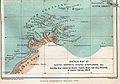 1894 Weddell Map.jpg 335 × 234; 24 KB
| “Old maps” means maps authored over 70 years ago, that is, in 1953 or earlier. |
The following 2 files are in this category, out of 2 total.

