Category:Old maps of the Städteregion Aachen
Use the appropriate category for maps showing all or a large part of the Städteregion Aachen. See subcategories for smaller areas:
| If the map shows | Category to use |
|---|---|
| the Städteregion Aachen on a recently created map | Category:Maps of the Städteregion Aachen or its subcategories |
| the Städteregion Aachen on a map created more than 70 years ago | Category:Old maps of the Städteregion Aachen or its subcategories |
| the history of the Städteregion Aachen on a recently created map | Category:Maps of the history of the Städteregion Aachen or its subcategories |
| the history of the Städteregion Aachen on a map created more than 70 years ago | Category:Old maps of the history of the Städteregion Aachen or its subcategories |
Subcategories
This category has the following 3 subcategories, out of 3 total.
E
O
Media in category "Old maps of the Städteregion Aachen"
The following 9 files are in this category, out of 9 total.
-

-
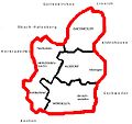
 Aachener Reich.jpg 400 × 323; 28 KB
-
 AachenerRevierKarte.jpg 896 × 1,002; 75 KB
-
 AachenerRevierKarte2.png 896 × 1,002; 223 KB
-
 AachenerRevierKarte2.svg 896 × 1,002; 65 KB
-
 Herzogenrath Karte 1803.jpg 1,368 × 1,649; 491 KB
-
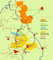
 Nordkreisaachen.JPG 762 × 720; 52 KB
-
 Sgrothen 1573inde.jpg 793 × 753; 110 KB
-
 Sgrothen Limburg Jülich.jpg 1,100 × 1,800; 846 KB
_(cropped).jpg)


