Category:Old maps of the United Kingdom from the Norman B. Leventhal Map Center
Subcategories
This category has the following 3 subcategories, out of 3 total.
Media in category "Old maps of the United Kingdom from the Norman B. Leventhal Map Center"
This category contains only the following file.
-
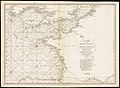 British Channel Bay of Biscay Chart 1780.jpg 9,041 × 6,638; 15.7 MB
