Category:Old maps of the canton of Solothurn
Media in category "Old maps of the canton of Solothurn"
The following 15 files are in this category, out of 15 total.
-

-
-
-
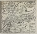
 Zentralbibliothek Solothurn - Der KANTON SOLOTHURN - aa0065.tif 2,948 × 2,440; 20.6 MB
-
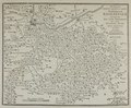
 Zentralbibliothek Solothurn - Des KANTONS BERN NöRDLICHER THEIL Nro 394 - aa0070.tif 3,426 × 2,446; 24 MB
-

-
 Zentralbibliothek Solothurn - Die Cantone Solothurn und Basel - aa0068.tif 2,236 × 2,769; 17.74 MB
-
 Zentralbibliothek Solothurn - CANTONE AARGAU SOLOTHURN BASEL - a0735.tif 3,493 × 2,490; 24.91 MB
-
 Zentralbibliothek Solothurn - VUE DES ALPES prise au dessus de lhermitage A SOLEURE - a0917.tif 3,612 × 2,280; 23.58 MB
-
 Zentralbibliothek Solothurn - CANTON SOLOTHURN - aa0644.tif 3,044 × 2,522; 21.99 MB
-

-
 Karte der Übertragungsleitung Kriegstetten–Solothurn.jpg 1,766 × 643; 233 KB
-
 Karte des Deutschen Reiches (5820669c).jpg 12,345 × 9,263; 55.19 MB
-
 ETH-BIB-Karte "Solothurner See"-Dia 247-13201.tif 3,837 × 2,749; 10.15 MB
-

.jpg)
.jpg)