Category:Oldhamstocks (civil parish)
Scottish parish | |||||
| Upload media | |||||
| Instance of | |||||
|---|---|---|---|---|---|
| Part of |
| ||||
| Named after | |||||
| Location |
| ||||
| Population |
| ||||
| Area |
| ||||
 | |||||
Subcategories
This category has the following 5 subcategories, out of 5 total.
D
- Dunglass bridge (1932) (11 F)
- Dunglass bridge (1994) (5 F)
- Dunglass Viaduct (4 F)
E
Media in category "Oldhamstocks (civil parish)"
The following 200 files are in this category, out of 333 total.
(previous page) (next page)-
 A barley field at Bilsdean - geograph.org.uk - 2446047.jpg 640 × 427; 253 KB
-
 A cabbage field at Springfield - geograph.org.uk - 2162186.jpg 800 × 600; 228 KB
-
-
 A field of Bales at Birnieknowes - geograph.org.uk - 5897753.jpg 2,048 × 1,536; 1.43 MB
-
 A Field of Bales at Birnieknowes - geograph.org.uk - 6262979.jpg 4,467 × 3,350; 3.09 MB
-
 A Field of ripe Oats at Birnieknowes - geograph.org.uk - 6257707.jpg 4,608 × 3,456; 4.16 MB
-
 A Giant Stack of Straw Bales at Birnieknowes - geograph.org.uk - 6267055.jpg 4,512 × 3,384; 4.51 MB
-
 A House by the Village Green in Oldhamstocks - geograph.org.uk - 6167523.jpg 4,592 × 3,448; 3.25 MB
-
 A Little Old House at Bilsdean - geograph.org.uk - 6067106.jpg 4,592 × 3,448; 4.6 MB
-
 A natural arch at Bilsdean - geograph.org.uk - 3182274.jpg 640 × 474; 231 KB
-

-
 A triangulation pillar at Dunglass - geograph.org.uk - 2064506.jpg 640 × 425; 164 KB
-
 A view from fields at Birnieknowes towards Lawfield - geograph.org.uk - 6258650.jpg 4,587 × 3,440; 4.09 MB
-
 A view from Springfield Farm - geograph.org.uk - 6179515.jpg 4,592 × 3,448; 2.7 MB
-
 A1 and the East Coast mainline crossing Dunglass Burn - geograph.org.uk - 6261144.jpg 1,067 × 1,600; 749 KB
-
 A1 northbound - geograph.org.uk - 2955814.jpg 640 × 480; 39 KB
-
 A1 northbound - geograph.org.uk - 2955816.jpg 640 × 446; 40 KB
-
 A1 northbound - geograph.org.uk - 2955817.jpg 640 × 453; 44 KB
-
 A1 northbound - geograph.org.uk - 2955818.jpg 640 × 407; 42 KB
-
 A1 towards Berwick - geograph.org.uk - 3008265.jpg 640 × 480; 53 KB
-
 A1 towards Berwick - geograph.org.uk - 3008280.jpg 640 × 507; 62 KB
-
 A1-NCN76 - geograph.org.uk - 2425044.jpg 640 × 359; 214 KB
-
 Ancient structure, Oldhamstocks - geograph.org.uk - 4473480.jpg 640 × 480; 102 KB
-
 Bales at Birnieknowes Farm - geograph.org.uk - 6262993.jpg 4,518 × 3,388; 2.96 MB
-
 Bales in the Fields at Birnieknowes - geograph.org.uk - 5897718.jpg 2,048 × 1,536; 1.3 MB
-
 Bales in the sunshine at Birnieknowes - geograph.org.uk - 5897746.jpg 2,048 × 1,536; 1.4 MB
-
 Bales lie in the Fields at Birnieknowes - geograph.org.uk - 5897731.jpg 2,048 × 1,536; 1.35 MB
-
 Barley near Oldhamstocks Mains - geograph.org.uk - 5892171.jpg 3,264 × 2,448; 5.16 MB
-
 Bilsdean Creek joining the North Sea - geograph.org.uk - 5833073.jpg 640 × 504; 117 KB
-
 Bilsdean Toll House - geograph.org.uk - 2722931.jpg 4,000 × 3,000; 4.27 MB
-
 Bilsdean, Lodge and Cottages in the snow - geograph.org.uk - 2722847.jpg 4,320 × 3,240; 3.96 MB
-
 Birch tree, Camy Cleugh Rig - geograph.org.uk - 1890454.jpg 640 × 359; 110 KB
-
 Birnieknowes - geograph.org.uk - 2425086.jpg 640 × 480; 256 KB
-
 Birnieknowes Farm in the Snow, Nov 2010 - geograph.org.uk - 2722880.jpg 4,320 × 3,240; 3 MB
-
 Birnieknowes near Thorntonloch - geograph.org.uk - 6261161.jpg 1,600 × 1,067; 655 KB
-

-
 Boundary stone, Wester Dod - geograph.org.uk - 2096356.jpg 480 × 640; 151 KB
-
 Bridges crossing the Dunglass Dean - geograph.org.uk - 5834047.jpg 640 × 473; 110 KB
-
 Bridges over Dunglass Burn - geograph.org.uk - 2470897.jpg 640 × 430; 40 KB
-
 Bridges, Dunglass - geograph.org.uk - 2425107.jpg 640 × 480; 355 KB
-
 Brussels Sprouts at Lawfield - geograph.org.uk - 5892363.jpg 3,264 × 2,448; 3.93 MB
-
 Brussels Sprouts in sunshine - geograph.org.uk - 5892388.jpg 3,264 × 2,448; 4.19 MB
-
 Bungalow and sheep at Cocklaw Farm. - geograph.org.uk - 2162699.jpg 800 × 600; 173 KB
-
 Bus shelter, Bilsdean - geograph.org.uk - 2608059.jpg 640 × 480; 95 KB
-
 Camy Cleugh Rig - geograph.org.uk - 1890436.jpg 640 × 359; 65 KB
-
 Cati Cleugh at Springfield - geograph.org.uk - 5892357.jpg 3,100 × 2,323; 3.28 MB
-
 Cattle in the Shed at Springfield Farm near Oldhamstocks - geograph.org.uk - 6003414.jpg 2,048 × 1,536; 950 KB
-
 Cattle near Branxton - geograph.org.uk - 2162238.jpg 800 × 600; 130 KB
-
 Children's playground, Oldhamstocks - geograph.org.uk - 4473484.jpg 640 × 480; 74 KB
-
 Church at Oldhamstocks - geograph.org.uk - 5917918.jpg 2,048 × 1,536; 1.44 MB
-
 Church in the Village of Oldhamstocks - geograph.org.uk - 6167483.jpg 4,592 × 3,448; 2.2 MB
-
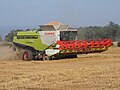
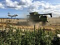
 Claas Combine cuts Wheat at Birnieknowes - geograph.org.uk - 6248234.jpg 4,608 × 3,456; 2.59 MB
-
 Claas Combine Cutting Wheat at Birnieknowes - geograph.org.uk - 6248222.jpg 4,608 × 3,456; 3.16 MB
-
 Claas Combine Harvesting Wheat at Birnieknowes - geograph.org.uk - 6247089.jpg 4,608 × 3,456; 2.64 MB
-
 Claas Combine Harvesting Wheat at Birnieknowes - geograph.org.uk - 6247110.jpg 4,472 × 3,354; 3.33 MB
-
 Claas Combine Harvesting Wheat at Birnieknowes - geograph.org.uk - 6248259.jpg 4,608 × 3,456; 2.57 MB
-
 Claas Combine Harvesting Wheat at Birnieknowes - geograph.org.uk - 6248273.jpg 4,608 × 3,456; 4.03 MB
-
 Claas Combine has finished cutting Wheat at Birnieknowes - geograph.org.uk - 6248283.jpg 4,608 × 3,456; 3.11 MB
-
 Claas Combine working in wheat fields at Birnieknowes - geograph.org.uk - 6248314.jpg 4,608 × 3,456; 4.14 MB
-

-
 Coastal East Lothian , Big Chief Looking Out To Sea - geograph.org.uk - 2498944.jpg 1,200 × 1,600; 288 KB
-

-

-
 Coastal East Lothian , In The Zone Near Thorntonloch - geograph.org.uk - 2499234.jpg 1,600 × 1,200; 293 KB
-

-

-
 Coastal East Lothian , Old Scaly Face - geograph.org.uk - 2498939.jpg 1,600 × 1,200; 312 KB
-

-

-

-

-

-

-
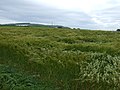
 Coastal stubble - geograph.org.uk - 3644999.jpg 640 × 480; 236 KB
-
 Collegiate Church at Dunglass - geograph.org.uk - 3899395.jpg 3,264 × 2,448; 4.46 MB
-
 Combine at Birnieknowes Farm - geograph.org.uk - 6258620.jpg 4,608 × 3,456; 3.96 MB
-
 Cotoneaster on a Wall at Birnieknowes - geograph.org.uk - 6264598.jpg 4,608 × 3,456; 2.85 MB
-
 Cottages at Birnieknowes beside the Wheat Field - geograph.org.uk - 6257714.jpg 4,608 × 3,456; 4.19 MB
-
 Crags, Dunglass - geograph.org.uk - 1885471.jpg 640 × 480; 166 KB
-
 Crib Burn - geograph.org.uk - 1890459.jpg 640 × 480; 130 KB
-
 Crop field in the wind near Bilsdean - geograph.org.uk - 3008292.jpg 640 × 480; 81 KB
-
 Crop field near Oldhamstocks Mains - geograph.org.uk - 4468645.jpg 640 × 480; 51 KB
-
 Crop field, Oldhamstocks - geograph.org.uk - 4468650.jpg 640 × 480; 71 KB
-
 Cycle path and A1 - geograph.org.uk - 2608035.jpg 640 × 359; 81 KB
-
 Daffodils at Bilsdean Cottages. - geograph.org.uk - 2162308.jpg 800 × 600; 109 KB
-
 Daffodils beside Dunglass Collegiate Church - geograph.org.uk - 6108221.jpg 4,592 × 3,448; 4.23 MB
-
 Daffodils beside Dunglass Collegiate Church - geograph.org.uk - 6108249.jpg 4,592 × 3,448; 5.34 MB
-
 Daffodils beside Dunglass Collegiate Church - geograph.org.uk - 6108267.jpg 4,592 × 3,448; 4.25 MB
-
 Daffodils by the Old Well in Oldhamstocks - geograph.org.uk - 6099494.jpg 2,048 × 1,536; 1.22 MB
-
 Dod Hill - geograph.org.uk - 1766335.jpg 640 × 359; 73 KB
-

-
 Dunglass Collegiate Church - geograph.org.uk - 5375681.jpg 1,200 × 1,600; 648 KB
-
 Dunglass Collegiate Church - geograph.org.uk - 5950558.jpg 1,024 × 768; 239 KB
-
 Dunglass Collegiate Church - geograph.org.uk - 6108235.jpg 4,592 × 3,448; 3.73 MB
-
 Dunglass Collegiate Church in Springtime - geograph.org.uk - 5375683.jpg 1,200 × 1,600; 717 KB
-
 Dunglass Old Bridge - geograph.org.uk - 1885482.jpg 640 × 480; 171 KB
-

-
 East Coast Main Line - geograph.org.uk - 2425080.jpg 640 × 480; 315 KB
-
 East Coast Main Line - geograph.org.uk - 2425097.jpg 640 × 480; 317 KB
-
 East Lodge at Dunglass Estate - geograph.org.uk - 6322751.jpg 4,608 × 3,456; 4.01 MB
-

-
 East Lothian coast at Bilsdean - geograph.org.uk - 5764719.jpg 800 × 600; 157 KB
-
 East Lothian Landscape , Deer on Cocklaw Hill - geograph.org.uk - 2251996.jpg 2,560 × 1,920; 2.25 MB
-
-

-
 East Lothian Townscape , Oldhamstocks - geograph.org.uk - 3506343.jpg 1,600 × 1,200; 572 KB
-
 Entering Oldhamstocks - geograph.org.uk - 4473477.jpg 640 × 480; 73 KB
-
 Ewelairs Hill - geograph.org.uk - 1890444.jpg 640 × 359; 73 KB
-
 Fairy Oven Rock - geograph.org.uk - 4654882.jpg 3,888 × 2,592; 7.04 MB
-
 Fairy Oven Rock Waterfall - geograph.org.uk - 4654875.jpg 3,888 × 2,592; 6.27 MB
-
 Fallen Beech at Dunglass Mains Home Farm - geograph.org.uk - 3899421.jpg 3,264 × 2,448; 5.21 MB
-
 Fallen Ivy - geograph.org.uk - 3899451.jpg 3,264 × 2,448; 5.4 MB
-
 Farm building at Birnieknowes - geograph.org.uk - 5892368.jpg 3,264 × 2,448; 4.94 MB
-
 Farm buildings at Springfield - geograph.org.uk - 5892360.jpg 3,264 × 2,448; 4.68 MB
-
 Farm buildings at Stottencleugh - geograph.org.uk - 5891572.jpg 3,264 × 2,448; 4.04 MB
-
 Farm buildings by the A1 - geograph.org.uk - 5892394.jpg 3,264 × 2,448; 3.83 MB
-
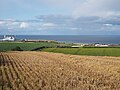
 Farmland at Bilsdean - geograph.org.uk - 6261151.jpg 1,600 × 1,067; 372 KB
-
 Farmland at Ecklaw near Cockburnspath - geograph.org.uk - 5917957.jpg 2,048 × 1,536; 1.17 MB
-

-

-
 Farmland near Lawfield - geograph.org.uk - 6228114.jpg 1,024 × 768; 229 KB
-
 Farmland towards the sea - geograph.org.uk - 3008262.jpg 640 × 480; 56 KB
-
 Farmland towards the sea - geograph.org.uk - 3008274.jpg 640 × 447; 59 KB
-
 Farmland, Linkhead - geograph.org.uk - 2425038.jpg 640 × 359; 233 KB
-
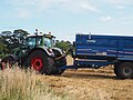
 Fendt Tractor and Stewart Trailer at Birnieknowes - geograph.org.uk - 6257761.jpg 4,608 × 3,456; 3.74 MB
-
 Field and wall at Thorntonloch - geograph.org.uk - 5892470.jpg 3,264 × 2,448; 3.4 MB
-
 Footbridge across the Dunglass Burn - geograph.org.uk - 5833444.jpg 640 × 485; 128 KB
-
 Footbridge along the John Muir Link - geograph.org.uk - 5832990.jpg 640 × 525; 108 KB
-
 Footbridge over Thornton Burn - geograph.org.uk - 4877378.jpg 640 × 480; 291 KB
-
 Ford on Oldhamstocks Burn - geograph.org.uk - 5829242.jpg 3,000 × 2,000; 5.59 MB
-
 Fordson Major Ploughing at Springfield Farm - geograph.org.uk - 6003403.jpg 2,048 × 1,536; 588 KB
-
 Fossil in rock fallen from cliff above - geograph.org.uk - 2531451.jpg 1,800 × 1,200; 450 KB
-
 Game feeding patch near Oldhamstocks - geograph.org.uk - 5892310.jpg 3,264 × 2,448; 3.27 MB
-
 Geese in the Paddock at Springfield Farm - geograph.org.uk - 6179502.jpg 4,592 × 3,448; 2.89 MB
-
 Globe Thistles at Birnieknowes - geograph.org.uk - 6247024.jpg 4,538 × 3,367; 3 MB
-
 Gorse bushes next to the John Muir Way - geograph.org.uk - 5833037.jpg 640 × 480; 127 KB
-
 Grazing near Hoprig - geograph.org.uk - 4473485.jpg 640 × 480; 78 KB
-
 Hall burial aisle, Dunglass Church - geograph.org.uk - 2552101.jpg 1,821 × 2,521; 1.05 MB
-
 Harvest Fields at Birnieknowes - geograph.org.uk - 6262950.jpg 4,478 × 3,358; 3.17 MB
-
 Harvest Fields at Birnieknowes - geograph.org.uk - 6262972.jpg 4,608 × 3,456; 3.06 MB
-
 Harvest Scene at Birnieknowes - geograph.org.uk - 6259511.jpg 4,467 × 3,350; 3.02 MB
-
 Harvest View over fields at Birnieknowes - geograph.org.uk - 6259515.jpg 4,608 × 3,456; 3.56 MB
-
 Harvesting the Kalettes Crop near Oldhamstocks - geograph.org.uk - 6003461.jpg 2,048 × 1,536; 694 KB
-
 High tide on the beach. - geograph.org.uk - 2531381.jpg 1,679 × 1,119; 455 KB
-
 House in Oldhamstocks - geograph.org.uk - 4468654.jpg 640 × 480; 84 KB
-
 House martin nests at Bilsdean - geograph.org.uk - 3182277.jpg 640 × 441; 312 KB
-
 House near Oldhamstocks - geograph.org.uk - 4468658.jpg 640 × 480; 60 KB
-
 Houses in Oldhamstocks - geograph.org.uk - 6101040.jpg 4,592 × 3,448; 4.27 MB
-
 Houses in the main street, Oldhamstocks - geograph.org.uk - 2175547.jpg 4,000 × 3,000; 3.38 MB
-
 Iron gate, Monynut Edge - geograph.org.uk - 1890378.jpg 640 × 359; 92 KB
-
 Jellyfish on the beach at Bilsdean - geograph.org.uk - 2445118.jpg 640 × 427; 239 KB
-
-
 John Deere Combine Cutting Oats at Birnieknowes - geograph.org.uk - 5887989.jpg 2,048 × 1,536; 1.19 MB
-
 John Deere Combine cutting oats at Birnieknowes - geograph.org.uk - 5888002.jpg 2,048 × 1,536; 1.14 MB
-
 John Deere Combine cutting wheat at Birnieknowes - geograph.org.uk - 6257730.jpg 4,608 × 3,456; 3.39 MB
-
 John Deere Combine cutting wheat at Birnieknowes - geograph.org.uk - 6257732.jpg 4,608 × 3,456; 1.98 MB
-
 John Deere Combine cutting wheat at Birnieknowes - geograph.org.uk - 6258501.jpg 4,288 × 2,848; 3.08 MB
-
 John Deere Combine empties his grain into Stewart Trailer - geograph.org.uk - 6257815.jpg 4,608 × 3,456; 4.35 MB
-
 John Deere Combine harvesting at Birnieknowes - geograph.org.uk - 6258503.jpg 4,288 × 2,848; 2.59 MB
-

-
 John Deere Tractor pulls a Trailer at Birnieknowes - geograph.org.uk - 5887993.jpg 2,048 × 1,536; 1.28 MB
-
 John Muir Link approaching Thorntonloch - geograph.org.uk - 4877380.jpg 640 × 480; 264 KB
-
 John Muir Link at Bilsdean Creek - geograph.org.uk - 5833068.jpg 640 × 480; 171 KB
-
 John Muir Link at the Linn - geograph.org.uk - 4878082.jpg 480 × 640; 348 KB
-
 John Muir Link at Thorntonloch beach - geograph.org.uk - 5832996.jpg 640 × 412; 56 KB
-

-

-
 John Muir Way next to the Dunglass Burn - geograph.org.uk - 5833419.jpg 640 × 440; 124 KB
-
-
 Kalettes Crop above Oldhamstocks - geograph.org.uk - 6003425.jpg 2,048 × 1,536; 804 KB
-
 Lawfield Farmhouse - geograph.org.uk - 2395922.jpg 4,320 × 3,240; 4.57 MB
-
 Lay-by on the A1 near Dunglass - geograph.org.uk - 2933929.jpg 640 × 480; 70 KB
-
 Lay-by on the A1 with snack van and toilets - geograph.org.uk - 5892666.jpg 1,024 × 683; 195 KB
-
 Linkshead - geograph.org.uk - 2470911.jpg 517 × 640; 51 KB
-
 Linkshead - geograph.org.uk - 2608030.jpg 640 × 359; 86 KB
-
 Lodge to the Dunglass estate - geograph.org.uk - 4878089.jpg 640 × 480; 301 KB
-
 Long Crib Burn - geograph.org.uk - 1879806.jpg 640 × 480; 141 KB
-
 Long Crib Burn - geograph.org.uk - 1890399.jpg 640 × 480; 116 KB
-
 Looking north from Birnieknowes - geograph.org.uk - 5892376.jpg 2,880 × 2,159; 2.69 MB
-
 Looking towards Branxton farm - geograph.org.uk - 2184227.jpg 4,320 × 3,240; 3.36 MB
-
 Looking towards Lawfield Farm - geograph.org.uk - 2162153.jpg 800 × 600; 114 KB
-
 Looking towards Lawfield Farm - geograph.org.uk - 6258659.jpg 4,608 × 3,456; 4.16 MB
-
 Looking towards St Abbs Head - geograph.org.uk - 2184214.jpg 4,320 × 3,240; 2.96 MB
-
 Low cliffs on the East Lothian coastline - geograph.org.uk - 5833022.jpg 640 × 481; 101 KB
-
 Machines at work in the Wheat Fields at Birnieknowes - geograph.org.uk - 6248297.jpg 4,608 × 3,456; 3.24 MB
-

-
 Mill at Dunglass - geograph.org.uk - 3899547.jpg 3,264 × 2,448; 5.85 MB
-
 Minor road junction - geograph.org.uk - 4473474.jpg 640 × 480; 75 KB
-
 Minor Road just past Lawfield Farm Cottages - geograph.org.uk - 2395932.jpg 4,320 × 3,240; 3.08 MB
-
 Minor road towards Bilsdean - geograph.org.uk - 3008288.jpg 640 × 480; 50 KB
-
 Minor road towards Birnieknowes - geograph.org.uk - 3008295.jpg 640 × 480; 46 KB
-
 Minor road towards Fulfordlees - geograph.org.uk - 4473486.jpg 640 × 480; 83 KB
-
 Minor road towards Oldhamstocks - geograph.org.uk - 4473471.jpg 640 × 480; 71 KB
-
 Minor road towards Oldhamstocks - geograph.org.uk - 4473473.jpg 640 × 480; 87 KB
-

-
 Monynut Edge - geograph.org.uk - 1879798.jpg 640 × 480; 128 KB
-
 Monynut Edge - geograph.org.uk - 1879800.jpg 640 × 359; 73 KB
-
 Moorland, Wester Dodd - geograph.org.uk - 2096363.jpg 640 × 359; 66 KB
-
 Natural arches at Bilsdean - geograph.org.uk - 3182263.jpg 640 × 454; 235 KB
-
 October Cottage, Oldhamstocks - geograph.org.uk - 5892104.jpg 3,264 × 2,448; 4.85 MB


_-_geograph.org.uk_-_2497071.jpg)


&filefrom=Offshore+Survey+at+Thorntonloch+-+geograph.org.uk+-+6359585.jpg#mw-category-media)