<nowiki>Ollersdorf im Burgenland; Ollersdorf im Burgenland; Ollersdorf im Burgenland; Оллерсдорф-им-Бургенланд; Ollersdorf im Burgenland; Ollersdorf im Burgenland; Ollersdorf im Burgenland; Ollersdorf im Burgenland; Оллерсдорф; Barátfalva; Ollersdorf im Burgenland; Ollersdorf im Burgenland; Ollersdorf im Burgenland; اولرشدورف ایم بورگنلند; 布尔根兰州奥勒尔斯多夫; Ollersdorf im Burgenland; Ollersdorf im Burgenland; オラースドルフ・イム・ブルゲンラント; Ollersdorf im Burgenland; Ollersdorf im Burgenland; Ollersdorf im Burgenland; Ollersdorf im Burgenland; Оллерсдорф-ім-Бургенланд; Оллерсдорф-им-Бургенланд; Ollersdorf im Burgenland; Ollersdorf im Burgenland; Ollersdorf im Burgenland; Ollersdorf im Burgenland; Оллерсдорф; Ollersdorf im Burgenland; Ollersdorf im Burgenland; Ollersdorf im Burgenland; comune austriaco; commune autrichienne; municipi d'Àustria; Marktgemeinde im Bezirk Güssing, Burgenland; komunë në Austri; Avusturya'da Burgenland ilinin Güssing ilçesine bağlı belediye; österreichische Gemeinde (Bezirk Güssing); kommun i Burgenland, Österrike; gemeente in Burgenland; kumun aostriat; chemun de l'Austria; község Ausztriában, Burgenland tartományban; komunumo de Aŭstrio; municipality in Güssing District, Burgenland, Austria; بلدية في النمسا; obec v okresu Güssing v Rakousku; trhová obec v Rakúsku; Barátfalva; オラースドルフ; Barátfalva; Barátfalva</nowiki>
Ollersdorf im Burgenland
municipality in Güssing District, Burgenland, Austria


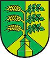 AUT Ollersdorf im Burgenland COA.jpg 349 × 411; 34 KB
 Map at ollersdorf im burgenland.png 400 × 240; 3 KB
 Ollersdorf 3133.jpg 4,666 × 3,114; 3.75 MB
 Ollersdorf im Burgenland im Bezirk GS.png 645 × 645; 24 KB
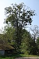 Winterlinde Ollersdorf.JPG 3,648 × 5,472; 7.65 MB


