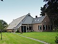
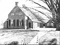
Category:Oosterheerdt, Marum
| Object location | | View all coordinates using: OpenStreetMap |
|---|
 | |||||
| Upload media | |||||
| Instance of | |||||
|---|---|---|---|---|---|
| Location | Marum, Groningen, Netherlands | ||||
| Street address |
| ||||
| Located on street |
| ||||
| Heritage designation |
| ||||
 | |||||
Nederlands: Boerderij Oosterheerdt
|
This is a category about rijksmonument number 28283
|
| Address |
|
Media in category "Oosterheerdt, Marum"
The following 16 files are in this category, out of 16 total.
-
 Aanzicht - Marum - 20151253 - RCE.jpg 1,200 × 788; 226 KB
-
 Aanzicht - Marum - 20151254 - RCE.jpg 1,200 × 788; 233 KB
-
 Achtergevel - Marum - 20455568 - RCE.jpg 1,200 × 900; 91 KB
-
 Boerderij - Marum - 20455572 - RCE.jpg 1,200 × 900; 193 KB
-
 Kopgevel koestal - Marum - 20455569 - RCE.jpg 1,200 × 900; 153 KB
-
 Oosterheerdt.jpg 4,608 × 3,456; 1.71 MB
-
 Tegeltableau - Marum - 20455573 - RCE.jpg 1,200 × 900; 119 KB
-
 Voor- en zijgevel nr. Marum 2 - Marum - 20455565 - RCE.jpg 1,200 × 900; 159 KB
-
 Voorgevel - Marum - 20455563 - RCE.jpg 1,200 × 900; 101 KB
-
 Voorgevel - Marum - 20455571 - RCE.jpg 1,200 × 900; 172 KB
-
 Voorgevel nr. Marum 1 - Marum - 20455566 - RCE.jpg 1,200 × 900; 173 KB
-
 Woonkamerinterieur - Marum - 20455574 - RCE.jpg 1,200 × 900; 61 KB
-
 Zijgevel - Marum - 20455567 - RCE.jpg 1,200 × 900; 92 KB
-
 Zijgevel - Marum - 20455575 - RCE.jpg 1,200 × 900; 131 KB
-
 Zijgevel - Marum - 20455576 - RCE.jpg 1,200 × 900; 134 KB
-
 Zijgevel woning - Marum - 20455570 - RCE.jpg 1,200 × 900; 140 KB


