Category:OpenStreetMap maps of Botswana
Countries of Africa: Algeria · Benin · Botswana · Burkina Faso · Burundi · Cameroon · Chad · Democratic Republic of the Congo · Djibouti · Egypt‡ · Equatorial Guinea · Eswatini · Ethiopia · The Gambia · Ghana · Guinea · Guinea-Bissau · Ivory Coast · Kenya · Libya · Madagascar · Mali · Morocco · Namibia · Niger · Nigeria · Rwanda · São Tomé and Príncipe · Sierra Leone · South Africa · South Sudan · Sudan · Tanzania · Togo · Tunisia · Uganda · Zambia
Other areas: Canary Islands · Madeira
‡: partly located in Africa
Other areas: Canary Islands · Madeira
‡: partly located in Africa
Media in category "OpenStreetMap maps of Botswana"
The following 4 files are in this category, out of 4 total.
-
 Botswana OSM may 2017.png 1,910 × 1,925; 650 KB
-
 Central Kalahari Game Reserve - OSM map.png 872 × 1,009; 90 KB
-
 Gaborone Road Map.png 1,547 × 916; 621 KB
-
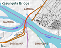 Kazungula Bridge Map.png 1,498 × 1,176; 336 KB


