Category:OpenStreetMap maps of Cuba
Insular countries of the Caribbean: The Bahamas · Cuba · Dominican Republic · Haiti · Jamaica · Saint Kitts and Nevis · Trinidad and Tobago
Continental countries: Colombia · Costa Rica · Guatemala · Mexico · Nicaragua · Panama · Venezuela
Other territories: Cayman Islands · French Guiana · Puerto Rico · United States Virgin Islands
Continental countries: Colombia · Costa Rica · Guatemala · Mexico · Nicaragua · Panama · Venezuela
Other territories: Cayman Islands · French Guiana · Puerto Rico · United States Virgin Islands
Subcategories
This category has only the following subcategory.
G
Media in category "OpenStreetMap maps of Cuba"
The following 56 files are in this category, out of 56 total.
-
 Abel Santamaria (Cuba).jpg 828 × 690; 105 KB
-
 Abel Santamaria-Cayo Hueso-Tuinicu OSM.jpg 853 × 1,353; 334 KB
-
 Aguada de Moya-Chorreron OSM map.jpg 1,025 × 1,042; 267 KB
-
 Arriete-Ciego Montero (OpenStreetMap).png 1,200 × 800; 111 KB
-
 Autopista A1–1 (OpenStreetMap).png 1,305 × 391; 303 KB
-
 Autopista de la Isla de la Juventud (OpenStreetMap).png 1,158 × 658; 177 KB
-
 Autopista del Mediodía (OpenStreetMap).png 1,108 × 1,122; 537 KB
-
 Autopista Havana–Mariel (OpenStreetMap).png 1,562 × 692; 367 KB
-
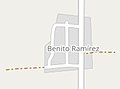 Benito Ramirez OSM.jpg 589 × 438; 41 KB
-
 Báez (Cuba, OpenStreetMap).png 1,180 × 618; 97 KB
-
 Cabezas (Cuba, OpenStreetMap).png 900 × 600; 73 KB
-
 Calabazar de Sagua (OpenStreetMap).png 1,090 × 625; 79 KB
-
 Camagüey station (OpenStreetMap).png 1,210 × 652; 94 KB
-
 Camilo Cienfuegos (Hershey, OpenStreetMap).png 1,200 × 800; 148 KB
-
 Canoa OMS map.png 505 × 451; 41 KB
-
 Cascajal (Cuba, OpenStreetMap).png 1,362 × 830; 125 KB
-
 CCS “Raúl Torres Acosta” in Vega Alta, Cuba.png 969 × 1,679; 663 KB
-
 Chicharón in Vega Alta, Cuba.png 485 × 643; 193 KB
-
 Eastern Cuban Departartment (Map View).jpg 943 × 452; 130 KB
-
 El Cubano OSM.jpg 634 × 704; 188 KB
-
 Esperanza (Villa Clara, OpenStreetMap).png 850 × 580; 103 KB
-
 Falla (Cuba, OpenStreetMap).png 1,270 × 620; 168 KB
-
 Guajén and El Perico - OpenStreetMap.png 428 × 255; 35 KB
-
 Guasimal (Cuba, OpenStreetMap).png 1,170 × 660; 88 KB
-
 Güinía de Miranda (OpenStreetMap).png 940 × 600; 70 KB
-
 Havana Districts Map (2022).svg 512 × 330; 6.01 MB
-
 Havana Districts Map + (2022).svg 512 × 330; 5.88 MB
-
 Jose Maria Perez OSM.jpg 952 × 1,195; 261 KB
-
 Juraguá (OpenStreetMap).png 970 × 635; 127 KB
-
 La Coloma (Cuba, OpenStreetMap).png 1,300 × 970; 209 KB
-
 La Fe (Sandino, OpenStreetMap).png 940 × 610; 56 KB
-
 La Lebiza in El Rincón.png 1,019 × 563; 115 KB
-
 Map of the CPA Benito Ramirez.jpg 886 × 635; 235 KB
-
 Mataguá (OpenStreetMap).png 830 × 585; 57 KB
-
 Mir (Cuba, OpenStreetMap).png 1,060 × 740; 105 KB
-
 OpenStreetMap - Vega Alta - CCS "Mártires de Vueltas".jpg 1,000 × 539; 156 KB
-
 OpenStreetMap of Guerrero, Cuba.png 786 × 546; 36 KB
-
-
 Playa Baracoa (OpenStreetMap).png 1,310 × 670; 152 KB
-

-
 Pueblo Nuevo (Matanzas) - OpenStreetMap.png 538 × 479; 192 KB
-
 Punta Brava (locator in Havana, OpenStreetMap).png 1,114 × 679; 549 KB
-
 Rancho Veloz (OpenStreetMap).png 920 × 640; 70 KB
-
 Rincón OSM.jpg 614 × 388; 99 KB
-
 Santa Clara Beltway (OpenStreetMap).png 1,033 × 577; 566 KB
-
 Santa Lucía (Minas de Matahambre, OpenStreetMap).png 1,240 × 640; 154 KB
-
 Santiago de Cuba station (OpenStreetMap).png 1,344 × 882; 119 KB
-
 Sierra Morena OSM.png 513 × 325; 55 KB
-
 Sola (Cuba, OpenStreetMap).png 1,200 × 600; 111 KB
-
 Surgidero de Batabanó (OpenStreetMap).png 1,250 × 625; 153 KB
-
 Taguayabón (OpenStreetMap).png 1,215 × 620; 68 KB
-
 Uvero (Guamá, OpenStreetMap).png 1,270 × 600; 89 KB
-
 Vega Alta-La Luz-La Quinta-Luis Arcos Bergens OMS map.jpg 722 × 663; 200 KB
-
 Vázquez (Cuba, OpenStreetMap).png 1,280 × 618; 123 KB
-
 Yamanigüey (OpenStreetMap).png 1,175 × 625; 116 KB
-
 Zulueta (Cuba, OpenStreetMap).png 930 × 520; 82 KB
.jpg)


.png)
.png)
.png)
.png)

.png)
.png)
.png)
.png)
.png)

.png)


.jpg)

.png)
.png)

.png)
.png)
.svg)
.svg)

.png)
.png)
.png)


.png)
.png)


.png)

_-_OpenStreetMap.png)
.png)
.png)

.png)
.png)
.png)

.png)
.png)
.png)
.png)

.png)
.png)
.png)
.png)