Category:OpenStreetMap maps of Odesa Oblast
Media in category "OpenStreetMap maps of Odesa Oblast"
The following 16 files are in this category, out of 16 total.
-
 Gulf of odesa texted.jpg 649 × 477; 63 KB
-
 Jardin botanique Odessa carte.png 867 × 582; 537 KB
-
 Location Map of Odessa.png 1,445 × 2,734; 2.06 MB
-
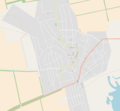
 Map of Artsyz.png 2,017 × 1,869; 925 KB
-
 Map of Bilhorod-Dnistrovskyi.png 2,017 × 1,869; 2.8 MB
-
 Map of Bolhrad.png 2,017 × 1,869; 603 KB
-
 Map of Gulf of Odesa.png 1,096 × 808; 484 KB
-
 Map of Izmail.png 2,062 × 1,910; 1.68 MB
-
 Map of Kiliya.png 2,017 × 1,869; 704 KB
-
 Map of Reni.png 2,017 × 1,869; 1.13 MB
-
 Map of Suvorove.png 2,017 × 1,869; 350 KB
-
 Map of Tarutyne.png 2,017 × 1,869; 741 KB
-
 Map of Tatarbunary.png 2,017 × 1,869; 539 KB
-
 Map of Vylkove.png 2,017 × 1,869; 680 KB
-
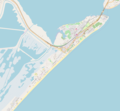 Map of Zatoka.png 2,017 × 1,869; 641 KB
-
 Northern Black Sea Ukraine.png 915 × 533; 276 KB


