Category:OpenStreetMap maps of Piedmont
- Regions of Italy: Abruzzo · Aosta Valley · Apulia · Basilicata · Calabria · Campania · Emilia-Romagna · Friuli-Venezia Giulia · Lazio · Liguria · Lombardy · Marche · Piedmont · Sicily · Trentino-South Tyrol · Tuscany · Umbria · Veneto
Subcategories
This category has the following 2 subcategories, out of 2 total.
C
- OpenStreetMap maps of Cuneo (2 F)
T
- OpenStreetMap maps of Turin (15 F)
Media in category "OpenStreetMap maps of Piedmont"
The following 43 files are in this category, out of 43 total.
-
 Alessandria - mappa rete filoviaria.svg 1,094 × 1,412; 4.41 MB
-
 Amione mappa.png 879 × 694; 486 KB
-
 Arona - mappa vecchio tracciato ferroviario.png 850 × 1,133; 959 KB
-
 Arzola location map.png 559 × 448; 296 KB
-
 Biecai Moie location map.png 881 × 422; 86 KB
-
 Colla location map.png 465 × 564; 325 KB
-
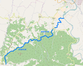
 Fiumetta location map.png 1,280 × 517; 684 KB
-
 Garbagna Novarese OSM 01.png 629 × 560; 105 KB
-
 Garbagna Novarese OSM 02.png 629 × 560; 187 KB
-
 Intra-Premeno railway map.JPG 987 × 1,200; 390 KB
-
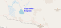 Lago della Brignola map.png 612 × 287; 41 KB
-
 Lago della Perla location map.png 398 × 335; 70 KB
-
 Lago della Vecchia.png 860 × 498; 33 KB
-
 Lago di Lomellina location map.png 680 × 371; 112 KB
-
 Lago di Ortiglieto 2016 mappa.png 952 × 553; 252 KB
-
 Lago di Pianfei location map.png 603 × 598; 263 KB
-
 Lago Raschera location map.png 1,229 × 466; 186 KB
-
 Lago Rascià location map.jpg 586 × 463; 115 KB
-
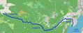
 Lago Revelli location map.jpg 942 × 437; 69 KB
-
 Location map Cittadella of Alessandria.png 10,629 × 7,268; 15.46 MB
-
 Location map foundation of Alessandria.png 13,236 × 10,601; 42.08 MB
-
 Mappa della provincia di Aosta.png 758 × 563; 411 KB
-
 Mappa ferrovia Arona-Novara.png 529 × 532; 294 KB
-
 Mappa ferrovia Asti-Castagnole delle Lanze.png 662 × 522; 232 KB
-
 Mappa ferrovia Mortara-Asti.png 695 × 515; 481 KB
-
 Mappa ferrovia Novara-Alessandria.png 533 × 503; 279 KB
-
 Mappa filovia Alba-Barolo.svg 1,140 × 1,359; 3.06 MB
-
 Mappa filovia Torino-Rivoli.png 1,500 × 929; 2.14 MB
-
 Mappa filovia Torino-Rivoli.svg 1,478 × 915; 3.52 MB
-
 Mappa intersezione A26 - A26-A7.png 934 × 1,040; 312 KB
-
 Mappa intersezione A7 - A26-A7.png 764 × 1,003; 276 KB
-
 Mappa SS 211 bis Variante di Tortona.png 969 × 523; 249 KB
-
 Mappa SS 211 della Lomellina.png 814 × 850; 1.16 MB
-
 Mappa SS 336 dell’Aeroporto della Malpensa.png 967 × 521; 481 KB
-
 Mappa SS 494 Vigevanese.png 682 × 770; 905 KB
-
 Mappa uscita Vercelli ovest.jpg 943 × 1,334; 147 KB
-
 Mongia location map.png 362 × 714; 368 KB
-
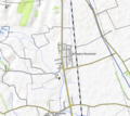
 Novare OSM 01.png 670 × 554; 317 KB
-
 Novare OSM 02.png 670 × 554; 476 KB
-
 Pascone OSM location map.png 1,301 × 1,040; 1.28 MB
-
 Piccola Dora location map.png 766 × 591; 556 KB
-
 Plesna location map.png 1,174 × 739; 601 KB
-
 Qualba location map.png 996 × 494; 448 KB


