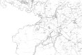
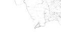
Category:Ordnance Survey 1st series 1:10560, Map of Stirlingshire
Traditional counties (shires) of Scotland: Aberdeenshire · Angus · Argyll ≈ Argyllshire · Ayrshire · Banffshire · Berwickshire · Buteshire · Caithness · Clackmannanshire · Cromartyshire · Dumbartonshire · Dumfriesshire · East Lothian · Fife · Inverness-shire · Kincardineshire · Kinross-shire · Kirkcudbrightshire · Lanarkshire · Midlothian · Moray · Nairnshire · the Orkney Islands ≈ Orkney Islands · Peeblesshire · Perthshire · Renfrewshire · Ross-shire · Roxburghshire · Selkirkshire · the Shetland Islands ≈ Shetland Islands · Stirlingshire · Sutherland · West Lothian · Wigtownshire
Media in category "Ordnance Survey 1st series 1:10560, Map of Stirlingshire"
The following 76 files are in this category, out of 76 total.
-
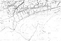
 Map of Stirlingshire Sheet 001, Ordnance Survey, 1864-1866.jpg 10,700 × 7,166; 3.01 MB
-
 Map of Stirlingshire Sheet 001, Ordnance Survey, 1864-1866.tiff 10,700 × 7,166; 219.37 MB
-
 Map of Stirlingshire Sheet 002, Ordnance Survey, 1864-1866.jpg 10,763 × 7,160; 5.32 MB
-
 Map of Stirlingshire Sheet 002, Ordnance Survey, 1864-1866.tiff 10,763 × 7,160; 220.48 MB
-
 Map of Stirlingshire Sheet 003, Ordnance Survey, 1864-1866.jpg 10,756 × 7,173; 3.09 MB
-
 Map of Stirlingshire Sheet 003, Ordnance Survey, 1864-1866.tiff 10,756 × 7,173; 220.74 MB
-
 Map of Stirlingshire Sheet 004, Ordnance Survey, 1864-1866.jpg 10,684 × 7,173; 6.89 MB
-
 Map of Stirlingshire Sheet 004, Ordnance Survey, 1864-1866.tiff 10,684 × 7,173; 219.26 MB
-
 Map of Stirlingshire Sheet 005, Ordnance Survey, 1864-1866.jpg 10,800 × 7,203; 1.44 MB
-
 Map of Stirlingshire Sheet 005, Ordnance Survey, 1864-1866.tiff 10,800 × 7,203; 222.57 MB
-
 Map of Stirlingshire Sheet 006, Ordnance Survey, 1864-1866.jpg 10,739 × 7,188; 6.54 MB
-
 Map of Stirlingshire Sheet 006, Ordnance Survey, 1864-1866.tiff 10,739 × 7,188; 220.85 MB
-
 Map of Stirlingshire Sheet 007, Ordnance Survey, 1864-1866.jpg 10,767 × 7,159; 3.27 MB
-
 Map of Stirlingshire Sheet 007, Ordnance Survey, 1864-1866.tiff 10,767 × 7,159; 220.53 MB
-
 Map of Stirlingshire Sheet 008, Ordnance Survey, 1864-1866.jpg 10,785 × 7,193; 2.29 MB
-
 Map of Stirlingshire Sheet 008, Ordnance Survey, 1864-1866.tiff 10,785 × 7,193; 221.95 MB
-
 Map of Stirlingshire Sheet 009, Ordnance Survey, 1864-1866.jpg 10,767 × 7,160; 3.69 MB
-
 Map of Stirlingshire Sheet 009, Ordnance Survey, 1864-1866.tiff 10,767 × 7,160; 220.56 MB
-
 Map of Stirlingshire Sheet 010, Ordnance Survey, 1864-1866.jpg 10,686 × 7,184; 4.21 MB
-
 Map of Stirlingshire Sheet 010, Ordnance Survey, 1864-1866.tiff 10,686 × 7,184; 219.64 MB
-
 Map of Stirlingshire Sheet 011, Ordnance Survey, 1864-1866.jpg 10,798 × 7,200; 1.19 MB
-
 Map of Stirlingshire Sheet 011, Ordnance Survey, 1864-1866.tiff 10,798 × 7,200; 222.43 MB
-
 Map of Stirlingshire Sheet 013, Ordnance Survey, 1864-1866.jpg 10,763 × 7,158; 9.22 MB
-
 Map of Stirlingshire Sheet 013, Ordnance Survey, 1864-1866.tiff 10,763 × 7,158; 220.42 MB
-
 Map of Stirlingshire Sheet 014, Ordnance Survey, 1864-1866.jpg 10,715 × 7,173; 7.5 MB
-
 Map of Stirlingshire Sheet 014, Ordnance Survey, 1864-1866.tiff 10,715 × 7,173; 219.89 MB
-
 Map of Stirlingshire Sheet 015, Ordnance Survey, 1864-1866.jpg 10,686 × 7,096; 8.24 MB
-
 Map of Stirlingshire Sheet 015, Ordnance Survey, 1864-1866.tiff 10,686 × 7,096; 216.95 MB
-
 Map of Stirlingshire Sheet 016, Ordnance Survey, 1864-1866.jpg 10,654 × 7,161; 8.43 MB
-
 Map of Stirlingshire Sheet 016, Ordnance Survey, 1864-1866.tiff 10,654 × 7,161; 218.28 MB
-
 Map of Stirlingshire Sheet 017, Ordnance Survey, 1864-1866.jpg 10,706 × 7,122; 12.82 MB
-
 Map of Stirlingshire Sheet 017, Ordnance Survey, 1864-1866.tiff 10,706 × 7,122; 218.15 MB
-
 Map of Stirlingshire Sheet 018, Ordnance Survey, 1864-1866.jpg 10,734 × 7,182; 5.35 MB
-
 Map of Stirlingshire Sheet 018, Ordnance Survey, 1864-1866.tiff 10,734 × 7,182; 220.56 MB
-
 Map of Stirlingshire Sheet 019, Ordnance Survey, 1864-1866.jpg 10,797 × 7,199; 1.17 MB
-
 Map of Stirlingshire Sheet 019, Ordnance Survey, 1864-1866.tiff 10,797 × 7,199; 222.38 MB
-
 Map of Stirlingshire Sheet 020, Ordnance Survey, 1864-1866.jpg 10,743 × 7,145; 6.52 MB
-
 Map of Stirlingshire Sheet 020, Ordnance Survey, 1864-1866.tiff 10,743 × 7,145; 219.61 MB
-
 Map of Stirlingshire Sheet 021, Ordnance Survey, 1864-1866.jpg 10,755 × 7,144; 16.96 MB
-
 Map of Stirlingshire Sheet 021, Ordnance Survey, 1864-1866.tiff 10,755 × 7,144; 219.82 MB
-
 Map of Stirlingshire Sheet 022, Ordnance Survey, 1864-1866.jpg 10,614 × 7,043; 7.94 MB
-
 Map of Stirlingshire Sheet 022, Ordnance Survey, 1864-1866.tiff 10,614 × 7,043; 213.87 MB
-
 Map of Stirlingshire Sheet 023, Ordnance Survey, 1864-1866.jpg 10,710 × 7,176; 12.15 MB
-
 Map of Stirlingshire Sheet 023, Ordnance Survey, 1864-1866.tiff 10,710 × 7,176; 219.88 MB
-
 Map of Stirlingshire Sheet 024, Ordnance Survey, 1864-1866.jpg 10,606 × 7,146; 10.44 MB
-
 Map of Stirlingshire Sheet 024, Ordnance Survey, 1864-1866.tiff 10,606 × 7,146; 216.84 MB
-
 Map of Stirlingshire Sheet 025, Ordnance Survey, 1864-1866.jpg 10,597 × 7,145; 2.54 MB
-
 Map of Stirlingshire Sheet 025, Ordnance Survey, 1864-1866.tiff 10,597 × 7,145; 216.62 MB
-
 Map of Stirlingshire Sheet 026, Ordnance Survey, 1864-1866.jpg 10,759 × 7,159; 2.91 MB
-
 Map of Stirlingshire Sheet 026, Ordnance Survey, 1864-1866.tiff 10,759 × 7,159; 220.37 MB
-
 Map of Stirlingshire Sheet 027, Ordnance Survey, 1864-1866.jpg 10,778 × 7,160; 9.82 MB
-
 Map of Stirlingshire Sheet 027, Ordnance Survey, 1864-1866.tiff 10,778 × 7,160; 220.79 MB
-
 Map of Stirlingshire Sheet 028, Ordnance Survey, 1864-1866.jpg 10,641 × 7,148; 9.13 MB
-
 Map of Stirlingshire Sheet 028, Ordnance Survey, 1864-1866.tiff 10,641 × 7,148; 217.61 MB
-
 Map of Stirlingshire Sheet 029, Ordnance Survey, 1864-1866.jpg 10,649 × 7,151; 8.05 MB
-
 Map of Stirlingshire Sheet 029, Ordnance Survey, 1864-1866.tiff 10,649 × 7,151; 217.87 MB
-
 Map of Stirlingshire Sheet 030, Ordnance Survey, 1864-1866.jpg 10,632 × 7,144; 12.87 MB
-
 Map of Stirlingshire Sheet 030, Ordnance Survey, 1864-1866.tiff 10,632 × 7,144; 217.31 MB
-
 Map of Stirlingshire Sheet 031, Ordnance Survey, 1864-1866.jpg 10,682 × 7,168; 7.7 MB
-
 Map of Stirlingshire Sheet 031, Ordnance Survey, 1864-1866.tiff 10,682 × 7,168; 219.06 MB
-
 Map of Stirlingshire Sheet 032, Ordnance Survey, 1864-1866.jpg 10,727 × 7,180; 5.6 MB
-
 Map of Stirlingshire Sheet 032, Ordnance Survey, 1864-1866.tiff 10,727 × 7,180; 220.36 MB
-
 Map of Stirlingshire Sheet 033, Ordnance Survey, 1864-1866.jpg 10,719 × 7,185; 1.74 MB
-
 Map of Stirlingshire Sheet 033, Ordnance Survey, 1864-1866.tiff 10,719 × 7,185; 220.34 MB
-
 Map of Stirlingshire Sheet 034, Ordnance Survey, 1864-1866.jpg 10,801 × 7,202; 1.23 MB
-
 Map of Stirlingshire Sheet 034, Ordnance Survey, 1864-1866.tiff 10,801 × 7,202; 222.56 MB
-
 Map of Stirlingshire Sheet 035, Ordnance Survey, 1864-1866.jpg 10,758 × 7,148; 7.24 MB
-
 Map of Stirlingshire Sheet 035, Ordnance Survey, 1864-1866.tiff 10,758 × 7,148; 220.01 MB
-
 Map of Stirlingshire Sheet 036, Ordnance Survey, 1864-1866.jpg 10,739 × 7,141; 2.36 MB
-
 Map of Stirlingshire Sheet 036, Ordnance Survey, 1864-1866.tiff 10,739 × 7,141; 219.4 MB
-
 Map of Stirlingshire Sheet 201, Ordnance Survey, 1864-1866.jpg 10,794 × 7,196; 1.2 MB
-
 Map of Stirlingshire Sheet 201, Ordnance Survey, 1864-1866.tiff 10,794 × 7,196; 222.23 MB
-
 Map of Stirlingshire Sheet 202, Ordnance Survey, 1864-1866.jpg 10,799 × 7,201; 1.22 MB
-
 Map of Stirlingshire Sheet 202, Ordnance Survey, 1864-1866.tiff 10,799 × 7,201; 222.48 MB
-
 Map of Stirlingshire Sheet 218, Ordnance Survey, 1864-1866.jpg 10,800 × 7,197; 1.16 MB
-
 Map of Stirlingshire Sheet 218, Ordnance Survey, 1864-1866.tiff 10,800 × 7,197; 222.38 MB


