Category:Orford, Suffolk
village and civil parish in Suffolk, England  | |||||
| Upload media | |||||
| Instance of | |||||
|---|---|---|---|---|---|
| Location |
| ||||
| Said to be the same as | Orford (Wikimedia duplicated page, civil parish) | ||||
 | |||||
Nederlands: Orford is een klein stadje in het bestuurlijke gebied Suffolk Coastal, in het Engelse graafschap Suffolk met ongeveer 700 inwoners.
Polski: Orford – miasto w Anglii, w hrabstwie Suffolk, w dystrykcie Suffolk Coastal. Leży 27 km na wschód od miasta Ipswich i 132 km na północny wschód od Londynu. W 2001 miasto liczyło 690 mieszkańców.
Subcategories
This category has the following 18 subcategories, out of 18 total.
B
C
- Chantry Farm, Orford (5 F)
- Orford Craft Shop (4 F)
- The Crown and Castle, Orford (8 F)
H
- Havergate Island (11 F)
I
J
- The Jolly Sailor, Orford (11 F)
K
- The Kings Head, Orford (17 F)
M
- Orford Methodist Church (7 F)
O
- The Old Friary, Orford (2 F)
- Orford Quay (19 F)
- Orford Town Hall (4 F)
- Orford War Memorial, Suffolk (2 F)
P
- Pump Street Bakery (3 F)
R
- Richardson's Smokehouse (4 F)
W
- The Watch House, Orford (3 F)
Pages in category "Orford, Suffolk"
This category contains only the following page.
Media in category "Orford, Suffolk"
The following 200 files are in this category, out of 576 total.
(previous page) (next page)-
 'Cobra Mist' building at Orford Ness - geograph.org.uk - 6276438.jpg 800 × 489; 86 KB
-
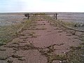 'End Of The Road' Orford Ness - geograph.org.uk - 292812.jpg 640 × 480; 92 KB
-

-

-
 'Lady Florence' on the River Ore - geograph.org.uk - 5825877.jpg 640 × 398; 53 KB
-
 'Power' service station, Orford - geograph.org.uk - 2947687.jpg 1,600 × 985; 279 KB
-
 002osd000000026u00277000.jpg 4,075 × 3,420; 1.46 MB
-
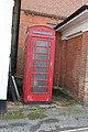 1030846 - Orford, K6 phone box.jpg 4,000 × 6,000; 9.95 MB
-
 1030872 - Orford, 117 Castle Hill.jpg 6,000 × 4,000; 9.09 MB
-
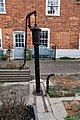 1377123 - Orford, Water pump.jpg 4,000 × 6,000; 11.6 MB
-
 3 Quay Street, Orford - geograph.org.uk - 2243852.jpg 640 × 480; 83 KB
-
 A fine brick house in Market Hill, Orford - geograph.org.uk - 4052369.jpg 1,536 × 1,022; 899 KB
-
 Allotments from Orford Castle - geograph.org.uk - 3889299.jpg 800 × 600; 64 KB
-
 Along the Sea Wall, Orford (27949200163).jpg 3,597 × 2,667; 6.84 MB
-
 Along the Sea Wall, Orford (28280558030).jpg 4,617 × 1,303; 3.95 MB
-
 Along the Sea Wall, Orford (28280648030).jpg 3,206 × 2,258; 6.5 MB
-
 Along the Sea Wall, Orford (28564729875).jpg 3,648 × 1,539; 5.69 MB
-
 Along the Sea Wall, Orford (28564923025).jpg 3,648 × 2,736; 6.24 MB
-
 Appleton-Alb345b.1Cropped.jpg 2,892 × 2,001; 740 KB
-
 Arriving on Orfordness - geograph.org.uk - 5532631.jpg 480 × 640; 55 KB
-
 Ash Carr across a drilled field - geograph.org.uk - 4361905.jpg 1,024 × 768; 436 KB
-
 AWRE - Laboratory 5 - geograph.org.uk - 5532664.jpg 480 × 640; 46 KB
-
 AWRE - Laboratory 6 - geograph.org.uk - 5532668.jpg 640 × 640; 69 KB
-

-
 B1084 enters Orford - geograph.org.uk - 3550891.jpg 3,648 × 2,736; 1.55 MB
-
 B1084 from the entrance to Newton Broadway - geograph.org.uk - 4361816.jpg 1,024 × 768; 456 KB
-
 B1084 Quay Street, Orford - geograph.org.uk - 2608964.jpg 3,072 × 2,304; 1.3 MB
-
 B1084 south of Five Cross Ways - geograph.org.uk - 3550884.jpg 3,648 × 2,736; 1.25 MB
-

-
 Bailey Bridge (24042240401).jpg 3,648 × 2,736; 3.36 MB
-

-
 Bailey Bridge Views Towards the Pagodas (23496594184).jpg 3,587 × 2,655; 2.8 MB
-
 Bailey Bridge Views Towards the Pagodas (23496604144).jpg 3,611 × 2,687; 2.02 MB
-
 Bailey Bridge Views Towards the Pagodas (23757023589).jpg 3,648 × 2,736; 2.03 MB
-
 Bailey Bridge Views Towards the Pagodas (24016722052).jpg 3,581 × 2,647; 2.32 MB
-
 Baker's Lane, Orford - geograph.org.uk - 4054115.jpg 1,152 × 1,536; 1,001 KB
-
 Bank of the River Ore - geograph.org.uk - 1758319.jpg 800 × 600; 169 KB
-

-
 Beyond these gates lies Cobra Mist - geograph.org.uk - 5532647.jpg 480 × 640; 71 KB
-
 Black Tower Generator House - geograph.org.uk - 2601019.jpg 800 × 531; 111 KB
-
 Blackstacks Reach - geograph.org.uk - 577981.jpg 640 × 480; 62 KB
-
 Block of houses in Daphne Road, Orford - geograph.org.uk - 4054080.jpg 1,536 × 1,152; 1.12 MB
-
 Boat on the River Ore - geograph.org.uk - 926897.jpg 640 × 469; 48 KB
-
 Boat on the River Ore at Orford - geograph.org.uk - 6279720.jpg 800 × 490; 74 KB
-
 Boat Study - geograph.org.uk - 933131.jpg 640 × 480; 87 KB
-
 Boats and buildings, Orford - geograph.org.uk - 2947640.jpg 1,600 × 908; 308 KB
-
 Boats and buoys - geograph.org.uk - 1396293.jpg 640 × 392; 43 KB
-
 Boats at Orford - geograph.org.uk - 3389166.jpg 640 × 480; 95 KB
-
 Boats at Orford Sailing Club - geograph.org.uk - 5825882.jpg 640 × 537; 101 KB
-
 Boats near the quay - Orford, Suffolk - geograph.org.uk - 5638814.jpg 1,600 × 900; 373 KB
-
 Boats old and new - geograph.org.uk - 661424.jpg 640 × 427; 79 KB
-
 Boats stored above the HWM - geograph.org.uk - 4361869.jpg 1,024 × 768; 224 KB
-
 Boats stored above the HWM - geograph.org.uk - 4361875.jpg 1,500 × 753; 321 KB
-
 Bomb in the Room - geograph.org.uk - 2601625.jpg 800 × 531; 72 KB
-
 Bridge over Stony Ditch - geograph.org.uk - 2601452.jpg 800 × 531; 101 KB
-
 Bridleway at Millfield Cottages, Orford - geograph.org.uk - 4052173.jpg 1,536 × 1,025; 1,007 KB
-
 Building last used as the NAAFI - geograph.org.uk - 5532644.jpg 640 × 480; 71 KB
-
 Buildings at Orford Quay, Orford, Suffolk - geograph.org.uk - 5638825.jpg 1,600 × 900; 211 KB
-
 Bullockshed Lane junction with Ferry Road - geograph.org.uk - 3558900.jpg 3,493 × 2,559; 1.34 MB
-
 Bush in Orford recreation ground - geograph.org.uk - 3891002.jpg 800 × 600; 207 KB
-
 Bushes in Orford recreation ground - geograph.org.uk - 3891019.jpg 800 × 600; 262 KB
-
 C J Martin's Boatyard, Orford - geograph.org.uk - 2575692.jpg 3,648 × 2,736; 3.37 MB
-
 Car park at Orford - geograph.org.uk - 5163887.jpg 640 × 479; 172 KB
-
 Carved bargeboards in Ferry Road, Orford - geograph.org.uk - 4052345.jpg 1,536 × 1,152; 928 KB
-
 Catamaran coming up the River Ore - geograph.org.uk - 2167900.jpg 640 × 480; 111 KB
-

-
 Chantry Farm nameplate - geograph.org.uk - 4361839.jpg 1,024 × 768; 352 KB
-
 Chantry Marshes - geograph.org.uk - 3305865.jpg 1,024 × 766; 114 KB
-
 Chantry Point - geograph.org.uk - 4022229.jpg 640 × 427; 127 KB
-
 Close up of part of Lab 4 - geograph.org.uk - 927329.jpg 480 × 640; 105 KB
-
 Coastal path south of Orford - geograph.org.uk - 4022207.jpg 640 × 427; 131 KB
-
 Concrete Blast Wall - geograph.org.uk - 2601421.jpg 800 × 531; 126 KB
-
 Concrete Blocks on the Shingle - geograph.org.uk - 927369.jpg 640 × 480; 74 KB
-
 Concrete Blocks on the Shingle - geograph.org.uk - 927370.jpg 640 × 476; 76 KB
-
 Cottages at numbers 66 & 67 Quay Street, Orford, Suffolk.jpg 5,760 × 3,840; 15.58 MB
-
 Cottages in Quay Street - geograph.org.uk - 5083168.jpg 4,288 × 2,848; 5.41 MB
-
 Cottages in Quay Street, Orford - geograph.org.uk - 2946145.jpg 1,600 × 1,057; 426 KB
-
 Cottages on Quay Street - geograph.org.uk - 3638416.jpg 2,048 × 1,536; 523 KB
-
 Cottages on Quay Street - geograph.org.uk - 6497768.jpg 1,280 × 853; 1.03 MB
-
 Cottages set back from Quay Street, Orford - geograph.org.uk - 4052384.jpg 1,536 × 1,152; 1.16 MB
-
 Cottages, numbers 64 & 65 Quay Street, Orford, Suffolk.jpg 5,448 × 3,632; 19.04 MB
-
 Cottages, Quay Street, Orford - geograph.org.uk - 1962928.jpg 640 × 427; 145 KB
-
 Crabbing at Orford - geograph.org.uk - 3389171.jpg 640 × 480; 86 KB
-
 Cracking Mud on the Foreshore - geograph.org.uk - 926522.jpg 480 × 640; 84 KB
-
 Crocus in Orford recreation ground - geograph.org.uk - 3890979.jpg 800 × 600; 224 KB
-
 Cuckold's Point from Chantry Point - geograph.org.uk - 4022246.jpg 640 × 427; 118 KB
-
 Cut Mark Orford 108 Front Street - geograph.org.uk - 5440589.jpg 2,231 × 2,231; 2.44 MB
-
 Cut Mark Orford Ness Stores Building - geograph.org.uk - 5368892.jpg 2,459 × 2,461; 4.71 MB
-
 Cut Mark Orford No 48 Church Street - geograph.org.uk - 5061310.jpg 1,920 × 1,920; 645 KB
-

-
 Daffodils opposite Orford Castle park - geograph.org.uk - 3891033.jpg 800 × 600; 226 KB
-

-

-
 Date and crest on building in Market Hill, Orford - geograph.org.uk - 4054107.jpg 1,536 × 1,152; 1,023 KB
-
 Decaying Boats on the Ore Foreshore - geograph.org.uk - 926501.jpg 480 × 640; 57 KB
-
 Derelict Bomb Ballistics Tower, Orford Ness - geograph.org.uk - 5926255.jpg 1,600 × 1,064; 507 KB
-
 Derelict Bomb Ballistics Tower, Orford Ness - geograph.org.uk - 6401229.jpg 1,600 × 1,063; 438 KB
-
 Derelict day cruiser - geograph.org.uk - 4361881.jpg 1,024 × 768; 241 KB
-
 Derelict fence, Orford Ness - geograph.org.uk - 4238254.jpg 640 × 425; 148 KB
-
 Derelict military buildings on Orford Ness - geograph.org.uk - 6429809.jpg 1,600 × 1,064; 556 KB
-
 Derelict military buildings on Orford Ness - geograph.org.uk - 6429810.jpg 1,600 × 1,064; 608 KB
-

-

-
 Dock and beached boats at Orford - geograph.org.uk - 5163885.jpg 640 × 479; 144 KB
-
 Dock at Orford - geograph.org.uk - 5163883.jpg 640 × 479; 134 KB
-

-
 Drilled field and farm track - geograph.org.uk - 4361900.jpg 1,024 × 768; 370 KB
-

-
 Entering Orford on Ferry Road - geograph.org.uk - 2608915.jpg 3,072 × 2,304; 1.28 MB
-
 Entrance to Laboratory 1 - Orford Ness - geograph.org.uk - 5899361.jpg 4,650 × 3,635; 3.37 MB
-
 Eroded Road - geograph.org.uk - 2600980.jpg 800 × 531; 149 KB
-
 Evergreen Oak in Orford Castle park - geograph.org.uk - 3889329.jpg 800 × 600; 177 KB
-
 Fallen Roof - geograph.org.uk - 2601562.jpg 800 × 531; 114 KB
-
 Farm track to Town Marshes - geograph.org.uk - 4361898.jpg 1,024 × 768; 388 KB
-
 Fence at Town Marshes - geograph.org.uk - 6276444.jpg 800 × 605; 145 KB
-
 Fencing - geograph.org.uk - 4479186.jpg 1,024 × 768; 217 KB
-
 Ferry has priority sign, Orford - geograph.org.uk - 3891130.jpg 600 × 800; 84 KB
-
 Ferry Road in Orford - geograph.org.uk - 6280941.jpg 800 × 532; 127 KB
-
 Ferry Road, Orford - geograph.org.uk - 4361824.jpg 1,024 × 768; 316 KB
-
 Ferry Road, Orford - geograph.org.uk - 5897257.jpg 5,184 × 3,660; 4.76 MB
-
 Fisheries information board in Orford car park - geograph.org.uk - 4361864.jpg 1,024 × 768; 529 KB
-
 Fisheries information board in Orford car park - geograph.org.uk - 4361865.jpg 768 × 1,024; 523 KB
-
 Fishermen's Huts (27948654113).jpg 2,796 × 2,103; 4.45 MB
-
 Fishing boat at Orford (15021705059).jpg 3,120 × 2,119; 2.93 MB
-
 Fishing boats and yachts - geograph.org.uk - 5356771.jpg 3,008 × 2,000; 1.4 MB
-
 Footbridge over a drainage ditch - geograph.org.uk - 4361928.jpg 1,024 × 768; 377 KB
-
 Footpath across the marsh at Chantry Point, Orford - geograph.org.uk - 4056259.jpg 1,152 × 1,536; 1.12 MB
-
 Footpath And Footbridge - geograph.org.uk - 4479190.jpg 1,024 × 768; 134 KB
-
 Footpath beside the River Ore at Orford - geograph.org.uk - 4056265.jpg 1,536 × 1,152; 1.08 MB
-
 Footpath to the west of Orford Castle - geograph.org.uk - 4055143.jpg 1,536 × 1,152; 1.11 MB
-
 Foreshore near Orford Quay - geograph.org.uk - 1755961.jpg 800 × 601; 156 KB
-
 Foreshore of the River Ore at Orford Quay - geograph.org.uk - 6477045.jpg 1,799 × 1,199; 281 KB
-
 Former perimeter fence to the Orford Ness military site - geograph.org.uk - 5927363.jpg 1,600 × 1,064; 371 KB
-
 Former Thames Barge - geograph.org.uk - 2601654.jpg 800 × 531; 104 KB
-
 Fresh water pipe to Orford Ness - geograph.org.uk - 2167935.jpg 640 × 480; 115 KB
-
 Front Street in Orford - geograph.org.uk - 6279740.jpg 800 × 403; 81 KB
-

-
 Gedgrave Road, Orford - geograph.org.uk - 4361819.jpg 1,024 × 768; 364 KB
-
 Getting Ready to Hitch Up - geograph.org.uk - 4195514.jpg 640 × 463; 69 KB
-
 Good Hope Orford - geograph.org.uk - 4047993.jpg 640 × 480; 89 KB
-
 GR postbox and ER K6 telephone box - geograph.org.uk - 4361855.jpg 768 × 1,024; 288 KB
-

-
 Grazing marsh on Orford Ness - geograph.org.uk - 5928254.jpg 1,600 × 1,064; 468 KB
-
 Grazing marsh on Orford Ness - geograph.org.uk - 5928322.jpg 1,600 × 1,064; 349 KB
-
 Halfway Reach along the River Ore - geograph.org.uk - 6276415.jpg 800 × 573; 100 KB
-

-
 Harbour at Orford - geograph.org.uk - 4145076.jpg 4,320 × 3,240; 4.16 MB
-
 Harbour office - geograph.org.uk - 5061874.jpg 640 × 480; 60 KB
-
 Hassock in Orford Church - geograph.org.uk - 5900665.jpg 4,918 × 3,581; 5.29 MB
-
 Headstone of John Green of Orford - geograph.org.uk - 5199192.jpg 3,456 × 2,592; 3.97 MB
-
 High Street - geograph.org.uk - 3558896.jpg 3,429 × 2,606; 2.22 MB
-
 High Street and Doctor's Lane, Orford - geograph.org.uk - 4054100.jpg 1,536 × 1,152; 1,003 KB
-
 High Street Orford - geograph.org.uk - 1329371.jpg 640 × 480; 104 KB
-
 High Voltage Cable Marker - geograph.org.uk - 4195517.jpg 640 × 480; 85 KB
-
 Hose tower at Orford fire station - geograph.org.uk - 4052180.jpg 1,536 × 1,024; 901 KB
-
 House - geograph.org.uk - 4479589.jpg 1,024 × 768; 173 KB
-
 House from the quay - geograph.org.uk - 3389168.jpg 480 × 640; 97 KB
-
 House on the quayside at Orford - geograph.org.uk - 4361878.jpg 1,024 × 768; 296 KB
-
 Houses in Quay Street - geograph.org.uk - 5083185.jpg 4,288 × 2,848; 6.35 MB
-
 Huts on Havergate Island - geograph.org.uk - 4023589.jpg 427 × 640; 132 KB
-
 In Orford churchyard - geograph.org.uk - 5151622.jpg 1,024 × 732; 1.01 MB
-
 Ivy covered trees in Orford - geograph.org.uk - 3889845.jpg 800 × 600; 249 KB
-
 Junction along Ferry Road - geograph.org.uk - 6280955.jpg 800 × 558; 118 KB
-
 Junction of Daphne Road and Burnt Lane, Orford - geograph.org.uk - 4054091.jpg 1,536 × 1,152; 957 KB
-
 Laboratory One - geograph.org.uk - 2601352.jpg 800 × 531; 140 KB
-

-
 Lighthouse Oil Store (28533349106).jpg 2,420 × 1,394; 2.17 MB
-
 Line Of Trees - geograph.org.uk - 4387164.jpg 1,024 × 768; 262 KB
-
 Lions at the door of Castle Antiques - geograph.org.uk - 4361856.jpg 1,024 × 768; 448 KB
-
 Lodge Farm north of Orford - geograph.org.uk - 6281101.jpg 800 × 520; 102 KB
-
 Lonely VW camper, Orford - geograph.org.uk - 2947675.jpg 656 × 800; 190 KB
-

-

-
 Looking Across the Shingle Banks - geograph.org.uk - 927354.jpg 640 × 483; 78 KB
-
 Looking across to Orford from the jetty on Orford Ness - geograph.org.uk - 6431316.jpg 1,064 × 1,600; 536 KB
-
 Looking Along the Bank Defences - geograph.org.uk - 925608.jpg 480 × 640; 90 KB
-
 Looking Along the Foreshore - geograph.org.uk - 925595.jpg 640 × 480; 78 KB
-
 Looking back at Orford from the river wall - geograph.org.uk - 4361914.jpg 1,024 × 768; 280 KB
-
 Looking back to Orford from Orford Ness - geograph.org.uk - 5899378.jpg 5,016 × 3,763; 4.38 MB
-
 Looking back towards Orford from Orfordness - geograph.org.uk - 2619502.jpg 3,018 × 2,070; 5.04 MB
-
 Looking north from Orford Ness Lighthouse - geograph.org.uk - 6398754.jpg 1,600 × 1,064; 333 KB
-
 Looking towards Orford from the Ness - geograph.org.uk - 6431311.jpg 1,600 × 1,064; 480 KB
-
 Looking towards Orford Quay - geograph.org.uk - 926306.jpg 640 × 480; 58 KB
-

-
 Looking upstream on the River Ore - geograph.org.uk - 926893.jpg 640 × 480; 47 KB
-
 Lookout Station - geograph.org.uk - 2600973.jpg 800 × 531; 118 KB
-
 Low tide at Orford - geograph.org.uk - 5151389.jpg 768 × 1,024; 798 KB
-
 Low tide at Orford - geograph.org.uk - 661405.jpg 640 × 426; 95 KB
-
 Market Hill in Orford - geograph.org.uk - 6280918.jpg 800 × 535; 83 KB
-
 Market Hill, Orford (2) - geograph.org.uk - 2947671.jpg 1,600 × 1,201; 393 KB
-
 Market Hill, Orford - geograph.org.uk - 2946141.jpg 1,600 × 1,066; 403 KB
-
 Market Hill, Orford - geograph.org.uk - 4054109.jpg 1,536 × 1,152; 1,024 KB
-
 Market Place, Orford - geograph.org.uk - 2947656.jpg 1,600 × 1,127; 281 KB
-
 Metal and the Lighthouse - geograph.org.uk - 2601003.jpg 547 × 800; 118 KB
-
 Military Testing Facilities - geograph.org.uk - 2601417.jpg 800 × 531; 117 KB
-
 Millennium beacon - geograph.org.uk - 4361604.jpg 768 × 1,024; 392 KB
-
 Millfield Cottages by Ipswich Road - geograph.org.uk - 5897252.jpg 4,964 × 3,465; 3.82 MB
-
 Molehills in Orford Castle park - geograph.org.uk - 3889233.jpg 800 × 600; 126 KB
-
 Moored boat on the River Ore - geograph.org.uk - 6279686.jpg 800 × 556; 81 KB
-
 Moored boats on the Foreshore - geograph.org.uk - 926518.jpg 640 × 463; 60 KB


.jpg)
.jpg)
.jpg)
.jpg)


.jpg)

.jpg)
.jpg)
.jpg)
.jpg)


.jpg)
.jpg)


.jpg)


_-_geograph.org.uk_-_2947671.jpg)


.jpg)