Category:Ormiston, East Lothian
village in East Lothian, Scotland, UK  | |||||
| Upload media | |||||
| Instance of | |||||
|---|---|---|---|---|---|
| Location |
| ||||
| Population |
| ||||
| Elevation above sea level |
| ||||
 | |||||
Subcategories
This category has the following 3 subcategories, out of 3 total.
O
- Ormiston Market Cross (11 F)
R
Media in category "Ormiston, East Lothian"
The following 91 files are in this category, out of 91 total.
-
 Avenue House, in 2024....5 The Wynd, Ormiston.jpg 8,000 × 6,000; 10.77 MB
-
 Beech House, Ormiston - geograph.org.uk - 1885470.jpg 1,024 × 768; 129 KB
-
 Cockburn Hall - geograph.org.uk - 2259235.jpg 640 × 480; 166 KB
-
 Cockburn Hall and War Memorial - geograph.org.uk - 3548577.jpg 2,560 × 1,920; 896 KB
-
 Cycle route near Ormiston - geograph.org.uk - 720129.jpg 640 × 480; 134 KB
-
 Entering Ormiston - geograph.org.uk - 4431977.jpg 1,024 × 682; 273 KB
-
 Grandstand at Ormiston - geograph.org.uk - 1885430.jpg 1,024 × 768; 111 KB
-
 Hillview House, Ormiston - geograph.org.uk - 1885474.jpg 1,024 × 768; 115 KB
-
 Kingfisher Bridge - geograph.org.uk - 1134792.jpg 640 × 480; 151 KB
-
 Leopard's Bane, Doronicum pardalianches - geograph.org.uk - 177276.jpg 640 × 431; 166 KB
-
 Leopard's Bane, Doronicum pardalianches - geograph.org.uk - 177278.jpg 527 × 640; 144 KB
-
 Limeylands Crescent - geograph.org.uk - 1885434.jpg 1,024 × 768; 104 KB
-
 Limeylands Road - geograph.org.uk - 2259237.jpg 640 × 480; 198 KB
-
 Limeylands Road - geograph.org.uk - 2259238.jpg 640 × 480; 202 KB
-
 Main Street - geograph.org.uk - 3548517.jpg 2,560 × 1,920; 2.03 MB
-
 Main Street - geograph.org.uk - 3548518.jpg 2,557 × 1,876; 806 KB
-
 Main Street, Ormiston - geograph.org.uk - 4431988.jpg 1,024 × 682; 160 KB
-
 Main Street, Ormiston - geograph.org.uk - 5114561.jpg 1,024 × 576; 341 KB
-
 Melangynas - Flickr - S. Rae.jpg 1,596 × 1,216; 690 KB
-
 Melinda - Flickr - S. Rae.jpg 813 × 720; 409 KB
-
 OHA New Build.jpg 800 × 533; 509 KB
-
 Ormiston - geograph.org.uk - 748830.jpg 640 × 480; 103 KB
-
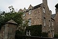
 Ormiston Hall.jpg 500 × 317; 47 KB
-
 Ormiston Main Street.jpg 3,872 × 2,592; 1.53 MB
-
 Ormiston Parish Church. - geograph.org.uk - 1001970.jpg 640 × 480; 129 KB
-
 Ormiston Primary School - geograph.org.uk - 3548582.jpg 2,560 × 1,920; 1.91 MB
-
 Ormiston Railway Station - geograph.org.uk - 748948.jpg 640 × 480; 147 KB
-
 Ormiston Sewage Works. - geograph.org.uk - 19699.jpg 640 × 387; 54 KB
-
 Ormiston War Memorial - geograph.org.uk - 3548579.jpg 1,872 × 2,544; 1.12 MB
-
 Ormiston, East Lothian (1).jpg 3,888 × 2,592; 3.66 MB
-
 Ormiston, East Lothian (11).jpg 2,592 × 3,888; 3.95 MB
-
 Ormiston, East Lothian (12).jpg 3,888 × 2,592; 3.62 MB
-
 Ormiston, East Lothian (13).jpg 2,592 × 3,888; 4.38 MB
-
 Ormiston, East Lothian (14).jpg 3,888 × 2,592; 4.66 MB
-
 Ormiston, East Lothian (15).jpg 3,888 × 2,592; 3.6 MB
-
 Ormiston, East Lothian (16).jpg 3,888 × 2,592; 4.16 MB
-
 Ormiston, East Lothian (17).jpg 3,888 × 2,592; 5 MB
-
 Ormiston, East Lothian (18).jpg 3,888 × 2,592; 4.19 MB
-
 Ormiston, East Lothian (19).jpg 3,888 × 2,592; 4.04 MB
-
 Ormiston, East Lothian (2).jpg 2,592 × 3,888; 4.12 MB
-
 Ormiston, East Lothian (20).jpg 3,888 × 2,592; 3.8 MB
-
 Ormiston, East Lothian (4).jpg 3,888 × 2,592; 3.47 MB
-
 Ormiston, East Lothian (9).jpg 3,888 × 2,592; 3.16 MB
-
 Pavilion with mural - geograph.org.uk - 1885417.jpg 1,024 × 768; 101 KB
-
 Pipiza luteitarsis (female) - Flickr - S. Rae (5).jpg 838 × 674; 249 KB
-
 Pipiza luteitarsis (female) - Flickr - S. Rae (6).jpg 860 × 682; 211 KB
-
 Pipiza sp. (male) - Flickr - S. Rae (4).jpg 1,203 × 1,008; 403 KB
-
 Pipiza sp. (male) - Flickr - S. Rae (5).jpg 972 × 808; 474 KB
-
 Platycheirus cf. scutatus (male) - Flickr - S. Rae (7).jpg 1,184 × 1,008; 392 KB
-
 Platycheirus cf. scutatus (male) - Flickr - S. Rae (8).jpg 1,028 × 908; 359 KB
-
 Platycheirus cf. scutatus (male) - Flickr - S. Rae (9).jpg 1,324 × 1,204; 515 KB
-
 Play park at Ormiston - geograph.org.uk - 1885410.jpg 1,024 × 768; 142 KB
-
 Post Office, 24, 26 Main Street, Ormiston.jpg 6,000 × 8,000; 12.78 MB
-
 Puddle Burn - geograph.org.uk - 749023.jpg 640 × 480; 158 KB
-
 Saldula sp.^ - on fencepost - Flickr - S. Rae.jpg 1,227 × 1,276; 940 KB
-
 Sargus sp. - Flickr - S. Rae.jpg 936 × 940; 185 KB
-
-
 The Bellyford Burn - geograph.org.uk - 746723.jpg 640 × 480; 137 KB
-

-
 The Hopetoun, Main Street - geograph.org.uk - 3548566.jpg 2,560 × 1,920; 2 MB
-
 Walk Plantation - geograph.org.uk - 720137.jpg 640 × 480; 172 KB
-
 A Row of cottages - geograph.org.uk - 995459.jpg 640 × 480; 49 KB
-
 A strip wood, Winton - geograph.org.uk - 1135944.jpg 640 × 480; 143 KB
-
 All you can eat buffet - for finches - geograph.org.uk - 537201.jpg 640 × 480; 90 KB
-
 Arable land, Tynemount. - geograph.org.uk - 73378.jpg 640 × 480; 53 KB
-
 Barley and its fate - geograph.org.uk - 19695.jpg 640 × 413; 43 KB
-
 Barley stubble - geograph.org.uk - 618836.jpg 480 × 640; 120 KB
-
 Barley, Ormiston - geograph.org.uk - 534154.jpg 640 × 480; 80 KB
-
 Bellyford Pit Bing (coal tip) - geograph.org.uk - 746769.jpg 640 × 480; 79 KB
-
 Bridge over old railway track - geograph.org.uk - 746774.jpg 640 × 480; 102 KB
-
 Bus shelter, Buxley - geograph.org.uk - 618834.jpg 640 × 480; 48 KB
-
 Buxley - geograph.org.uk - 618835.jpg 640 × 480; 69 KB
-

-
 Colliery site - geograph.org.uk - 19698.jpg 480 × 640; 94 KB
-
 Farm lane, Tynemount - geograph.org.uk - 534167.jpg 640 × 480; 92 KB
-
 Farm lane, Tynemount. - geograph.org.uk - 73389.jpg 640 × 480; 70 KB
-
 Farmland, House of Muir - geograph.org.uk - 13019.jpg 640 × 215; 25 KB
-
 Fountainhall Farm Cottages - geograph.org.uk - 77977.jpg 640 × 480; 379 KB
-
 Green lane to Elphinstone - geograph.org.uk - 618839.jpg 640 × 480; 76 KB
-
 Newly mown verges - geograph.org.uk - 534158.jpg 640 × 480; 100 KB
-
 Ormiston Post Office - geograph.org.uk - 292196.jpg 410 × 640; 62 KB
-
 Overgrown gateway - geograph.org.uk - 532623.jpg 640 × 480; 97 KB
-
 Public walkway - geograph.org.uk - 662470.jpg 640 × 480; 118 KB
-
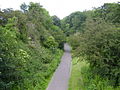
 Railway Walk - geograph.org.uk - 405648.jpg 640 × 480; 169 KB
-
 Ruined Building at Fountainhall - geograph.org.uk - 174188.jpg 640 × 480; 116 KB
-
 Sign Post - geograph.org.uk - 405626.jpg 640 × 480; 174 KB
-
 Spraying, Ormiston. - geograph.org.uk - 73395.jpg 640 × 480; 67 KB
-
 The Coalgate - geograph.org.uk - 534152.jpg 640 × 480; 54 KB
-

-
 The Tyne near Ormiston. - geograph.org.uk - 700972.jpg 640 × 480; 107 KB
-
 Wolfstar - geograph.org.uk - 73401.jpg 640 × 480; 66 KB


.jpg)
.jpg)
.jpg)
.jpg)
.jpg)
.jpg)
.jpg)
.jpg)
.jpg)
.jpg)
.jpg)
.jpg)
.jpg)
.jpg)

_-_Flickr_-_S._Rae_(5).jpg)
_-_Flickr_-_S._Rae_(6).jpg)
_-_Flickr_-_S._Rae_(4).jpg)
_-_Flickr_-_S._Rae_(5).jpg)
_-_Flickr_-_S._Rae_(7).jpg)
_-_Flickr_-_S._Rae_(8).jpg)
_-_Flickr_-_S._Rae_(9).jpg)


_-_geograph.org.uk_-_746769.jpg)


