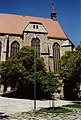
Category:Othmarkirche (Mödling)
| Object location | | View all coordinates using: OpenStreetMap |
|---|
building in Lower Austria, Austria   | |||||
| Upload media | |||||
| Instance of | |||||
|---|---|---|---|---|---|
| Location | Mödling, Mödling District, Lower Austria, Austria | ||||
| Street address |
| ||||
| Architectural style | |||||
| Heritage designation | |||||
 | |||||
Deutsch: Othmarkirche in Mödling
| This category shows the protected monument with the number 32958 in Austria. (Commons, de, Wikidata) |
Deutsch: Pfarrhof bei der Othmarkirche
| This category shows the protected monument with the number 66419 in Austria. (Commons, de, Wikidata) |
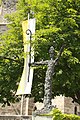
Deutsch: Figur Heiliger Othmar vor der Pfarrkirche
Subcategories
This category has the following 4 subcategories, out of 4 total.
I
K
Media in category "Othmarkirche (Mödling)"
The following 54 files are in this category, out of 54 total.
-
 Anton Hansch Abendstimmugn in Mödling 1850.jpg 3,784 × 3,038; 2.51 MB
-
 Aquä Mödling1732.jpg 2,592 × 3,888; 1.72 MB
-
 Aquädukt mödling + othmarkirche.JPG 3,072 × 4,608; 8.01 MB
-
 GuentherZ 2010-11-20 0063 Moedling Sankt-Othmar-Kirche Gedenktafel Panzerregiment3.jpg 1,800 × 1,345; 1.1 MB
-
 Karner hl. Pantaleon und Pfarrkirche St. Othmar, Mödling.JPG 5,184 × 3,456; 7.8 MB
-
 Moedling st.othmar.JPG 790 × 1,170; 162 KB
-
 Mödling - altes Rathaus (1).JPG 3,543 × 2,363; 6.22 MB
-
 Mödling - St.-Othmar-Kirche.JPG 3,543 × 3,016; 11.07 MB
-
 Mödling 066 (7112876711).jpg 1,635 × 1,094; 1.03 MB
-
 Mödling 1929.JPG 2,592 × 3,888; 1.03 MB
-
 Mödling 2326.jpg 2,592 × 3,888; 757 KB
-
 Mödling 3390.jpg 3,456 × 5,184; 9.58 MB
-
 Mödling 8271.jpg 3,888 × 2,592; 1.29 MB
-
 Mödling 8636.jpg 2,592 × 3,888; 1.64 MB
-
 Mödling 8637.jpg 3,888 × 2,592; 1.64 MB
-
 Mödling 8638.jpg 2,592 × 3,888; 1.02 MB
-
 Mödling 8639.jpg 3,888 × 2,592; 1.65 MB
-
 Mödling 8644.jpg 3,888 × 2,592; 1.39 MB
-
 Mödling 8645.jpg 2,592 × 3,888; 2.03 MB
-
 Mödling 8681.jpg 2,592 × 3,888; 1.58 MB
-
 Mödling Kurpark 6199.JPG 3,456 × 5,184; 7.94 MB
-
 Mödling Sankt Othmar - Grab Löhr 1.jpg 2,855 × 3,466; 8 MB
-
 Mödling Sankt Othmar - Grab Löhr 2.jpg 3,472 × 2,896; 7.96 MB
-
 Mödling Sankt Othmar - Maßwerkfenster 1.jpg 3,720 × 2,820; 8.28 MB
-
 Mödling Sankt Othmar - Maßwerkfenster 2.jpg 2,728 × 3,822; 9.16 MB
-
 Mödling Sankt Othmar - Maßwerkfenster 3.jpg 3,000 × 4,000; 10.16 MB
-
 Mödling Sankt Othmar - Maßwerkfenster 4.jpg 3,688 × 2,776; 8.56 MB
-
 Mödling Sankt Othmar - Ölberg.jpg 1,683 × 2,926; 4.45 MB
-
 Mödling St.Othmarkirche.JPG 2,990 × 2,347; 2.94 MB
-
 Mödling, Pfarrkirche hl. Othmar 1.jpg 4,032 × 3,024; 5.58 MB
-
 Mödling, Pfarrkirche hl. Othmar 2.jpg 4,032 × 3,024; 4.66 MB
-
 Mödling, Pfarrkirche hl. Othmar 3.jpg 4,032 × 3,024; 4.07 MB
-
 Mödling-Grab-Loehr 1358.jpg 4,640 × 6,960; 15.8 MB
-
 Mödling-Grab-Loehr 1359.jpg 6,960 × 4,640; 13.78 MB
-
 Mödling-Othmarkirche 1356.jpg 4,640 × 6,960; 17.84 MB
-
 Mödling-Othmarkirche 1357.jpg 4,640 × 6,960; 16.85 MB
-
 Mödling-Othmarkirche 5499.JPG 3,456 × 5,184; 9.02 MB
-
 Mödling-Othmarkirche 5500.JPG 3,456 × 5,184; 7.32 MB
-
 Mödling-Othmarkirche 8552.jpg 3,456 × 5,184; 10.16 MB
-
 Mödling-Othmarkirche 8553.jpg 3,456 × 5,184; 9.74 MB
-
 Mödling-Othmarkirche 8554.jpg 3,456 × 5,184; 9.46 MB
-
 Mödling-StOthmar 2018.JPG 5,184 × 3,456; 8.36 MB
-
 Mödling-StOthmar 2019.JPG 3,456 × 5,184; 9.51 MB
-
 Mödling.JPG 6,378 × 3,724; 20.98 MB
-
 Othmarkirche (Mödling).jpg 1,024 × 798; 447 KB
-
 Othmarkirche moedling.jpg 1,024 × 768; 435 KB
-
 Othmarkirche Mödling.jpg 3,885 × 2,593; 5.43 MB
-
 P1030877 (2358487765).jpg 1,056 × 594; 177 KB
-
 Peyfuss Mödlinger Waisenrath.jpg 2,758 × 4,295; 972 KB
-
 Raulino – Tower in Mödling.jpg 3,070 × 2,230; 4 MB
-
 Schiff Pfarrkirche hl. Othmar, Mödling 01.JPG 3,456 × 5,184; 7.33 MB
-
 Schiff Pfarrkirche hl. Othmar, Mödling 02.JPG 3,208 × 4,904; 4.72 MB
-
 St.Othmar9.jpg 3,465 × 2,322; 881 KB
-
 Turm Pfarrkirche hl. Othmar, Mödling.JPG 3,456 × 5,184; 4 MB


.JPG)
.jpg)


.jpg)


.jpg)


