Category:Otterford
English: Otterford is a village and civil parish in Somerset, England. It is situated on the Blackdown Hills, south of Taunton in the Taunton Deane district. The village has a population of 384.
village and civil parish in Somerset, United Kingdom  | |||||
| Upload media | |||||
| Instance of | |||||
|---|---|---|---|---|---|
| Location | Somerset West and Taunton, Somerset, South West England, England | ||||
 | |||||
Subcategories
This category has only the following subcategory.
L
Media in category "Otterford"
The following 200 files are in this category, out of 271 total.
(previous page) (next page)-
 Ander's Lane - geograph.org.uk - 4799891.jpg 1,024 × 768; 315 KB
-
 Ander's Lane Farm - geograph.org.uk - 4496729.jpg 800 × 533; 211 KB
-
 Ander's Lane Farm - geograph.org.uk - 4496730.jpg 800 × 533; 167 KB
-
 Anders Lane - geograph.org.uk - 1865706.jpg 640 × 468; 132 KB
-

-

-

-

-
 B3170, Brown Down - geograph.org.uk - 4495647.jpg 800 × 533; 138 KB
-
 B3170, Brown Down - geograph.org.uk - 4496739.jpg 800 × 533; 98 KB
-
 B3170, Brown Down - geograph.org.uk - 4496766.jpg 800 × 533; 138 KB
-
 B3170, North Down - geograph.org.uk - 4496754.jpg 800 × 533; 166 KB
-
 Barn conversion, at Fyfett - geograph.org.uk - 1187166.jpg 640 × 480; 76 KB
-
 Beech trees at Grigg's Farm - geograph.org.uk - 2830362.jpg 3,252 × 2,141; 5.8 MB
-
 Bishops Wood Chapel - geograph.org.uk - 4800019.jpg 1,024 × 768; 155 KB
-
 Bishopswood - geograph.org.uk - 2808161.jpg 3,888 × 2,592; 6.97 MB
-
 Bishopswood - geograph.org.uk - 5336052.jpg 1,024 × 768; 206 KB
-
 Bishopswood Chapel - geograph.org.uk - 1033000.jpg 640 × 401; 67 KB
-
 Bishopswood from the hill - geograph.org.uk - 2808169.jpg 3,888 × 2,592; 5.16 MB
-
 Bishopswood Meadows Lime Kiln - geograph.org.uk - 2830301.jpg 3,888 × 2,592; 5.91 MB
-
 Bishopswood Meadows Nature Reserve - geograph.org.uk - 2830280.jpg 3,888 × 2,592; 4.44 MB
-
 Bishopswood Meadows Nature Reserve - geograph.org.uk - 2830293.jpg 3,888 × 2,592; 7.44 MB
-
 Bluebells above Otterford Lakes - geograph.org.uk - 1865544.jpg 640 × 480; 165 KB
-
 Buildings at Warren's Farm - geograph.org.uk - 1865797.jpg 640 × 437; 91 KB
-
 Candelight Inn, Bishopswood - geograph.org.uk - 4800032.jpg 1,024 × 768; 175 KB
-
 Candlelight Inn by daylight - geograph.org.uk - 4172578.jpg 800 × 600; 141 KB
-
 Candlelight Inn, Bishopswood - geograph.org.uk - 3467257.jpg 480 × 640; 87 KB
-
 Cascade, Top Lake, Otterhead - geograph.org.uk - 1866949.jpg 640 × 480; 148 KB
-
 Channel to Channel (205) - geograph.org.uk - 4177859.jpg 800 × 600; 199 KB
-
 Channel to Channel (206) - geograph.org.uk - 4177871.jpg 800 × 600; 126 KB
-
 Channel to Channel (207) - geograph.org.uk - 4177878.jpg 800 × 600; 193 KB
-
 Channel to Channel (208) - geograph.org.uk - 4177881.jpg 800 × 600; 163 KB
-
 Channel to Channel (209) - geograph.org.uk - 4177892.jpg 800 × 600; 150 KB
-
 Channel to Channel (210) - geograph.org.uk - 4177896.jpg 800 × 600; 180 KB
-
 Channel to Channel (211) - geograph.org.uk - 4177908.jpg 800 × 600; 146 KB
-
 Channel to Channel (212) - geograph.org.uk - 4177918.jpg 800 × 600; 219 KB
-
 Channel to Channel (213) - geograph.org.uk - 4177939.jpg 800 × 600; 137 KB
-
 Channel to Channel (214) - geograph.org.uk - 4177948.jpg 800 × 600; 270 KB
-
 Channel to Channel (215) - geograph.org.uk - 4177953.jpg 800 × 600; 160 KB
-
 Channel to Channel (216) - geograph.org.uk - 4177972.jpg 800 × 600; 142 KB
-
 Channel to Channel (217) - geograph.org.uk - 4177991.jpg 800 × 600; 231 KB
-
 Channel to Channel (218) - geograph.org.uk - 4177996.jpg 800 × 600; 228 KB
-
 Channel to Channel (219) - geograph.org.uk - 4178002.jpg 800 × 600; 178 KB
-
 Channel to Channel (220) - geograph.org.uk - 4178005.jpg 800 × 600; 170 KB
-
 Channel to Channel (221) - geograph.org.uk - 4178014.jpg 800 × 600; 218 KB
-
 Channel to Channel (222) - geograph.org.uk - 4178027.jpg 800 × 600; 204 KB
-
 Channel to Channel (223) - geograph.org.uk - 4178035.jpg 673 × 800; 131 KB
-
 Channel to Channel (224) - geograph.org.uk - 4178042.jpg 800 × 600; 205 KB
-
 Channel to Channel (225) - geograph.org.uk - 4178050.jpg 800 × 600; 232 KB
-
 Channel to Channel (226) - geograph.org.uk - 4178052.jpg 800 × 600; 129 KB
-
 Channel to Channel (227) - geograph.org.uk - 4178064.jpg 800 × 600; 163 KB
-
 Channel to Channel (228) - geograph.org.uk - 4178773.jpg 800 × 624; 193 KB
-
 Channel to Channel (229) - geograph.org.uk - 4178776.jpg 800 × 600; 172 KB
-
 Channel to Channel (230) - geograph.org.uk - 4178777.jpg 800 × 600; 148 KB
-
 Channel to Channel (231) - geograph.org.uk - 4178778.jpg 800 × 600; 191 KB
-
 Channel to Channel (232) - geograph.org.uk - 4178779.jpg 800 × 600; 273 KB
-
 Channel to Channel (233) - geograph.org.uk - 4178783.jpg 800 × 600; 213 KB
-
 Channel to Channel (234) - geograph.org.uk - 4178787.jpg 800 × 600; 125 KB
-
 Channel to Channel (235) - geograph.org.uk - 4178790.jpg 800 × 600; 231 KB
-
 Channel to Channel (236) - geograph.org.uk - 4178793.jpg 800 × 600; 241 KB
-
 Channel to Channel (237) - geograph.org.uk - 4178795.jpg 1,024 × 768; 318 KB
-
 Channel to Channel (238) - geograph.org.uk - 4178799.jpg 800 × 600; 249 KB
-
 Channel to Channel (239) - geograph.org.uk - 4178800.jpg 800 × 600; 226 KB
-
 Channel to Channel (240) - geograph.org.uk - 4178802.jpg 800 × 600; 187 KB
-
 Channel to Channel (241) - geograph.org.uk - 4178804.jpg 800 × 600; 243 KB
-
 Channel to Channel (242) - geograph.org.uk - 4178807.jpg 800 × 600; 164 KB
-
 Channel to Channel (243) - geograph.org.uk - 4178810.jpg 800 × 600; 145 KB
-
 Channel to Channel (244) - geograph.org.uk - 4178812.jpg 800 × 600; 245 KB
-
 Channel to Channel (245) - geograph.org.uk - 4178815.jpg 800 × 600; 216 KB
-
 Channel to Channel (246) - geograph.org.uk - 4178816.jpg 800 × 600; 176 KB
-
 Channel to Channel (249) - geograph.org.uk - 4178825.jpg 800 × 600; 199 KB
-
 Channel to Channel (250) - geograph.org.uk - 4178827.jpg 800 × 600; 205 KB
-
 Channel to Channel (251) - geograph.org.uk - 4178830.jpg 600 × 800; 170 KB
-
 Channel to Channel (263) - geograph.org.uk - 4465587.jpg 800 × 600; 164 KB
-
 Channel to Channel (264) - geograph.org.uk - 4465589.jpg 800 × 600; 198 KB
-
 Channel to Channel (265) - geograph.org.uk - 4465592.jpg 800 × 600; 230 KB
-
 Channel to Channel (266) - geograph.org.uk - 4465594.jpg 800 × 600; 166 KB
-
 Channel to Channel (267) - geograph.org.uk - 4465598.jpg 800 × 600; 200 KB
-
 Channel to Channel (268) - geograph.org.uk - 4465600.jpg 800 × 600; 152 KB
-
 Channel to Channel (269) - geograph.org.uk - 4465604.jpg 800 × 600; 174 KB
-
 Church Farm, Otterford - geograph.org.uk - 1187031.jpg 640 × 480; 72 KB
-
 Churchstanton , Royston Lake - geograph.org.uk - 6366839.jpg 6,000 × 4,000; 7.37 MB
-
 Churchstanton , Top Lake - geograph.org.uk - 6366859.jpg 6,000 × 4,000; 6.8 MB
-
 Churchstanton , Webber's Farm - geograph.org.uk - 6366834.jpg 6,000 × 4,000; 6.38 MB
-
 Churchstanton, a Blackdown crossroads - geograph.org.uk - 173605.jpg 640 × 427; 157 KB
-
 Cottage at Royston Water - geograph.org.uk - 4799907.jpg 1,024 × 768; 253 KB
-
 Cottage on Brown Down - geograph.org.uk - 4800013.jpg 1,024 × 768; 259 KB
-
 Cottages, Holman Clavel - geograph.org.uk - 4736685.jpg 2,810 × 1,879; 859 KB
-
 Crossing the Yarty - geograph.org.uk - 2408758.jpg 480 × 640; 151 KB
-
 Crossroads and bus stop at Prior's Park - geograph.org.uk - 4772571.jpg 1,024 × 717; 264 KB
-
 Crossroads near Prior's Park Farm - geograph.org.uk - 1865315.jpg 640 × 445; 94 KB
-
 Crossroads on the B3170 - geograph.org.uk - 4799956.jpg 1,024 × 796; 175 KB
-

-
 Direction Sign - Signpost near Prior's Park, Widcombe - geograph.org.uk - 6098331.jpg 1,157 × 1,740; 404 KB
-
 Earthworks, at Church Farm, Otterford - geograph.org.uk - 1187017.jpg 640 × 480; 121 KB
-
 Farmyard entrance, Fyfett - geograph.org.uk - 1187615.jpg 640 × 456; 68 KB
-
 Fernleigh, near Fyfett - geograph.org.uk - 1187631.jpg 640 × 480; 75 KB
-

-
 Field by Warren's Farm - geograph.org.uk - 1865806.jpg 640 × 427; 91 KB
-
 Field near Otterford - geograph.org.uk - 1865486.jpg 640 × 480; 114 KB
-
 Field of stubble at Warren's Farm - geograph.org.uk - 4799944.jpg 1,024 × 768; 266 KB
-
 Field, Brown Down - geograph.org.uk - 4495656.jpg 800 × 533; 105 KB
-
 Field, Brown Down - geograph.org.uk - 4496736.jpg 800 × 533; 63 KB
-
 Field, Holman Clavel - geograph.org.uk - 4452549.jpg 2,762 × 1,966; 1.4 MB
-
 Fields, east of Otterford - geograph.org.uk - 1187654.jpg 640 × 448; 77 KB
-
 Foot way at Grigg's Farm - geograph.org.uk - 2830358.jpg 2,681 × 1,891; 5.13 MB
-

-

-
 Fyfett Ford - geograph.org.uk - 4976605.jpg 3,000 × 2,000; 2.26 MB
-
 Fyfett Ford - geograph.org.uk - 4976633.jpg 3,000 × 2,000; 1.95 MB
-
 Fyfett. The path follows this route - geograph.org.uk - 2830371.jpg 3,888 × 2,592; 6.36 MB
-
 Garden walls, Otterhead - geograph.org.uk - 1865562.jpg 640 × 480; 149 KB
-
 Hayne - geograph.org.uk - 3584825.jpg 1,024 × 786; 255 KB
-
 Higher Fyfett - geograph.org.uk - 2409268.jpg 640 × 482; 89 KB
-
 Higher Howstead - geograph.org.uk - 1187128.jpg 640 × 480; 91 KB
-
 Higher Whatley Farm - geograph.org.uk - 2830330.jpg 3,888 × 2,592; 6.65 MB
-
 Hillside above Howstead - geograph.org.uk - 2829104.jpg 640 × 484; 98 KB
-
 Hillside, below Grigg's Farm - geograph.org.uk - 4799859.jpg 1,024 × 768; 248 KB
-
 Holman Clavel - geograph.org.uk - 4775585.jpg 1,024 × 768; 163 KB
-
 Holman Clavel - Royal Blue 1299 (OTT98) rear.JPG 1,024 × 1,366; 579 KB
-
 Isolated house, on North Down - geograph.org.uk - 1187078.jpg 640 × 480; 80 KB
-
 Junction, Holman Clavel - geograph.org.uk - 4736654.jpg 2,112 × 2,816; 1.15 MB
-
 Lane at Howstead - geograph.org.uk - 2829118.jpg 480 × 640; 114 KB
-
 Lane climbing Brown Down - geograph.org.uk - 1865692.jpg 480 × 640; 145 KB
-
 Lane into the Yarty valley - geograph.org.uk - 2829065.jpg 480 × 640; 129 KB
-
 Lane near Higher Yalham Farm - geograph.org.uk - 1865381.jpg 509 × 640; 145 KB
-
 Lane near Higher Yalham Farm - geograph.org.uk - 1865387.jpg 480 × 640; 141 KB
-
 Lane near Otterford - geograph.org.uk - 1867097.jpg 640 × 480; 141 KB
-
 Lane on Brown Down - geograph.org.uk - 1865724.jpg 640 × 480; 147 KB
-
 Lane on North Down - geograph.org.uk - 1865391.jpg 640 × 472; 125 KB
-
 Lane to Royston Water - geograph.org.uk - 1865681.jpg 640 × 480; 143 KB
-
 Line of footpath on Brown Down - geograph.org.uk - 1865746.jpg 640 × 480; 133 KB
-

-
 Lower Whatley Farm - geograph.org.uk - 2830319.jpg 3,888 × 2,592; 5.13 MB
-
 Main street, Bishopswood - geograph.org.uk - 4800024.jpg 1,024 × 800; 167 KB
-
 Meadow by the Yarty - geograph.org.uk - 2409310.jpg 640 × 460; 92 KB
-
 Milestone, Brown Down - geograph.org.uk - 4495645.jpg 533 × 800; 123 KB
-
 Minor road to Howstead - geograph.org.uk - 1187115.jpg 640 × 480; 139 KB
-
 Minor road, near Churchinford - geograph.org.uk - 1183964.jpg 640 × 480; 115 KB
-
 North Down - geograph.org.uk - 4496748.jpg 800 × 533; 79 KB
-
 North Down Plantation - geograph.org.uk - 4496770.jpg 800 × 533; 175 KB
-
 North Down Plantation - geograph.org.uk - 4496790.jpg 800 × 533; 193 KB
-

-

-

-

-

-
 Old Lime Quarry at Bishopswood Meadows - geograph.org.uk - 2830309.jpg 2,592 × 3,888; 4.9 MB
-

-
 Old turnpike, Blackdown Hills - geograph.org.uk - 1865203.jpg 640 × 442; 75 KB
-
 Otterford , Blackdown Hill - geograph.org.uk - 6366957.jpg 6,000 × 4,000; 4.5 MB
-
 Otterford , Car Park - geograph.org.uk - 6366869.jpg 6,000 × 4,000; 6.46 MB
-
 Otterford , Church Farm - geograph.org.uk - 6366883.jpg 6,000 × 4,000; 7.39 MB
-
 Otterford , Church Farm - geograph.org.uk - 6366884.jpg 6,000 × 4,000; 5.75 MB
-
 Otterford , Country Lane - geograph.org.uk - 6366882.jpg 6,000 × 4,000; 6.2 MB
-
 Otterford , Country Road - geograph.org.uk - 6366956.jpg 6,000 × 4,000; 5.82 MB
-
 Otterford , Farm Track - geograph.org.uk - 6366873.jpg 6,000 × 4,000; 7.68 MB
-
 Otterford , Grassy Field - geograph.org.uk - 6366885.jpg 6,000 × 4,000; 6.17 MB
-
 Otterford , Grassy Field - geograph.org.uk - 6366887.jpg 6,000 × 4,000; 4.11 MB
-
 Otterford , Lodge - geograph.org.uk - 6366870.jpg 6,000 × 4,000; 6.84 MB
-
 Otterford , River Otter - geograph.org.uk - 6366890.jpg 4,000 × 6,000; 7.79 MB
-
 Otterford , St Leonard's Church - geograph.org.uk - 6366877.jpg 6,000 × 4,000; 6.48 MB
-
 Otterford , St Leonard's Church - geograph.org.uk - 6366878.jpg 4,000 × 6,000; 6.45 MB
-
 Otterford , St Leonard's Church - geograph.org.uk - 6366880.jpg 6,000 × 4,000; 6.48 MB
-
 Otterford , Top Lake - geograph.org.uk - 6366862.jpg 6,000 × 4,000; 7.41 MB
-
 Otterford , Top Lake - geograph.org.uk - 6366865.jpg 6,000 × 4,000; 6.24 MB
-
 Otterford , Track - geograph.org.uk - 6366866.jpg 6,000 × 4,000; 6.75 MB
-
 Otterford , Track - geograph.org.uk - 6366867.jpg 6,000 × 4,000; 7.67 MB
-
 Otterford , Track - geograph.org.uk - 6366868.jpg 6,000 × 4,000; 6.57 MB
-
 Otterford , Village Scenery - geograph.org.uk - 6366871.jpg 6,000 × 4,000; 4.88 MB
-
 Otterford - geograph.org.uk - 2592902.jpg 1,600 × 1,067; 331 KB
-
 Otterford from the north - geograph.org.uk - 1865459.jpg 640 × 426; 81 KB
-
 Otterford Mill - geograph.org.uk - 4799853.jpg 1,024 × 768; 235 KB
-
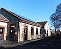 Otterford Parish Hall - geograph.org.uk - 4800017.jpg 1,024 × 835; 175 KB
-
 Otterford, entrance to Yalham Farmhouse - geograph.org.uk - 206380.jpg 640 × 427; 212 KB
-
 Outbuilding, Holman Clavel - geograph.org.uk - 4736673.jpg 1,920 × 1,349; 449 KB
-
 Path near Warren's Farm - geograph.org.uk - 1865783.jpg 640 × 480; 113 KB
-
 Postbox, Royston Water - geograph.org.uk - 1866239.jpg 640 × 480; 115 KB
-
 Prior's Park Farm - geograph.org.uk - 1865285.jpg 520 × 640; 119 KB
-
 Reservoir outflow, Royston Water - geograph.org.uk - 1183530.jpg 640 × 480; 106 KB
-

-
 Road at Royston Water - geograph.org.uk - 1866160.jpg 480 × 640; 134 KB
-
 Road at Widcombe - geograph.org.uk - 1865322.jpg 640 × 480; 111 KB
-
 Road below Fyfett - geograph.org.uk - 2830388.jpg 3,888 × 2,592; 6.13 MB
-
 Road from Staple Hill - geograph.org.uk - 2354061.jpg 640 × 480; 88 KB
-
 Road into Bishopswood - geograph.org.uk - 3467215.jpg 640 × 475; 82 KB
-
 Road junction, Royston Water - geograph.org.uk - 1866110.jpg 640 × 480; 110 KB
-
 Road on Brown Down - geograph.org.uk - 4495809.jpg 800 × 533; 177 KB
-
 Road on Staple Hill - geograph.org.uk - 4496795.jpg 800 × 533; 80 KB
-
 Road to Bishopswood - geograph.org.uk - 4799931.jpg 1,024 × 768; 351 KB
-
 Road to Fyfett - geograph.org.uk - 1187621.jpg 640 × 480; 101 KB
-
 Road to Holman Clavel - geograph.org.uk - 1196634.jpg 640 × 480; 108 KB
-
 Road to Otterford Mill - geograph.org.uk - 2409320.jpg 640 × 382; 74 KB
-
 Road to Robin Hood’s Butts - geograph.org.uk - 1866056.jpg 640 × 480; 123 KB
-
 Robin Hood's Butts - geograph.org.uk - 1187638.jpg 640 × 480; 140 KB
-
 Robin Hood's Butts - geograph.org.uk - 4495651.jpg 800 × 533; 56 KB
-
 Robin Hood's Butts - geograph.org.uk - 4495662.jpg 800 × 533; 130 KB
-
 Robin Hood's Butts - geograph.org.uk - 4496741.jpg 800 × 533; 156 KB
-
 Robin Hood's Butts - geograph.org.uk - 4799946.jpg 1,024 × 768; 294 KB
-
 Royston Water - geograph.org.uk - 1183510.jpg 640 × 480; 96 KB


_-_geograph.org.uk_-_4177859.jpg)
_-_geograph.org.uk_-_4177871.jpg)
_-_geograph.org.uk_-_4177878.jpg)
_-_geograph.org.uk_-_4177881.jpg)
_-_geograph.org.uk_-_4177892.jpg)
_-_geograph.org.uk_-_4177896.jpg)
_-_geograph.org.uk_-_4177908.jpg)
_-_geograph.org.uk_-_4177918.jpg)
_-_geograph.org.uk_-_4177939.jpg)
_-_geograph.org.uk_-_4177948.jpg)
_-_geograph.org.uk_-_4177953.jpg)
_-_geograph.org.uk_-_4177972.jpg)
_-_geograph.org.uk_-_4177991.jpg)
_-_geograph.org.uk_-_4177996.jpg)
_-_geograph.org.uk_-_4178002.jpg)
_-_geograph.org.uk_-_4178005.jpg)
_-_geograph.org.uk_-_4178014.jpg)
_-_geograph.org.uk_-_4178027.jpg)
_-_geograph.org.uk_-_4178035.jpg)
_-_geograph.org.uk_-_4178042.jpg)
_-_geograph.org.uk_-_4178050.jpg)
_-_geograph.org.uk_-_4178052.jpg)
_-_geograph.org.uk_-_4178064.jpg)
_-_geograph.org.uk_-_4178773.jpg)
_-_geograph.org.uk_-_4178776.jpg)
_-_geograph.org.uk_-_4178777.jpg)
_-_geograph.org.uk_-_4178778.jpg)
_-_geograph.org.uk_-_4178779.jpg)
_-_geograph.org.uk_-_4178783.jpg)
_-_geograph.org.uk_-_4178787.jpg)
_-_geograph.org.uk_-_4178790.jpg)
_-_geograph.org.uk_-_4178793.jpg)
_-_geograph.org.uk_-_4178795.jpg)
_-_geograph.org.uk_-_4178799.jpg)
_-_geograph.org.uk_-_4178800.jpg)
_-_geograph.org.uk_-_4178802.jpg)
_-_geograph.org.uk_-_4178804.jpg)
_-_geograph.org.uk_-_4178807.jpg)
_-_geograph.org.uk_-_4178810.jpg)
_-_geograph.org.uk_-_4178812.jpg)
_-_geograph.org.uk_-_4178815.jpg)
_-_geograph.org.uk_-_4178816.jpg)
_-_geograph.org.uk_-_4178825.jpg)
_-_geograph.org.uk_-_4178827.jpg)
_-_geograph.org.uk_-_4178830.jpg)
_-_geograph.org.uk_-_4465587.jpg)
_-_geograph.org.uk_-_4465589.jpg)
_-_geograph.org.uk_-_4465592.jpg)
_-_geograph.org.uk_-_4465594.jpg)
_-_geograph.org.uk_-_4465598.jpg)
_-_geograph.org.uk_-_4465600.jpg)
_-_geograph.org.uk_-_4465604.jpg)


_rear.JPG)


