Category:Oude Singel 222, Leiden
| Object location | | View all coordinates using: OpenStreetMap |
|---|
 | |||||
| Upload media | |||||
| Instance of |
| ||||
|---|---|---|---|---|---|
| Location | Leiden, South Holland, Netherlands | ||||
| Street address |
| ||||
| Heritage designation |
| ||||
 | |||||
|
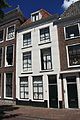
This is a category about rijksmonument number 25383
|
| Address |
|
Media in category "Oude Singel 222, Leiden"
The following 4 files are in this category, out of 4 total.
-
 Gevels - Leiden - 20136859 - RCE.jpg 1,200 × 797; 178 KB
-
 Leiden - Oude Singel 222, 222 a en 222 b.jpg 2,736 × 3,648; 3.81 MB
-
 Oude Singel 222, Leiden.JPG 2,848 × 4,272; 2.16 MB
-
 Overzicht met ophaalbrug - Leiden - 20382183 - RCE.jpg 1,200 × 1,198; 248 KB


