Category:Oudegracht 329, Utrecht
| Object location | | View all coordinates using: OpenStreetMap |
|---|
 | |||||
| Upload media | |||||
| Instance of |
| ||||
|---|---|---|---|---|---|
| Location | Utrecht, Netherlands | ||||
| Street address |
| ||||
| Located on street | |||||
| Heritage designation |
| ||||
 | |||||
|
This is a category about rijksmonument number 36573
|
| Address |
|
Media in category "Oudegracht 329, Utrecht"
The following 5 files are in this category, out of 5 total.
-
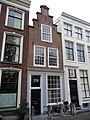 Oudegracht 329.JPG 2,592 × 3,456; 4.25 MB
-
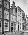
 Overzicht - Utrecht - 20236840 - RCE.jpg 1,200 × 806; 276 KB
-
 Voorgevels - Utrecht - 20236837 - RCE.jpg 807 × 1,200; 196 KB
-
 Voorgevels - Utrecht - 20236838 - RCE.jpg 955 × 1,200; 234 KB
-
 Voorgevels - Utrecht - 20236839 - RCE.jpg 959 × 1,200; 252 KB


