Category:Oudekamp 12, Utrecht
| Object location | | View all coordinates using: OpenStreetMap |
|---|
 | |||||
| Upload media | |||||
| Instance of | |||||
|---|---|---|---|---|---|
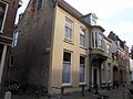
| Location | Utrecht, Netherlands | ||||
| Street address |
| ||||
| Located on street | |||||
| Heritage designation |
| ||||
 | |||||
|
This is a category about rijksmonument number 31113
|
| Address |
|
Media in category "Oudekamp 12, Utrecht"
The following 3 files are in this category, out of 3 total.
-
 Oudekamp.12.jpg 3,072 × 2,304; 1.09 MB
-
 Rijksmonument-31113-20110918165707.jpg 1,936 × 2,592; 1.78 MB
-
 Voorgevel - Utrecht - 20236856 - RCE.jpg 886 × 1,200; 207 KB

