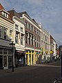
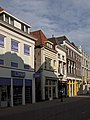
Category:Oudestraat 51, Kampen
| Object location | | View all coordinates using: OpenStreetMap |
|---|
building in Kampen, Netherlands  | |||||
| Upload media | |||||
| Instance of | |||||
|---|---|---|---|---|---|
| Location | Kampen, Overijssel, Netherlands | ||||
| Heritage designation |
| ||||
 | |||||
|
This is a category about rijksmonument number 23081
|
| Address |
|
Media in category "Oudestraat 51, Kampen"
The following 4 files are in this category, out of 4 total.
-
 Kampen Oudestraat4749.jpg 2,736 × 3,648; 5.33 MB
-
 Kampen Oudestraat51.jpg 2,736 × 3,648; 4.92 MB
-
 Kampen Oudestraat53.jpg 2,736 × 3,648; 5.92 MB
-
 Voorgevel - Kampen - 20123300 - RCE.jpg 803 × 1,200; 196 KB


