Category:Oving, Buckinghamshire
English: Oving (pronounced "Ooving") is a village and also a civil parish within Aylesbury Valedistrict in Buckinghamshire, England. It is located about three and a half miles north east of Waddesdon, four miles south of Winslow.
village and civil parish in Buckinghamshire, England, UK  | |||||
| Upload media | |||||
| Instance of | |||||
|---|---|---|---|---|---|
| Location | Buckinghamshire, South East England, England | ||||
| Said to be the same as | Oving (Wikimedia duplicated page, civil parish) | ||||
 | |||||
Subcategories
This category has the following 2 subcategories, out of 2 total.
B
- Black Boy, Oving (5 F)
Media in category "Oving, Buckinghamshire"
The following 59 files are in this category, out of 59 total.
-
 A less famous James Bond - geograph.org.uk - 2594406.jpg 480 × 640; 95 KB
-
 A muddy path and a garage with elaborate gates - geograph.org.uk - 2747177.jpg 2,048 × 1,536; 1.05 MB
-
 All Saints' Church - geograph.org.uk - 3579693.jpg 1,600 × 1,068; 453 KB
-
 All Saints' Oving - geograph.org.uk - 3276588.jpg 2,560 × 1,920; 1,014 KB
-
 Anglian Water installation - geograph.org.uk - 3579715.jpg 1,600 × 1,068; 483 KB
-
 Building in the field - geograph.org.uk - 3579706.jpg 1,600 × 1,074; 406 KB
-
 Buildings on Bunshill - geograph.org.uk - 3276659.jpg 2,560 × 1,920; 918 KB
-
 Bun's Hill in December - geograph.org.uk - 2742120.jpg 2,048 × 1,536; 1.37 MB
-
 Bunshill and Oving - geograph.org.uk - 3276665.jpg 2,560 × 1,920; 1.01 MB
-
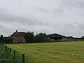 Buttermilkhall Farm - geograph.org.uk - 447820.jpg 640 × 480; 51 KB
-
 Cars coming up Marston Hill - geograph.org.uk - 4136102.jpg 4,320 × 3,240; 5.23 MB
-

-
 Church gates, Oving - geograph.org.uk - 2594402.jpg 640 × 480; 108 KB
-
 Church Road, Oving - geograph.org.uk - 2594386.jpg 640 × 480; 87 KB
-
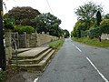 Church steps, Oving - geograph.org.uk - 2594396.jpg 640 × 480; 97 KB
-
 Field at Oving - geograph.org.uk - 2420266.jpg 2,464 × 1,632; 4.96 MB
-
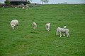 Field of ewes and lambs. - geograph.org.uk - 4296.jpg 640 × 426; 58 KB
-

-
 Fields running down from Meadway, Oving - geograph.org.uk - 431278.jpg 640 × 480; 161 KB
-
 Footpath alongside the grounds of Oving House - geograph.org.uk - 2742071.jpg 2,048 × 1,536; 1.22 MB
-
 Footpath down to the Aylesbury ring - geograph.org.uk - 3579708.jpg 1,200 × 1,600; 480 KB
-
 Footpath off Meadway - geograph.org.uk - 3579642.jpg 1,600 × 1,069; 531 KB
-
 Footpath to Marston - geograph.org.uk - 3579699.jpg 1,600 × 1,069; 585 KB
-
 Footpath to North Marston over a brook - geograph.org.uk - 3555778.jpg 1,200 × 1,600; 727 KB
-
 Footpath towards Buttermilkhall Farm - geograph.org.uk - 3579644.jpg 1,600 × 1,068; 691 KB
-
 Footpath towards Buttermilkhall Farm - geograph.org.uk - 3579691.jpg 1,600 × 1,068; 616 KB
-
 Footpath towards Hoggeston - geograph.org.uk - 3555776.jpg 1,600 × 1,067; 489 KB
-
 Footpath towards Oving - geograph.org.uk - 3579685.jpg 1,600 × 1,066; 686 KB
-
 Grass covered road junction - geograph.org.uk - 3276648.jpg 2,560 × 1,920; 1,002 KB
-
 Grass traffic island, Oving - geograph.org.uk - 3276652.jpg 2,560 × 1,920; 972 KB
-
 Lane and Ramhill Farm, Oving - geograph.org.uk - 433481.jpg 640 × 480; 173 KB
-

-
 North Marston Hill View (92284161).jpg 400 × 267; 41 KB
-
 Oak Tree in Oving - geograph.org.uk - 848798.jpg 640 × 480; 86 KB
-

-
 Outer Aylesbury Ring - geograph.org.uk - 4783031.jpg 640 × 498; 114 KB
-
 Outer Aylesbury Ring - geograph.org.uk - 4783037.jpg 640 × 480; 94 KB
-
 Oving churchyard - geograph.org.uk - 2594422.jpg 640 × 480; 119 KB
-
 Oving House Geograph-2742081-by-Virginia-Knight.jpg 2,048 × 1,536; 865 KB
-
 Path heading to Marston Hill - geograph.org.uk - 4783053.jpg 640 × 480; 85 KB
-
 Path nearing Buttermilkhall Farm - geograph.org.uk - 5963593.jpg 640 × 480; 59 KB
-
 Path on Bunshill - geograph.org.uk - 5978935.jpg 640 × 480; 146 KB
-
 Path with patch of red campion - geograph.org.uk - 431255.jpg 640 × 480; 306 KB
-
 Pulpit Lane, Oving - geograph.org.uk - 2746299.jpg 2,048 × 1,536; 1.22 MB
-
 Pulpit Lane, Oving - geograph.org.uk - 2747148.jpg 2,048 × 1,536; 826 KB
-
 Pulpit Lane, Oving, in winter - geograph.org.uk - 2747161.jpg 1,536 × 2,048; 818 KB
-
 Snowdrops in Bunces Lane, Oving - geograph.org.uk - 848902.jpg 640 × 427; 145 KB
-
 Spare Trailers on Meadway - geograph.org.uk - 3579647.jpg 1,600 × 1,069; 548 KB
-
 Squatter Cottage, Oving - geograph.org.uk - 4136097.jpg 4,320 × 3,240; 4.57 MB
-
 Thatched cottage, Oving - geograph.org.uk - 2594394.jpg 640 × 480; 81 KB
-
 The Meadway, Oving, in winter - geograph.org.uk - 2746289.jpg 2,048 × 1,536; 769 KB
-
 The Old Chapel - geograph.org.uk - 2746314.jpg 2,048 × 1,536; 894 KB
-
 The road into Pitchcott - geograph.org.uk - 3579714.jpg 1,600 × 1,068; 426 KB
-
 The way to Oving - geograph.org.uk - 3579703.jpg 1,200 × 1,600; 500 KB
-
 Track to Ramhill Farmhouse - geograph.org.uk - 433488.jpg 640 × 480; 214 KB
-
 View from Black Boy pub - geograph.org.uk - 60134.jpg 640 × 480; 125 KB
-
 View from Bunces Lane. Oving - geograph.org.uk - 848855.jpg 640 × 427; 74 KB
-
 Blackberry Farm Animal Centre - geograph.org.uk - 261777.jpg 640 × 470; 87 KB
-
 Road past Blackberry Farm - geograph.org.uk - 261778.jpg 640 × 377; 56 KB


.jpg)


