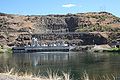
Category:Oxbow Dam
hydroelectric run-of-the-river rockfill dam on the Snake River on the Idaho-Oregon border, United States  | |||||
| Upload media | |||||
| Instance of | |||||
|---|---|---|---|---|---|
| Location |
| ||||
| Nominal power capacity |
| ||||
| Length |
| ||||
| Drainage basin | |||||
 | |||||
Media in category "Oxbow Dam"
The following 4 files are in this category, out of 4 total.
-
 Oxbow Dam, Hells Canyon, Snake River - panoramio.jpg 2,552 × 1,912; 2.63 MB
-
 Oxbow Hydroelectric dam.jpg 749 × 500; 107 KB
-
 Oxbowdam.jpg 400 × 262; 25 KB
-
 Snake River.jpg 8,386 × 2,229; 14.97 MB

