Category:Pülsdorf 13
| Object location | | View all coordinates using: OpenStreetMap |
|---|
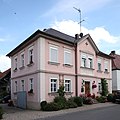
This is the category of the Bavarian Baudenkmal (cultural heritage monument) with the ID D-4-73-138-50 (Wikidata)
|
cultural heritage monument D-4-73-138-50 (0) in Itzgrund, Bavaria  | |||||
| Upload media | |||||
| Instance of | |||||
|---|---|---|---|---|---|
| Location | Itzgrund, Coburg, Upper Franconia, Bavaria, Germany | ||||
| Street address |
| ||||
| Has part(s) |
| ||||
| Heritage designation | |||||
 | |||||
Media in category "Pülsdorf 13"
This category contains only the following file.
-
 Pülsdorf13.jpg 3,744 × 3,744; 1.8 MB