Category:PNG created with Inkscape:Maps
Subcategories
This category has only the following subcategory.
C
- Created with QGIS and Inkscape (27 F)
Media in category "PNG created with Inkscape:Maps"
The following 39 files are in this category, out of 39 total.
-
 2008 Ghanaian General Election Map.png 430 × 600; 68 KB
-
 Abkhazia map-fr librsvg.png 945 × 737; 785 KB
-
 Abkhazia map-fr rendersvg.png 945 × 737; 993 KB
-
 African continent-繁體中文.png 1,595 × 1,470; 659 KB
-
 Baltische Stämme um 1200.png 1,980 × 2,180; 473 KB
-
 Bihar Corona Map.png 565 × 533; 61 KB
-
 Day Boulevard.png 1,676 × 986; 330 KB
-
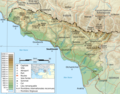
 Dominican Republic relief location map.jpg 1,338 × 1,088; 403 KB
-
 Ethnic map of caucasus.png 977 × 1,111; 381 KB
-
 Falkland Islands topographic map-en librsvg.png 2,550 × 1,990; 1.97 MB
-
 Falkland Islands topographic map-en rendersvg.png 2,550 × 1,990; 2.23 MB
-
 Fenway (parkway).png 1,440 × 847; 524 KB
-
 Foursquare-logo.png 442 × 122; 10 KB
-
 Frankish Empire 481 to 814-fr.png 2,087 × 1,476; 559 KB
-
 Furnace Brook Parkway.png 1,000 × 588; 349 KB
-
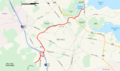
 Interstate 495 Massachusetts.png 2,598 × 1,529; 1,015 KB
-
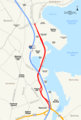
 Interstate 95 in Massachusetts.png 2,598 × 1,529; 1,013 KB
-
 Israel relief location map.jpg 614 × 1,141; 179 KB
-
 Languages-Europe.png 886 × 793; 361 KB
-
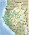 Localisation de Lambaréné.jpg 649 × 768; 316 KB
-
 Map of US 66.png 936 × 576; 102 KB
-
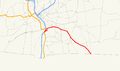
 Massachusetts Route 2.png 2,598 × 1,529; 1,013 KB
-
 Massachusetts Route 3.png 2,598 × 1,529; 1,012 KB
-
 Massachusetts Route 75.png 1,149 × 675; 39 KB
-
 Massachusetts Route 83.png 1,149 × 676; 26 KB
-
 Metropolitan Park System Boston.png 1,460 × 1,369; 467 KB
-
 Morrissey Boulevard.png 1,780 × 2,639; 667 KB
-
 North Shore MA.png 1,600 × 1,000; 403 KB
-
 Ok-17 path.png 3,425 × 2,031; 307 KB
-
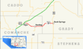
 Ok-17A path.png 3,425 × 2,031; 179 KB
-
 Park Drive Boston.png 1,440 × 847; 526 KB
-
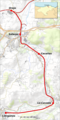 Ramal Orejo-Liérganes.png 1,025 × 2,049; 2.18 MB
-
 Route of the Tottenham outrage chase-ar.png 3,142 × 1,877; 2.13 MB
-
 Saint Martin location map.jpg 2,560 × 1,850; 356 KB
-
 Saint Martin relief location map.jpg 1,175 × 849; 170 KB
-
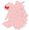 ShropshireParish OswestryRural2011.png 584 × 612; 126 KB
-
 Soldiers Field Road.png 1,284 × 755; 219 KB
-
 South Shore MA.png 1,091 × 683; 300 KB
-
 West Bank relief location map.jpg 614 × 543; 112 KB


.png)


