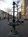
Category:Paardendrinkbak bij Sint-Matthiaskerk (Maastricht)
| Object location | | View all coordinates using: OpenStreetMap |
|---|
monument in Maastricht, Netherlands  | |||||
| Upload media | |||||
| Instance of | |||||
|---|---|---|---|---|---|
| Location |
| ||||
| Street address |
| ||||
| Located on street | |||||
| Heritage designation |
| ||||
 | |||||
|
This is a category about rijksmonument number 506664
|
| Address |
|
Media in category "Paardendrinkbak bij Sint-Matthiaskerk (Maastricht)"
The following 5 files are in this category, out of 5 total.
-
 Fontein, overzicht - Maastricht - 20147661 - RCE.jpg 788 × 1,200; 249 KB
-
 Fontein, overzicht - Maastricht - 20147662 - RCE.jpg 788 × 1,200; 235 KB
-

-
 Maastricht, Boschstraat, paardendrinkfontein01.jpg 1,800 × 2,400; 1.56 MB
-
 Maastricht, Boschstraat, paardendrinkfontein02.jpg 1,800 × 2,400; 1.53 MB


