Category:Paasloo
| Object location | | View all coordinates using: OpenStreetMap |
|---|
farm village in the Netherlands  | |||||
| Upload media | |||||
| Instance of | |||||
|---|---|---|---|---|---|
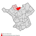
| Location | Steenwijkerland, Overijssel, Netherlands | ||||
 | |||||
Subcategories
This category has the following 3 subcategories, out of 3 total.
B
R
Media in category "Paasloo"
The following 10 files are in this category, out of 10 total.
-
-
 20140416 Grafzerk Clara Eggink Paasloo.jpg 4,784 × 3,588; 2.88 MB
-
 20140416 Grafzerk JC Bloem Paasloo.jpg 4,896 × 3,672; 3.81 MB
-
 20140416 Heden door Ruurd Hallema Paasloo.jpg 4,896 × 3,672; 5.06 MB
-
 20140416 JC Bloem door Titus Leeser Paasloo.jpg 3,002 × 4,003; 1.79 MB
-
 20140416 Toekomst door Ruurd Hallema Paasloo.jpg 4,896 × 3,672; 4.82 MB
-
 20140416 Verleden door Ruurd Hallema Paasloo.jpg 4,896 × 3,672; 4.79 MB
-
 20140416 Verleden heden toekomst2 door Ruurd Hallema Paasloo.jpg 4,550 × 3,412; 3.2 MB
-
 Grafzerken Bloem Eggink Paasloo.jpg 5,921 × 2,134; 2.72 MB
-
 Verleden heden toekomst door Ruurd Hallema Paasloo.jpg 2,675 × 3,567; 906 KB


