Category:Pachaug Trail
Pachaug Trail in Connecticut, United States.
Media in category "Pachaug Trail"
The following 16 files are in this category, out of 16 total.
-
 CT Pachaug-Great Meadow Swamp nll nps.jpg 2,717 × 2,200; 795 KB
-
 Nehantic Trail and Pachaug Trail eastern fork split.jpg 1,936 × 2,592; 3.1 MB
-
 Nehantic Trail and Pachaug Trail western fork split.jpg 2,592 × 1,936; 2.68 MB
-
 Pachaug Trail - "Welcome to Rhode Island sign" at Beach Pond, Hope Valley, RI.jpg 2,592 × 1,936; 2.23 MB
-
 Pachaug Trail - 2 Great Meadow Brook Pond, Voluntown, CT.jpg 2,592 × 1,936; 2.21 MB
-
 Pachaug Trail - Beach Pond, Hope Valley, RI.jpg 2,592 × 1,936; 2.11 MB
-
 Pachaug Trail - Great Meadow Brook Pond, Voluntown, CT.jpg 2,592 × 1,936; 2.03 MB
-
 Pachaug Trail - Green Fall Pond northernmost shore looking south, Voluntown, CT.jpg 2,592 × 1,936; 1.49 MB
-
 Pachaug Trail - Porter Pond, Sterling, CT.jpg 2,592 × 1,936; 2.38 MB
-
 Pachaug Trail - split rock passage near Green Fall Pond trail head, Voluntown, CT.jpg 2,592 × 1,936; 2.89 MB
-
 Pachaug Trail - Terminus at Green Fall Pond, Voluntown, CT.jpg 1,936 × 2,592; 2.49 MB
-
 Pachaug Trail - Wiclcabouet Marsh, Voluntown, CT.jpg 2,592 × 1,936; 1.81 MB
-
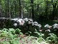
 Pachaug-Nehantic Crossover - stone wall ruins, Voluntown, CT.jpg 2,592 × 1,936; 2.76 MB
-
 Pachaug-Tippecansett Connector Trail sign south of Noah Ark Road , Voluntown, CT.jpg 2,592 × 1,936; 2.37 MB
-
 Quinebaug-Pachaug Connector Trail Sign at junction at Phillips Pond.jpg 1,936 × 2,592; 3.13 MB
-
 Stone fence hear Nehantic Trail & Nehantic-Pachaug Crossover Trail intersection.jpg 2,592 × 1,936; 2.57 MB


