Category:Padfield
village in United Kingdom  | |||||
| Upload media | |||||
| Instance of | |||||
|---|---|---|---|---|---|
| Location | High Peak, Derbyshire, East Midlands, England | ||||
 | |||||
Media in category "Padfield"
The following 65 files are in this category, out of 65 total.
-
 Allotments off Platt Street, Padfield - geograph.org.uk - 5898645.jpg 640 × 480; 133 KB
-
 Banks Wood Park - geograph.org.uk - 83555.jpg 640 × 480; 71 KB
-
 Blackshaw Farm - geograph.org.uk - 2475624.jpg 640 × 427; 91 KB
-
 Bramah Edge - geograph.org.uk - 11422.jpg 640 × 480; 103 KB
-
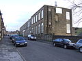
 Brick houses in Post Street Padfield - geograph.org.uk - 4168932.jpg 640 × 427; 56 KB
-
 Cemetery Road, Glossop - geograph.org.uk - 1821500.jpg 1,024 × 768; 148 KB
-
 Cemetery Road, Glossop - geograph.org.uk - 1821501.jpg 1,024 × 768; 92 KB
-
 Cemetery Road, Glossop - geograph.org.uk - 1886277.jpg 1,024 × 768; 142 KB
-
 Cemetery Road, Glossop - geograph.org.uk - 1886282.jpg 1,024 × 768; 97 KB
-
 Cemetery Road, Padfield - geograph.org.uk - 1886294.jpg 1,024 × 768; 102 KB
-
 Cemetery Road, Padfield - geograph.org.uk - 1886297.jpg 1,024 × 768; 100 KB
-
 Cottages at Little Padfield Farm - geograph.org.uk - 3475589.jpg 4,000 × 3,000; 3.49 MB
-
 Creator- H. Allison & Co. Photographers (5465442010).jpg 800 × 608; 157 KB
-
 Field in Derbyshire - geograph.org.uk - 2431970.jpg 2,592 × 1,944; 613 KB
-
 Gate into Field near Windy Arbour Hotel - geograph.org.uk - 2525576.jpg 640 × 427; 266 KB
-
 Grassland off Park Road - geograph.org.uk - 5898625.jpg 640 × 480; 89 KB
-
 Grassland, Little Padfield Farm - geograph.org.uk - 5898627.jpg 640 × 480; 100 KB
-
 Grazing near Laneside Farm - geograph.org.uk - 5898617.jpg 640 × 480; 77 KB
-
 Houses on Platt Street, Padfield - geograph.org.uk - 5898639.jpg 640 × 480; 91 KB
-
 Longdendale - geograph.org.uk - 6219913.jpg 800 × 533; 540 KB
-
 Looking toward Padfield - geograph.org.uk - 5788091.jpg 14,508 × 3,000; 7.3 MB
-
 Lower Cross Farm, Padfield.jpg 5,504 × 3,096; 8.86 MB
-
-
 Near Little Padfield Farm - geograph.org.uk - 3475580.jpg 3,906 × 2,872; 3.16 MB
-

-
 North Road, Glossop - geograph.org.uk - 1886303.jpg 1,024 × 768; 95 KB
-
 Old and new houses in Padfield - geograph.org.uk - 4851477.jpg 1,024 × 615; 448 KB
-
 Old cottages on Padfield Main Road - geograph.org.uk - 4168972.jpg 640 × 427; 67 KB
-
 Over fields to Peak Naze - geograph.org.uk - 4684328.jpg 2,304 × 1,728; 858 KB
-
 Overgrown footpath, Padfield - geograph.org.uk - 5898637.jpg 640 × 480; 100 KB
-
 Padfield - A stile with a view.jpg 1,064 × 1,448; 1.21 MB
-
-

-

-

-
 Padfield, High Peak.jpg 5,504 × 3,096; 6.03 MB
-
 Padfield4761.JPG 2,048 × 1,536; 774 KB
-
 Padfield4762.JPG 2,048 × 1,536; 775 KB
-
 Padfield4766.JPG 2,048 × 1,536; 797 KB
-
 Padfield4772.JPG 2,048 × 1,536; 753 KB
-
 Padfield4773.JPG 2,048 × 1,536; 763 KB
-
 Padfield4774.JPG 2,048 × 1,536; 761 KB
-
 Padfield4780.JPG 2,048 × 1,536; 755 KB
-
 Padfield4781.JPG 2,048 × 1,536; 743 KB
-
 PadfieldMainRoad8564.JPG 2,048 × 1,536; 784 KB
-
 Park Road, Top o'th' Hill Farm - geograph.org.uk - 3250360.jpg 640 × 480; 466 KB
-
 Peel's Arms, Padfield - geograph.org.uk - 3593909.jpg 3,264 × 2,448; 1.84 MB
-
 Peels arms public house. - geograph.org.uk - 5827206.jpg 1,024 × 683; 221 KB
-
 Pennines in Derbyshire - geograph.org.uk - 2431964.jpg 2,592 × 1,944; 662 KB
-
 Platt Street, Padfield - geograph.org.uk - 5898647.jpg 640 × 480; 74 KB
-
 Public footpath sign to Little Padfield - geograph.org.uk - 4684332.jpg 2,304 × 1,728; 820 KB
-
 Redgate - geograph.org.uk - 3250358.jpg 640 × 480; 392 KB
-
 The Longdendale Trail - geograph.org.uk - 2552571.jpg 427 × 640; 114 KB
-
 The Longdendale Trail from Padfield Main Road - geograph.org.uk - 3475614.jpg 4,000 × 3,000; 2.76 MB
-
 The Longdendale Trail, heading north east - geograph.org.uk - 4826645.jpg 1,024 × 768; 213 KB
-
 The Old Liberal Club, Padfield - geograph.org.uk - 4168968.jpg 640 × 427; 90 KB
-
 The start of the Longdendale Trail - geograph.org.uk - 4826642.jpg 1,024 × 768; 206 KB
-
 Top o'th' Hill Farm, Hadfield - geograph.org.uk - 3250363.jpg 640 × 480; 439 KB
-
 Towards Padfield - geograph.org.uk - 1055408.jpg 640 × 480; 133 KB
-
 Track to Little Padfield Farm - geograph.org.uk - 5898636.jpg 640 × 480; 106 KB
-
 Victorian postbox on Platt Street, Padfield - geograph.org.uk - 5898898.jpg 1,141 × 2,344; 474 KB
-
 View from Woodhead Road - geograph.org.uk - 2475612.jpg 640 × 427; 67 KB
-
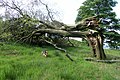 Wind-blown beech tree - geograph.org.uk - 2552626.jpg 640 × 427; 294 KB
-
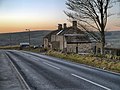
 Windy Harbour Farm Hotel - geograph.org.uk - 2525573.jpg 640 × 427; 214 KB
-
 Woodhead Road-Cemetery Road, Glossop - geograph.org.uk - 1886236.jpg 1,024 × 768; 133 KB


.jpg)


_looking_towards_Hadfield_-_geograph.org.uk_-_4168929.jpg)


