Category:Pak A
| Object location | | View all coordinates using: OpenStreetMap |
|---|
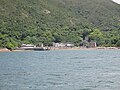
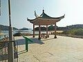
English: Pak A is a coastal village of High Island, a former island of Sai Kung District, Hong Kong.
中文:北丫
Pictures of Pak A: [1]
Subcategories
This category has the following 5 subcategories, out of 5 total.
C
I
- Ip Ancestral Hall, Pak A (5 F)
L
- Lung Shun Wan Mission Centre (7 F)
N
- Ng Ancestral Hall, Pak A (3 F)
P
- Pak A Pier (6 F)
Media in category "Pak A"
The following 19 files are in this category, out of 19 total.
-
 Pak A 01.jpg 2,560 × 1,536; 1.91 MB
-
 Pak A 02.jpg 4,608 × 3,456; 3.84 MB
-
 Pak A 03.jpg 2,560 × 1,536; 1.73 MB
-
 Pak A 04.jpg 4,608 × 3,456; 6.07 MB
-
 Pak A 05.jpg 4,608 × 3,456; 5.67 MB
-
 Pak A 06.jpg 4,608 × 3,456; 5.49 MB
-
 Pak A 07.jpg 3,971 × 2,979; 4.54 MB
-
 Pak A 08.jpg 4,160 × 3,120; 5.53 MB
-
 Pak A 09.jpg 4,160 × 3,120; 4.73 MB
-
 Pak A 14.jpg 4,160 × 3,120; 4.67 MB
-
 Pak A 15.jpg 4,160 × 3,120; 3.58 MB
-
 Pak A 16.jpg 4,160 × 3,120; 5.06 MB
-
 Pak A 17.jpg 4,160 × 3,120; 3.51 MB
-
 Pak A 21.jpg 4,160 × 3,120; 5.85 MB
-
 Pak A 24.jpg 4,160 × 3,120; 3.31 MB
-
 Pak A 25.jpg 4,160 × 3,120; 2.93 MB
-
 Pak A 26.jpg 4,160 × 3,120; 3.29 MB
-
 Pak A 27.jpg 4,160 × 3,120; 4.12 MB
-
 Pak A 28.jpg 4,160 × 3,120; 4.23 MB


