Category:Pangbourne
English: Images relating to the village and civil parish of Pangbourne, Berkshire, England. For more information see the Wikipedia article Pangbourne.
village in the United Kingdom  | |||||
| Upload media | |||||
| Instance of | |||||
|---|---|---|---|---|---|
| Location | West Berkshire, Berkshire, South East England, England | ||||
| Located in or next to body of water | |||||
| Population |
| ||||
| Area |
| ||||
 | |||||
Subcategories
This category has the following 16 subcategories, out of 16 total.
B
- Bere Court (1 F)
- Bowden House, Berkshire (1 F)
J
N
- Northridge, Pangbourne (2 F)
P
- Pangbourne Fire Station (2 F)
- Plaques in Pangbourne (3 F)
R
- Pangbourne railway station (61 F)
- River Thames at Pangbourne (44 F)
T
V
- Village sign, Pangbourne (3 F)
W
- Whitchurch Bridge (26 F)
Media in category "Pangbourne"
The following 200 files are in this category, out of 354 total.
(previous page) (next page)-
 'Little Oaks', Green Lane - geograph.org.uk - 2787271.jpg 1,024 × 683; 198 KB
-
 66004 passes Lotts Hole Pangbourne 14th May 2018.jpg 4,608 × 3,456; 7.32 MB
-
 66712 passes Lotts Hole Pangbourne 14th May 2018.jpg 4,608 × 3,456; 10.34 MB
-
 66720 passes Sotts Hole, Pangbourne 3rd May 2018.jpg 4,608 × 3,456; 5.57 MB
-
 A brave Goose - geograph.org.uk - 1905710.jpg 1,024 × 683; 169 KB
-
 A muddy Thames Path on Pangbourne Meadow - geograph.org.uk - 3024858.jpg 1,500 × 1,000; 242 KB
-
 A sodden Thames Path - geograph.org.uk - 3023851.jpg 1,500 × 1,000; 245 KB
-
 A wet Pangbourne Meadow - geograph.org.uk - 3024864.jpg 1,500 × 1,000; 176 KB
-
 A329 and River Thames diverge - geograph.org.uk - 2820373.jpg 3,648 × 2,736; 1.49 MB
-
 A329 Shooter's Hill - geograph.org.uk - 6190821.jpg 1,024 × 684; 335 KB
-
 A329 Shooter's Hill - geograph.org.uk - 6190826.jpg 1,024 × 684; 341 KB
-
 A340 at Pangbourne village boundary - geograph.org.uk - 3128992.jpg 640 × 480; 78 KB
-
 Alley to the station - geograph.org.uk - 1914071.jpg 533 × 800; 143 KB
-

-
 Along Tidmarsh Lane - geograph.org.uk - 3829330.jpg 800 × 637; 136 KB
-
 An Egyptian goose and goslings on Pangbourne Meadow - geograph.org.uk - 3023560.jpg 1,500 × 1,030; 232 KB
-
 An Electric MINI - geograph.org.uk - 1710621.jpg 1,024 × 683; 185 KB
-
 Another bend - geograph.org.uk - 1720977.jpg 1,024 × 683; 252 KB
-
 Approaching Whitchurch Toll Bridge - geograph.org.uk - 4442546.jpg 2,592 × 1,944; 1.87 MB
-
 Arch across the road - geograph.org.uk - 1509853.jpg 426 × 640; 114 KB
-
 Arch over the track - geograph.org.uk - 1509859.jpg 640 × 427; 108 KB
-
 Avenue at Bere Court - geograph.org.uk - 5281734.jpg 4,500 × 3,000; 3.83 MB
-
 Back of the surgery - geograph.org.uk - 1492534.jpg 640 × 427; 98 KB
-
 Back over the bridge - geograph.org.uk - 1714815.jpg 640 × 427; 82 KB
-
 Back to Pangbourne - geograph.org.uk - 1711836.jpg 533 × 800; 58 KB
-
 Back to the Elephant - geograph.org.uk - 1479484.jpg 640 × 427; 83 KB
-
 Back to the road - geograph.org.uk - 1479587.jpg 426 × 640; 124 KB
-
 Bars on the entrance - geograph.org.uk - 1908883.jpg 1,024 × 683; 200 KB
-
 Bartholomews Bottom - geograph.org.uk - 3829414.jpg 1,024 × 768; 152 KB
-
 Bench mark on the arch - geograph.org.uk - 2029087.jpg 600 × 800; 139 KB
-
 Bench mark on the pillar - geograph.org.uk - 1910680.jpg 533 × 800; 138 KB
-
 Benchmark on 'Little Oaks', Green Lane - geograph.org.uk - 2787232.jpg 683 × 1,024; 142 KB
-
 Benchmark on buttress of ^8 Reading Road - geograph.org.uk - 2787306.jpg 683 × 1,024; 290 KB
-
 Benchmark on parapet pier of Whitchurch Bridge - geograph.org.uk - 2710491.jpg 683 × 1,024; 208 KB
-
 Benchmark on river bridge, High Street - geograph.org.uk - 2785962.jpg 1,024 × 683; 264 KB
-
 Benchmark on St James the Less Church - geograph.org.uk - 2786171.jpg 683 × 1,024; 344 KB
-
 Benchmark on ^12 Stokes View - geograph.org.uk - 2787056.jpg 683 × 1,024; 255 KB
-
 Bend in the river - geograph.org.uk - 1720949.jpg 1,024 × 683; 243 KB
-
 Bend on Pangbourne hill - geograph.org.uk - 1721429.jpg 533 × 800; 81 KB
-
 Bird in the weather vane - geograph.org.uk - 1479210.jpg 426 × 640; 70 KB
-
 Blocks of flats in Pangbourne - geograph.org.uk - 3948998.jpg 640 × 430; 65 KB
-
 Boat over the river - geograph.org.uk - 1505124.jpg 426 × 640; 124 KB
-
 Boats leaving Whitchurch lock - geograph.org.uk - 6168997.jpg 3,453 × 2,126; 2.9 MB
-
 Bourne Road, Pangbourne - geograph.org.uk - 504357.jpg 640 × 480; 146 KB
-
 Bourne Road, Pangbourne - geograph.org.uk - 504359.jpg 640 × 480; 181 KB
-
 Bridge across the ditch - geograph.org.uk - 1711821.jpg 1,024 × 683; 149 KB
-
 Bridge from the track - geograph.org.uk - 1509882.jpg 640 × 427; 130 KB
-
 Bridge over the road - geograph.org.uk - 1479575.jpg 426 × 640; 108 KB
-

-
 Brook under the A329 - geograph.org.uk - 916003.jpg 640 × 427; 123 KB
-
 Building in the garden - geograph.org.uk - 1479204.jpg 640 × 427; 96 KB
-
 Cables through the trees - geograph.org.uk - 5281752.jpg 1,258 × 1,600; 872 KB
-
 Cemetery near Pangbourne - geograph.org.uk - 20615.jpg 640 × 480; 161 KB
-
 Chalk cliff by the railway - geograph.org.uk - 5367450.jpg 640 × 426; 89 KB
-
 Chalk cliffs in a railway cutting - geograph.org.uk - 3948997.jpg 640 × 430; 85 KB
-
 Chalk cutting - geograph.org.uk - 5646545.jpg 640 × 426; 96 KB
-
 Cliffdene Keswick House, Pangbourne EH 1288657.jpg 4,032 × 3,024; 2.02 MB
-
 Close up of the bench mark - geograph.org.uk - 1910706.jpg 600 × 800; 159 KB
-
 Club on the corner - geograph.org.uk - 2029049.jpg 1,024 × 768; 198 KB
-
 Clubhouse in the corner - geograph.org.uk - 1908919.jpg 1,024 × 683; 179 KB
-
 Clump of trees at Hoarecroft Shaw - geograph.org.uk - 3756498.jpg 640 × 480; 71 KB
-
 Co-op garage on Reading Road, Pangbourne - geograph.org.uk - 5955836.jpg 1,920 × 1,280; 963 KB
-
 Collins DIY on Reading Road, Pangbourne - geograph.org.uk - 5955835.jpg 1,920 × 1,280; 1.19 MB
-
 Cones in front - geograph.org.uk - 1908970.jpg 1,024 × 768; 223 KB
-
 Corner Cottage and May Cottage - geograph.org.uk - 6133548.jpg 3,323 × 2,209; 1.85 MB
-
 Cottage and Pylon - geograph.org.uk - 3824306.jpg 1,024 × 738; 306 KB
-
 Courtlands Hill - geograph.org.uk - 1719991.jpg 1,024 × 683; 194 KB
-
 Covered in Ivy - geograph.org.uk - 2182494.jpg 533 × 800; 148 KB
-
 Crossroads at Maidenhatch Lodge - geograph.org.uk - 2818025.jpg 640 × 480; 134 KB
-
 Cut mark on this corner - geograph.org.uk - 2029133.jpg 600 × 800; 169 KB
-
 Cutting west of Pangbourne station - geograph.org.uk - 5371348.jpg 640 × 435; 117 KB
-
 Cutting west of Pangbourne station - geograph.org.uk - 5371349.jpg 640 × 450; 125 KB
-
 Cutting west of Pangbourne station - geograph.org.uk - 5371352.jpg 640 × 409; 118 KB
-
 Ditches across the field - geograph.org.uk - 1712354.jpg 1,024 × 683; 88 KB
-
 Dragon Boat Final - geograph.org.uk - 3512549.jpg 3,900 × 2,700; 3.63 MB
-
 Egyptian goose, Pangbourne - geograph.org.uk - 427286.jpg 640 × 480; 126 KB
-
 Elephant Hotel View - geograph.org.uk - 1832575.jpg 640 × 480; 66 KB
-
 Entrance to Great Bear - geograph.org.uk - 1384183.jpg 640 × 425; 217 KB
-
 Entrance to Great Bear - geograph.org.uk - 1384255.jpg 427 × 640; 171 KB
-
 Estate across the road - geograph.org.uk - 1710559.jpg 1,024 × 683; 102 KB
-
 Farmland above Pangbourne - geograph.org.uk - 6241085.jpg 1,024 × 780; 227 KB
-
 Farmland, Pangbourne - geograph.org.uk - 2680098.jpg 640 × 480; 120 KB
-
 Fast lines through the station - geograph.org.uk - 1917618.jpg 1,024 × 683; 261 KB
-
 Fence across the entrance - geograph.org.uk - 1905659.jpg 1,024 × 683; 280 KB
-
 Field and a Small Wood - geograph.org.uk - 3824335.jpg 1,024 × 578; 116 KB
-
 Field by Tidmarsh Lane, Maidenhatch - geograph.org.uk - 5101937.jpg 2,048 × 1,536; 1.48 MB
-
 Finger sign by the bridge - geograph.org.uk - 1714866.jpg 1,024 × 683; 89 KB
-
 Finn Hair and River Pang bridge, High Street - geograph.org.uk - 2786032.jpg 1,024 × 683; 220 KB
-
 Flats above chalk cutting - geograph.org.uk - 5646546.jpg 640 × 426; 84 KB
-
 Flood in Alder Copse - geograph.org.uk - 3800004.jpg 1,600 × 1,179; 641 KB
-
 Flower's Hill junction with Tidmarsh Road - geograph.org.uk - 2710764.jpg 1,024 × 683; 292 KB
-
 Flowers Hill - geograph.org.uk - 1719949.jpg 1,024 × 683; 176 KB
-
-
 Flush bracket number 5 - geograph.org.uk - 2029148.jpg 600 × 800; 165 KB
-
 Footbridge on the Thames Path - geograph.org.uk - 3023863.jpg 1,500 × 1,000; 265 KB
-
 Footpath at Berrys Copse - geograph.org.uk - 4860037.jpg 1,600 × 1,200; 938 KB
-
 Footpath leading up - geograph.org.uk - 1919190.jpg 533 × 800; 181 KB
-
 Footpath north of Bere Court - geograph.org.uk - 5281763.jpg 1,600 × 1,067; 611 KB
-
 Footpath to the left - geograph.org.uk - 1509865.jpg 640 × 427; 142 KB
-
 Fork in the river - geograph.org.uk - 1479434.jpg 640 × 427; 131 KB
-
 Frith, Francis - Pangbourne Brücke (Zeno Fotografie).jpg 1,600 × 1,076; 304 KB
-
 Front of the pillbox - geograph.org.uk - 1710682.jpg 1,024 × 683; 159 KB
-
 Garage near the bridge - geograph.org.uk - 1476427.jpg 640 × 427; 73 KB
-
 Garden by the river - geograph.org.uk - 3023535.jpg 1,000 × 1,500; 302 KB
-
 Gate near the bridge - geograph.org.uk - 1509875.jpg 640 × 427; 145 KB
-
 Gates to the house - geograph.org.uk - 1720986.jpg 1,024 × 683; 157 KB
-
 Goose by the river - geograph.org.uk - 1905695.jpg 1,024 × 683; 178 KB
-

-
 Green Lane - geograph.org.uk - 1719981.jpg 1,024 × 683; 236 KB
-
 Hay making on Farmland near Pangbourne - geograph.org.uk - 20614.jpg 640 × 480; 155 KB
-
 Hazard on the bridge - geograph.org.uk - 1476463.jpg 640 × 427; 91 KB
-
 Height marker on the bank - geograph.org.uk - 1479447.jpg 426 × 640; 121 KB
-
 Hidden in the shrubbery - geograph.org.uk - 1491254.jpg 640 × 427; 140 KB
-
 Hoarecroft Shaw - geograph.org.uk - 1384268.jpg 640 × 427; 185 KB
-
 Horseshoe bend on the Pang - geograph.org.uk - 1720953.jpg 1,024 × 683; 247 KB
-
 Horseshoe Park, Pangbourne - geograph.org.uk - 788624.jpg 640 × 480; 52 KB
-
 Horseshoe Road - geograph.org.uk - 1710613.jpg 533 × 800; 89 KB
-
 House at Pangbourne - John Belcher architect.png 1,832 × 1,488; 3.87 MB
-
 House at Pangbourne, Berkshire, UK - garden front - John Belcher architect.png 1,646 × 1,118; 2.43 MB
-
 House on Shooters Hill - geograph.org.uk - 3023542.jpg 1,500 × 1,000; 258 KB
-
 House on Shooters Hill, Pangbourne - geograph.org.uk - 5955841.jpg 1,920 × 1,280; 1.63 MB
-
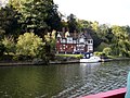
 Houses by the river - geograph.org.uk - 1509844.jpg 640 × 427; 109 KB
-
 Houses in Hartslock Court - geograph.org.uk - 5371346.jpg 640 × 393; 118 KB
-
 Houses in Thames Avenue - geograph.org.uk - 5371344.jpg 640 × 406; 78 KB
-
 Impressive building - geograph.org.uk - 2029040.jpg 1,024 × 768; 203 KB
-
 Into Berkshire - geograph.org.uk - 1492539.jpg 640 × 427; 89 KB
-
 Into the Thames - geograph.org.uk - 1479585.jpg 640 × 427; 106 KB
-
 Junction by the avenue - geograph.org.uk - 1479573.jpg 426 × 640; 57 KB
-
 Junction to Upper Basildon - geograph.org.uk - 915490.jpg 640 × 427; 104 KB
-
 Lane to Lower Bowden - geograph.org.uk - 915484.jpg 427 × 640; 85 KB
-

-
 Little Bowden view - geograph.org.uk - 4869289.jpg 3,264 × 2,448; 2.57 MB
-
 Looking at the pillbox - geograph.org.uk - 1711766.jpg 1,024 × 683; 99 KB
-
 Looking through the bridge - geograph.org.uk - 1914031.jpg 1,024 × 683; 162 KB
-
 Looking to the roundabout - geograph.org.uk - 1476440.jpg 640 × 427; 74 KB
-
 Looking towards Pangbourne - geograph.org.uk - 1714802.jpg 1,024 × 683; 105 KB
-
 Looking towards Tielhurst - geograph.org.uk - 1915807.jpg 1,024 × 683; 144 KB
-
 Looking up the sluice - geograph.org.uk - 1711809.jpg 1,024 × 683; 139 KB
-
 Lower Bowden - geograph.org.uk - 4860028.jpg 3,779 × 2,693; 2.8 MB
-
 Lower Bowden Farm field gateway - geograph.org.uk - 2558790.jpg 3,648 × 2,736; 2.03 MB
-
 Milestone at bottom of Flower's Hill - geograph.org.uk - 2710751.jpg 683 × 1,024; 275 KB
-
 Mill to the left - geograph.org.uk - 1480760.jpg 640 × 427; 84 KB
-
 Moorings at Pangbourne Meadow - geograph.org.uk - 950902.jpg 640 × 480; 79 KB
-
 Mountain High - geograph.org.uk - 1710454.jpg 533 × 800; 66 KB
-
 Mown hay, Pangbourne - geograph.org.uk - 867595.jpg 640 × 480; 150 KB
-
 Myrtles 1919.png 285 × 382; 314 KB
-
 Nearly finished - geograph.org.uk - 2029037.jpg 1,024 × 768; 220 KB
-
 Neville Turner estate agents on High Street - geograph.org.uk - 3024878.jpg 1,500 × 1,000; 183 KB
-
 New building near the river - geograph.org.uk - 1905677.jpg 1,024 × 683; 207 KB
-
 New Paint on the Milestone - geograph.org.uk - 3800021.jpg 640 × 422; 130 KB
-
 Northridge 55 Shooters Hill Pangbourne - geograph.org.uk - 3858517.jpg 1,984 × 1,488; 1.05 MB
-
 Notice on the door - geograph.org.uk - 1910654.jpg 533 × 800; 60 KB
-
 Old and New Hydrant Signs - geograph.org.uk - 4860053.jpg 1,600 × 1,200; 591 KB
-
 Old lamppost near the river - geograph.org.uk - 1720963.jpg 533 × 800; 117 KB
-
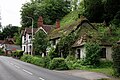
 Old thatched cottage at Pangbourne - geograph.org.uk - 4642646.jpg 800 × 531; 135 KB
-
 On to the Thames - geograph.org.uk - 1479442.jpg 426 × 640; 113 KB
-
 Orange Way after Wiltshire (304) - geograph.org.uk - 3583437.jpg 800 × 600; 202 KB
-
 Orange Way after Wiltshire (305) - geograph.org.uk - 3583439.jpg 800 × 600; 165 KB
-
 Orange Way after Wiltshire (306) - geograph.org.uk - 3583510.jpg 800 × 600; 177 KB
-
 Orange Way after Wiltshire (307) - geograph.org.uk - 3583518.jpg 800 × 600; 187 KB
-
 Car in the window - geograph.org.uk - 1492601.jpg 640 × 427; 79 KB
-
 Pangbourne - geograph.org.uk - 5422571.jpg 3,691 × 2,461; 7.65 MB
-
 Pangbourne - geograph.org.uk - 5422579.jpg 3,981 × 2,653; 7.17 MB
-
 Pangbourne - geograph.org.uk - 5422584.jpg 3,360 × 2,240; 7.68 MB
-
 Pangbourne - geograph.org.uk - 5422586.jpg 3,731 × 2,488; 6.75 MB
-
 Pangbourne - geograph.org.uk - 8212.jpg 640 × 431; 92 KB
-
 Pangbourne - Upstream on River Thames 1727098 856f523f.jpg 640 × 369; 93 KB
-
 Pangbourne Bowling club - geograph.org.uk - 1910640.jpg 1,024 × 683; 178 KB
-
 Pangbourne cemetery - geograph.org.uk - 1384260.jpg 640 × 427; 192 KB
-
 Pangbourne estate agents - geograph.org.uk - 1476474.jpg 640 × 427; 75 KB
-
 Pangbourne Hall - geograph.org.uk - 1832589.jpg 640 × 480; 66 KB
-
 Pangbourne Hill - geograph.org.uk - 1479197.jpg 640 × 427; 83 KB
-
 Pangbourne Meadow - geograph.org.uk - 4442488.jpg 2,592 × 1,944; 2.2 MB
-
 Pangbourne Meadow - geograph.org.uk - 6169182.jpg 3,453 × 2,126; 2.84 MB
-
 Pangbourne Meadow, Pangbourne - geograph.org.uk - 1388875.jpg 640 × 473; 110 KB
-
 Pangbourne Meadows - geograph.org.uk - 8210.jpg 640 × 431; 90 KB
-
 Pangbourne Meadows - geograph.org.uk - 924812.jpg 427 × 640; 155 KB
-
 Pangbourne Meadows - geograph.org.uk - 924818.jpg 640 × 427; 160 KB
-
 Pangbourne Meadows - geograph.org.uk - 924824.jpg 427 × 640; 182 KB
-
 Pangbourne Meadows - geograph.org.uk - 924841.jpg 640 × 427; 170 KB
-
 Pangbourne Meadows moorings - geograph.org.uk - 924831.jpg 640 × 427; 170 KB
-
 Pangbourne Place at Pangbourne, Berkshire.jpg 1,024 × 683; 99 KB
-
 Pangbourne Police station - geograph.org.uk - 1710462.jpg 1,024 × 683; 123 KB
-
 Pangbourne Post Office - geograph.org.uk - 1476512.jpg 640 × 427; 83 KB
-
 Pangbourne post office - geograph.org.uk - 1721450.jpg 1,024 × 683; 137 KB
-
 Pangbourne railway bridge - geograph.org.uk - 1914022.jpg 1,024 × 683; 182 KB
-
 Pangbourne Recreation Ground - geograph.org.uk - 5367454.jpg 419 × 640; 44 KB
-
 Pangbourne recreation ground - geograph.org.uk - 5371342.jpg 640 × 417; 73 KB
-
 Pangbourne Sewage Works - geograph.org.uk - 3949000.jpg 640 × 501; 64 KB
-

-

-
 PangbourneMeadows 01.JPG 1,996 × 1,477; 1.11 MB
-
 Parade by the George - geograph.org.uk - 1479520.jpg 426 × 640; 70 KB
-
 Path past the cottage - geograph.org.uk - 1480754.jpg 640 × 427; 89 KB
-
 Pet Trade Livestock on Tidmarsh Lane - geograph.org.uk - 5101938.jpg 2,008 × 1,482; 1,017 KB
-
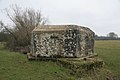
 Pillbox at Pangbourne - geograph.org.uk - 6340805.jpg 4,608 × 3,456; 3.24 MB
-
 Pillbox at the farm - geograph.org.uk - 1908866.jpg 1,024 × 683; 233 KB
-
 Pillbox on the gridline - geograph.org.uk - 1710667.jpg 1,024 × 683; 114 KB
-
 Pillbox under the branches - geograph.org.uk - 1505127.jpg 640 × 480; 102 KB
-
 Playground at the park - geograph.org.uk - 1908928.jpg 1,024 × 683; 125 KB


_near_Pangbourne_-_geograph.org.uk_-_20611.jpg)


.jpg)


_-_geograph.org.uk_-_3583437.jpg)
_-_geograph.org.uk_-_3583439.jpg)
_-_geograph.org.uk_-_3583510.jpg)
_-_geograph.org.uk_-_3583518.jpg)


