Category:Part of Cadder in Glasgow
part of a Scottish civil parish | |||||
| Upload media | |||||
| Instance of |
| ||||
|---|---|---|---|---|---|
| Part of | |||||
| Location |
| ||||
| Population |
| ||||
| Area |
| ||||
| |||||
Media in category "Part of Cadder in Glasgow"
The following 27 files are in this category, out of 27 total.
-
 Arrochar Street - geograph.org.uk - 1220701.jpg 640 × 480; 112 KB
-
 Arrochar Street at Invershiel Road - geograph.org.uk - 1220708.jpg 640 × 480; 142 KB
-
 Blackhill Road - geograph.org.uk - 1127754.jpg 640 × 480; 121 KB
-
 Broken wall by Robroyston Road - geograph.org.uk - 1336412.jpg 640 × 480; 155 KB
-
 Cortmalaw Close - geograph.org.uk - 1336398.jpg 640 × 480; 107 KB
-
 Dougalston Road housing - geograph.org.uk - 1220714.jpg 640 × 480; 131 KB
-
 Electricity pylons - geograph.org.uk - 1336584.jpg 640 × 480; 117 KB
-
 Hollinwell Road - geograph.org.uk - 1220710.jpg 640 × 480; 112 KB
-
 Houses on Arrochar Street - geograph.org.uk - 1220736.jpg 640 × 480; 155 KB
-
 Luddon Contractors - geograph.org.uk - 1127750.jpg 640 × 480; 105 KB
-
 Marshland next to Lambhill Cemetery - geograph.org.uk - 1127767.jpg 640 × 480; 152 KB
-
 Muddy field at Parkholm Farm - geograph.org.uk - 1127763.jpg 640 × 480; 89 KB
-
 Path into Balmuildy Wood - geograph.org.uk - 1127740.jpg 640 × 480; 160 KB
-
 Private road to Lochfauld - geograph.org.uk - 1127758.jpg 640 × 480; 129 KB
-
 Road into Glasgow - geograph.org.uk - 1127743.jpg 640 × 480; 113 KB
-
 Robroyston Road - geograph.org.uk - 1336394.jpg 640 × 480; 115 KB
-
 Robroyston Road - geograph.org.uk - 1336410.jpg 640 × 480; 129 KB
-

-

-
 Small burn by Hillhead Street - geograph.org.uk - 1336380.jpg 640 × 480; 137 KB
-
 St Joseph's Nursing Home - geograph.org.uk - 1336390.jpg 640 × 480; 143 KB
-
 Stream and Wallace's Well - geograph.org.uk - 1336427.jpg 640 × 480; 134 KB
-
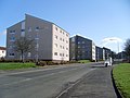
 Summerston flats and John Paul Academy - geograph.org.uk - 1220698.jpg 640 × 480; 127 KB
-
 View roughly north from Robroyston Road - geograph.org.uk - 1336441.jpg 640 × 480; 106 KB
-
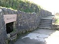 Wallace's Well - geograph.org.uk - 1491912.jpg 640 × 480; 142 KB
-
 Wallacewell Road at Hillhead Road - geograph.org.uk - 1336373.jpg 640 × 480; 127 KB
-
 Waterhaughs Place - geograph.org.uk - 1336367.jpg 640 × 480; 115 KB


_near_Stepps_Bypass_-_geograph.org.uk_-_1538967.jpg)


