Category:Paths in the Republic of Ireland
Subcategories
This category has the following 4 subcategories, out of 4 total.
B
F
G
H
Media in category "Paths in the Republic of Ireland"
The following 32 files are in this category, out of 32 total.
-
 20130810 dublin040.JPG 3,872 × 2,592; 4.81 MB
-

-
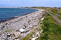 Along Rossbehy Creek - geograph.org.uk - 778838.jpg 637 × 425; 103 KB
-
 Celbridge - Castletown House - 20180324102048.jpg 4,032 × 3,024; 3.15 MB
-

-
 Coast north of Dunmore Head - geograph.org.uk - 1229408.jpg 640 × 428; 87 KB
-
 County Cavan - Calf House - 20190514150611.jpg 5,872 × 3,915; 16.21 MB
-
 County Cavan - Tullygobbin Hill - 20190514161254.jpg 5,476 × 3,651; 4.07 MB
-
 County Cavan - Tullygobbin Hill - 20190514165734.jpg 5,777 × 3,851; 19.26 MB
-
 County Cavan - Tullygobbin Hill - 20190514165745.jpg 3,819 × 5,728; 10.39 MB
-
 County Cavan - Tullygobbin Hill - 20190514165806.jpg 5,896 × 3,931; 4.31 MB
-
 County Cavan - Tullygobbin Hill - 20190514170009.jpg 5,857 × 3,905; 4.47 MB
-
 Exit from the beach at Nohaval Cove - geograph.org.uk - 1398551.jpg 480 × 640; 237 KB
-
 Gate on cliff path - geograph.org.uk - 909026.jpg 640 × 480; 107 KB
-
 Lickeen Wood - geograph.org.uk - 778279.jpg 637 × 425; 120 KB
-
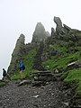
 Looking down the Devil's Ladder - geograph.org.uk - 895831.jpg 640 × 624; 160 KB
-
 Path Between Creevy and Rossnowlagh - geograph.org.uk - 943131.jpg 480 × 640; 113 KB
-
 Path from Lord Brandon's Cottage - geograph.org.uk - 781129.jpg 637 × 425; 96 KB
-
 Path in Ward River Valley Park near Knocksedan.jpg 4,896 × 3,264; 6.52 MB
-
 Path near Clonmass Bay - geograph.org.uk - 899872.jpg 640 × 480; 275 KB
-
-
 Path to Coomavoon - geograph.org.uk - 778375.jpg 637 × 425; 84 KB
-
 Rocky path to Port a Dorais - geograph.org.uk - 909035.jpg 640 × 480; 107 KB
-
 Route to Torc Mountain - geograph.org.uk - 776974.jpg 637 × 425; 88 KB
-
 Route to Torc Mountain - geograph.org.uk - 776981.jpg 637 × 425; 90 KB
-
 Stile on Coastal Path to Rossnowlagh - geograph.org.uk - 942933.jpg 480 × 640; 98 KB
-
 The Bradan Walk - The Rock Walk - geograph.org.uk - 782390.jpg 479 × 640; 150 KB
-
 The Kerry Way - geograph.org.uk - 775814.jpg 637 × 425; 96 KB
-
 Track to Gowlane - geograph.org.uk - 913647.jpg 512 × 640; 134 KB
-
 Track to Gowlane - geograph.org.uk - 913659.jpg 510 × 640; 134 KB
-
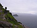 View back to Kerry - geograph.org.uk - 1024077.jpg 640 × 480; 52 KB
-
 Windy Gap - geograph.org.uk - 778377.jpg 637 × 425; 90 KB


