Category:Pavel
| Object location | | View all coordinates using: OpenStreetMap |
|---|
 | |||||
| Upload media | |||||
| Instance of | |||||
|---|---|---|---|---|---|
| Location | Komárno, Komárno District, Nitra Region, Slovakia | ||||
 | |||||
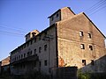
Pavel (Hungarian: Szentpálpuszta) is a part of the former municipality Nová Stráž (Őrsújfalu), since 1980 part of Komárno (Komárom).
Media in category "Pavel"
The following 6 files are in this category, out of 6 total.
-
 Szentpálpuszta.JPG 2,304 × 1,728; 663 KB
-
 Őrsújfalu024.JPG 1,600 × 1,200; 426 KB
-
 Őrsújfalu025.JPG 1,600 × 1,200; 398 KB
-
 Őrsújfalu026.JPG 1,600 × 1,200; 517 KB
-
 Őrsújfalu027.JPG 1,600 × 1,200; 398 KB
-
 Őrsújfalu028.JPG 1,600 × 1,200; 495 KB


