Category:Pencarreg
Cymraeg: Pentref a chymuned yn Sir Gaerfyrddin yw Pencarreg. Saif ar lan ddeheuol Afon Teifi, ychydig i'r gogledd-ddwrain o dref Llanybydder, ar y briffordd A485 rhwng Llanybydder a Llanbedr Pont Steffan. Mae'r eglwys wedi ei hadeiladu ar graig uwchben y pentref, a saif Llyn Pencarreg gerllaw.
English: Pencarreg is a village and community (civil parish) located in Carmarthenshire, West Wales, United Kingdom, to the south-west of Lampeter.
village and community in Carmarthenshire, Wales, UK   | |||||
| Upload media | |||||
| Instance of | |||||
|---|---|---|---|---|---|
| Location | Carmarthenshire, Wales | ||||
| Population |
| ||||
| Area |
| ||||
 | |||||
Subcategories
This category has the following 2 subcategories, out of 2 total.
L
- Llyn Pencarreg (2 F)
S
Media in category "Pencarreg"
The following 200 files are in this category, out of 200 total.
-

-
 A482 towards Cwmann at Coedeiddig - geograph.org.uk - 6400773.jpg 5,179 × 3,451; 4.01 MB
-

-
 A485 at Parc-y-Rhos - geograph.org.uk - 3123960.jpg 640 × 425; 62 KB
-
 A485 entering Pencarreg - geograph.org.uk - 3124315.jpg 640 × 408; 63 KB
-
 A485 enters Pencarreg - geograph.org.uk - 2663669.jpg 3,648 × 2,575; 1.32 MB
-
 A485 from Cwmann towards Pencarreg, Carmarthenshire - geograph.org.uk - 6177011.jpg 1,600 × 1,533; 564 KB
-
 A485 leaving A482 junction - geograph.org.uk - 3123938.jpg 640 × 344; 62 KB
-

-
 A485 west of Cwmann - geograph.org.uk - 3123972.jpg 640 × 408; 66 KB
-
 A485 west of Robin's Roost - geograph.org.uk - 3124186.jpg 640 × 433; 46 KB
-
 Across Pont Stephen into Lampeter - geograph.org.uk - 6153519.jpg 3,405 × 2,430; 1.82 MB
-
 Allt y Gelli - geograph.org.uk - 4081041.jpg 640 × 480; 163 KB
-
 Ancient Cairn - geograph.org.uk - 1389591.jpg 640 × 482; 52 KB
-
 Ancient Settlement - geograph.org.uk - 1389703.jpg 640 × 482; 68 KB
-
 Bend by Cwmann St James church - geograph.org.uk - 3123940.jpg 640 × 418; 65 KB
-
 Bethel Parc-y-Rhos - geograph.org.uk - 4342726.jpg 1,024 × 768; 144 KB
-
 Boggy ground on Mynydd Pencarreg - geograph.org.uk - 1176896.jpg 640 × 480; 69 KB
-
 Bridge over the River Teifi in Lampeter - geograph.org.uk - 2088718.jpg 2,560 × 1,920; 1,007 KB
-
 Bryn Cynon - geograph.org.uk - 533329.jpg 640 × 480; 70 KB
-

-
 Byway across Bryn Mawr, Carmarthenshire - geograph.org.uk - 1212657.jpg 640 × 437; 160 KB
-

-
 Byway towards Bryn Mawr, Carmarthenshire - geograph.org.uk - 1219186.jpg 640 × 480; 165 KB
-
 Cae Mawr - geograph.org.uk - 4793697.jpg 640 × 480; 123 KB
-
 Capel Esgairdawe - Esgairdawe Chapel - geograph.org.uk - 4793567.jpg 640 × 480; 111 KB
-

-
 Closed road near Esgairdawe - geograph.org.uk - 4679345.jpg 1,024 × 680; 394 KB
-
 Closed road near Esgairdawe - geograph.org.uk - 4679348.jpg 800 × 531; 180 KB
-
 Coedmor-fach - geograph.org.uk - 2078490.jpg 1,600 × 1,200; 308 KB
-
 Country road crossing Nant Tawe - geograph.org.uk - 4679379.jpg 800 × 531; 163 KB
-

-
 Crossroads at Bryn Manalog - geograph.org.uk - 4424046.jpg 1,024 × 683; 250 KB
-
 Cwmann boundary sign, Carmarthenshire - geograph.org.uk - 6176933.jpg 1,600 × 1,366; 398 KB
-

-
 Cwmann Sewage Pumping Station, Carmarthenshire - geograph.org.uk - 6177732.jpg 1,024 × 993; 344 KB
-
 Cwmanne Tavern - geograph.org.uk - 2663517.jpg 3,592 × 2,629; 1.25 MB
-
 Cwmanne Tavern - geograph.org.uk - 3123816.jpg 640 × 394; 69 KB
-
 Cwmanne Tavern, Cwmann, Carmarthenshire - geograph.org.uk - 6177847.jpg 1,600 × 1,249; 448 KB
-
 Cysgod-y-Coed, Cwmann, Carmarthenshire - geograph.org.uk - 6177184.jpg 1,600 × 1,277; 376 KB
-
 DAR Teifi Stores, Cwmann, Carmarthenshire - geograph.org.uk - 6177860.jpg 1,600 × 1,170; 323 KB
-
 Disused railway bridge over the River Teifi in Lampeter - geograph.org.uk - 2071411.jpg 1,920 × 2,560; 985 KB
-
 Disused Railway Line - geograph.org.uk - 777502.jpg 640 × 482; 117 KB
-

-
 Entering Carmarthenshire at Lampeter - geograph.org.uk - 3123814.jpg 640 × 424; 54 KB
-
 Entrance to Kings Park - geograph.org.uk - 884033.jpg 640 × 480; 133 KB
-
 Esgairdawe chapel - geograph.org.uk - 4678486.jpg 1,024 × 680; 261 KB
-
 Esgairdawe Chapel ^ Chapel House - geograph.org.uk - 4342774.jpg 1,024 × 768; 269 KB
-

-

-

-
 Farmland near Cwmann, Carmarthenshire - geograph.org.uk - 1219212.jpg 640 × 480; 131 KB
-
 Farmland near Esgairdawe - geograph.org.uk - 4679359.jpg 800 × 531; 114 KB
-

-

-

-

-
 Ffarm Llwyn Cuan Farm - geograph.org.uk - 4081057.jpg 640 × 480; 109 KB
-
 Ffawydd - Beech trees - geograph.org.uk - 4081028.jpg 640 × 480; 139 KB
-
 Field near the head of Cwm Tawe - geograph.org.uk - 837568.jpg 640 × 428; 108 KB
-
 Field with Thistles - geograph.org.uk - 1389745.jpg 640 × 482; 78 KB
-
 Field, Bryn Eiddig - geograph.org.uk - 6400743.jpg 5,179 × 3,451; 4.8 MB
-
 Fields north of Fro-wen farm - geograph.org.uk - 1139195.jpg 640 × 428; 106 KB
-
 Fields northwest of Derlwyn farm - geograph.org.uk - 837697.jpg 640 × 428; 100 KB
-
 Fields south of Capelstwr - geograph.org.uk - 1139208.jpg 640 × 428; 80 KB
-
 Fields west of Pant-y-fen - geograph.org.uk - 837682.jpg 640 × 428; 88 KB
-
 Forestry clearfell near Bryn-du - geograph.org.uk - 837561.jpg 640 × 428; 133 KB
-

-
 From 30 to 50 beyond Cwmann, Carmarthenshire - geograph.org.uk - 6177005.jpg 1,600 × 1,433; 385 KB
-
 From 50 to 30 on the approach to Cwmann, Carmarthenshire - geograph.org.uk - 6177024.jpg 1,600 × 1,309; 668 KB
-
 Garage and track to Rhydfallen-Isaf - geograph.org.uk - 1337766.jpg 595 × 640; 109 KB
-
 Garden at Rhydfallen Ganol. - geograph.org.uk - 1337754.jpg 640 × 480; 81 KB
-
 Grassy eyot in the Teifi, Lampeter - geograph.org.uk - 6177953.jpg 1,600 × 1,094; 341 KB
-

-
 Grazing near Cwmann, Carmarthenshire - geograph.org.uk - 1240975.jpg 640 × 443; 118 KB
-
 Hall in Cwmann, Carmarthenshire - geograph.org.uk - 6177208.jpg 1,600 × 1,200; 448 KB
-
 Heading for the ridge - geograph.org.uk - 837625.jpg 640 × 428; 113 KB
-
 Hen Ysgol Dolgwm - Dolgwm Old School - geograph.org.uk - 4080967.jpg 640 × 480; 122 KB
-
 Heol Glan Tawe - Glan Tawe Road - geograph.org.uk - 4793961.jpg 640 × 480; 135 KB
-
 Heol Parc-y-Rhos - geograph.org.uk - 1276917.jpg 480 × 640; 89 KB
-

-
 Hilltop Cairn - geograph.org.uk - 1389603.jpg 640 × 482; 61 KB
-
 Houses alongside the A485, Cwmann, Carmarthenshire - geograph.org.uk - 6177815.jpg 1,600 × 1,353; 408 KB
-
 Houses in Cwmann, Carmarthenshire - geograph.org.uk - 6177191.jpg 1,600 × 1,231; 428 KB
-

-
 Into Cwmann, Carmarthenshire - geograph.org.uk - 6177121.jpg 1,600 × 1,307; 433 KB
-
 Junction at the edge of Cwmann, Carmarthenshire - geograph.org.uk - 6177128.jpg 1,600 × 1,600; 472 KB
-
 Junction north of the Nant Thames - geograph.org.uk - 811290.jpg 640 × 428; 133 KB
-
 Lampeter Flood Plain, flooded - geograph.org.uk - 629949.jpg 640 × 353; 55 KB
-
 Lampeter Grid Station - geograph.org.uk - 632341.jpg 640 × 480; 70 KB
-
 Lane heading for Esgairdawe - geograph.org.uk - 837571.jpg 640 × 428; 139 KB
-
 Lane in Cwm Tawe - geograph.org.uk - 837573.jpg 640 × 423; 145 KB
-
 Lane southeast from Dolgwm-uchaf - geograph.org.uk - 1139190.jpg 640 × 428; 112 KB
-
 Lane to the quarry in snow - geograph.org.uk - 2090937.jpg 1,600 × 1,200; 420 KB
-
 Lane towards Beili-coch, Cwmann, Carmarthenshire - geograph.org.uk - 6177166.jpg 1,600 × 1,562; 675 KB
-
 Line of Trees by Maes-Y-Llan - geograph.org.uk - 4342812.jpg 1,024 × 768; 304 KB
-
 Line spur pole in a Cwmann field, Carmarthenshire - geograph.org.uk - 6177067.jpg 1,600 × 1,386; 271 KB
-
 Llanbedr Pont Steffan, Ceredigion - geograph.org.uk - 2000005.jpg 640 × 463; 140 KB
-

-
 Llwybr Cae Mawr - Cae Mawr path - geograph.org.uk - 4793692.jpg 640 × 480; 91 KB
-

-
 Llwybr Esgair-Dawe - Esgair-Dawe path - geograph.org.uk - 4793594.jpg 640 × 480; 150 KB
-
 Local business entrance - geograph.org.uk - 837687.jpg 640 × 428; 135 KB
-
 Lovely view available - geograph.org.uk - 1306135.jpg 640 × 480; 110 KB
-
 Meadow near Esgair-wen-isaf - geograph.org.uk - 837551.jpg 640 × 428; 107 KB
-
 Meadow west of the Nant Tawe - geograph.org.uk - 837598.jpg 640 × 428; 122 KB
-
 Molehills in Pasture - geograph.org.uk - 1389692.jpg 640 × 482; 75 KB
-
 Motor World, Cwmann, Carmarthenshire - geograph.org.uk - 6177853.jpg 1,600 × 1,459; 435 KB
-
 Mynydd Pencarreg - geograph.org.uk - 3254803.jpg 1,600 × 1,200; 624 KB
-
 Mynydd Pencarreg - geograph.org.uk - 4081079.jpg 640 × 480; 88 KB
-
 Mynydd Pencarreg - geograph.org.uk - 4081088.jpg 640 × 480; 94 KB
-
 Mynydd Pencarreg Mountain - geograph.org.uk - 4081069.jpg 640 × 480; 81 KB
-

-
 Nant Dolgwm Stream - geograph.org.uk - 4081050.jpg 640 × 480; 145 KB
-
 Nant Tawe valley - geograph.org.uk - 4679370.jpg 1,024 × 680; 301 KB
-

-

-

-

-

-
 Old slate quarry in winter - geograph.org.uk - 2089694.jpg 2,560 × 1,920; 1.04 MB
-

-
 Ordnance Survey Concrete Block - geograph.org.uk - 5206875.jpg 640 × 410; 143 KB
-
 Ordnance Survey Cut Mark - geograph.org.uk - 5206869.jpg 640 × 413; 73 KB
-
 Ordnance Survey Cut Mark - geograph.org.uk - 5216363.jpg 640 × 349; 81 KB
-
 Ordnance Survey Cut Mark - geograph.org.uk - 5519700.jpg 640 × 391; 77 KB
-
 Ordnance Survey Cut Mark - geograph.org.uk - 5519706.jpg 640 × 461; 91 KB
-
 Ordnance Survey Flush Bracket G3328 - geograph.org.uk - 4752186.jpg 4,000 × 3,000; 4.49 MB
-
 OSBM Flush Bracket G3328 - Cwmann, Post-gwyn - geograph.org.uk - 2959326.jpg 1,600 × 1,200; 532 KB
-
 OSBM Flush Bracket G3328 - Cwmann, Post-gwyn - geograph.org.uk - 3085114.jpg 1,600 × 1,200; 576 KB
-
 Part of Llwyn-Owen Farm - geograph.org.uk - 4340426.jpg 1,024 × 768; 188 KB
-
 Pasture and sheep - geograph.org.uk - 884052.jpg 640 × 357; 47 KB
-
 Pencarreg Halt geograph-2510844-by-Ben-Brooksbank.jpg 2,391 × 1,419; 711 KB
-

-
 Railway Terrace houses, Cwmann, Carmarthenshire - geograph.org.uk - 6177824.jpg 1,600 × 1,200; 556 KB
-
 River northeast of Pont Stephen, Lampeter - geograph.org.uk - 6153643.jpg 1,024 × 984; 333 KB
-
 Road descending past Rhiwlas farm - geograph.org.uk - 837565.jpg 640 × 428; 119 KB
-
 Road heading for Pant-y-ffin - geograph.org.uk - 837676.jpg 640 × 428; 126 KB
-
 Road junction in Esgairdawe - geograph.org.uk - 4678472.jpg 800 × 531; 104 KB
-
 Road junction near Blaenbydernyn - geograph.org.uk - 837692.jpg 640 × 428; 91 KB
-
 Road passing through Esgairdawe - geograph.org.uk - 4678474.jpg 800 × 531; 130 KB
-
 Robin's Roost B^B from A485 - geograph.org.uk - 3124164.jpg 640 × 444; 47 KB
-
 Robin's Roost Guest House - geograph.org.uk - 2663539.jpg 3,648 × 2,634; 1.46 MB
-
 Rock Outcrop - geograph.org.uk - 1389641.jpg 640 × 482; 75 KB
-

-
 Rugby pitch in Cwmann, Carmarthenshire - geograph.org.uk - 6177137.jpg 1,600 × 881; 208 KB
-
 School pupils, Pencarreg (1891) NLW3363804.jpg 594 × 426; 65 KB
-
 Sheep in the shade - geograph.org.uk - 837702.jpg 640 × 428; 141 KB
-
 Southeast boundary sign, Lampeter - geograph.org.uk - 6150113.jpg 1,022 × 1,024; 322 KB
-
 St James's Church, Cwmann - geograph.org.uk - 3613670.jpg 4,320 × 3,240; 2.98 MB
-
 St James's Church, Cwmann - geograph.org.uk - 3613672.jpg 4,320 × 3,240; 2.81 MB
-
 Stream below the A485 in Cwmann, Carmarthenshire - geograph.org.uk - 6177703.jpg 1,600 × 1,200; 666 KB
-
 SW side of St James Church, Cwmann, Carmarthenshire - geograph.org.uk - 6177034.jpg 1,600 × 1,479; 520 KB
-
 The A482 by Coedeiddig - geograph.org.uk - 1139221.jpg 640 × 428; 98 KB
-
 The Afon Teifi at Lampeter, Ceredigion - geograph.org.uk - 2000020.jpg 640 × 430; 134 KB
-
 The Burger Box, Cwmann, Carmarthenshire - geograph.org.uk - 6177841.jpg 1,024 × 650; 181 KB
-
 The field next door - Cae Blaen-dyffryn - geograph.org.uk - 6147232.jpg 1,600 × 1,200; 548 KB
-
 The former Ram Inn - geograph.org.uk - 3076181.jpg 640 × 480; 145 KB
-
 The old Ram Inn at Ram - geograph.org.uk - 3076180.jpg 640 × 480; 78 KB
-
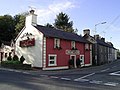
 The Red Lion, Pencarreg - geograph.org.uk - 2663670.jpg 2,422 × 1,919; 549 KB
-
 Thistle field - geograph.org.uk - 884042.jpg 640 × 482; 58 KB
-
 Thistle View - geograph.org.uk - 1390450.jpg 640 × 482; 84 KB
-
 Towards Parc-y-Rhos from lay-by, A482 - geograph.org.uk - 6400761.jpg 5,179 × 3,451; 3.9 MB
-
 Track to Rhydfallen -Isaf - geograph.org.uk - 1337743.jpg 640 × 480; 107 KB
-
 Tree-lined part of the A485 in Cwmann, Carmarthenshire - geograph.org.uk - 6177690.jpg 1,600 × 1,200; 548 KB
-

-
 Ty adfeiliedig - A ruined property - geograph.org.uk - 6253497.jpg 1,024 × 768; 226 KB
-
 Victorian postbox - geograph.org.uk - 4678489.jpg 531 × 800; 120 KB
-

-
 View from a field gate, Cwmann, Carmarthenshire - geograph.org.uk - 6177808.jpg 1,600 × 1,262; 418 KB
-
 View from lay-by, A482 - geograph.org.uk - 6400750.jpg 5,184 × 3,456; 5.32 MB
-
 View of Lampeter from road junction - geograph.org.uk - 884046.jpg 640 × 498; 125 KB
-
 View over Lampeter and the Teifi Valley - geograph.org.uk - 2090931.jpg 2,560 × 1,920; 1,023 KB
-
 View over Lampeter and the Teifi Valley - geograph.org.uk - 2090942.jpg 1,495 × 1,033; 978 KB
-

-

-
 View towards Llanybydder - geograph.org.uk - 4342836.jpg 1,024 × 683; 109 KB
-
 Wales Carmarthenshire Community Pencarreg map.svg 512 × 399; 1.12 MB
-
 War Memorial at Cwmann, Carmarthenshire - geograph.org.uk - 1219230.jpg 464 × 640; 175 KB
-
 War Memorial at Cwmann, Carmarthenshire - geograph.org.uk - 1240965.jpg 640 × 437; 151 KB
-

-

-

-
 White houses in Cwmann, Carmarthenshire - geograph.org.uk - 6177727.jpg 1,600 × 1,087; 369 KB
-

-
 A485 approaching Cwmann - geograph.org.uk - 632211.jpg 640 × 480; 61 KB
-
 Barn near Pencarreg - geograph.org.uk - 730028.jpg 640 × 482; 90 KB
-

-

-
 Byway, Bryn Mawr, Carmarthenshire - geograph.org.uk - 566408.jpg 640 × 451; 122 KB
-
 Cellan Road and Coedmore Farm - geograph.org.uk - 583681.jpg 640 × 480; 70 KB
-
 Cottage with Tin Roof - geograph.org.uk - 730003.jpg 640 × 444; 88 KB
-
 Dunbia, Meat Processing Plant - geograph.org.uk - 729996.jpg 640 × 399; 43 KB
-
 Entrance to Hendai Farm - geograph.org.uk - 625550.jpg 640 × 480; 87 KB
-
 Fields near Pen-lan - geograph.org.uk - 633129.jpg 640 × 480; 42 KB
-
 Mynydd Pencarreg - geograph.org.uk - 39923.jpg 388 × 600; 126 KB
-
 Nant Hor - geograph.org.uk - 632329.jpg 640 × 480; 53 KB
-
 Tal-y-fedw Farm - geograph.org.uk - 583678.jpg 640 × 480; 101 KB
-
 Tan-y-foel - geograph.org.uk - 580386.jpg 640 × 480; 89 KB
-
 The Cwmanne Tavern - geograph.org.uk - 533341.jpg 640 × 480; 83 KB


_NLW3363804.jpg)


