Category:Penicuik to Dalkeith Walkway
route in Midlothian in the east of Scotland  | |||||
| Upload media | |||||
| Instance of | |||||
|---|---|---|---|---|---|
| Location | Midlothian, Scotland | ||||
| |||||
Subcategories
This category has the following 3 subcategories, out of 3 total.
A
- Auchendinny tunnel (west) (7 F)
- Auchendinny Viaduct (7 F)
R
- Rosslyn Castle railway station (10 F)
Media in category "Penicuik to Dalkeith Walkway"
The following 9 files are in this category, out of 9 total.
-
 Bridge to Firth House - geograph.org.uk - 1199440.jpg 640 × 480; 97 KB
-
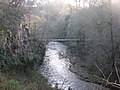
 Footbridge across the Dean Burn - geograph.org.uk - 1398777.jpg 640 × 427; 117 KB
-
 Iron Railway Bridge over River North Esk, Auchendinny.jpg 1,600 × 1,200; 795 KB
-
-
 Old railway platform at Lea Farm - geograph.org.uk - 1044893.jpg 640 × 360; 113 KB
-
 Penicuik - Musselburgh Foot ^ Cycleway - geograph.org.uk - 3961035.jpg 1,600 × 1,067; 651 KB
-
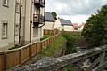
 Retaining wall by old railway track - geograph.org.uk - 913295.jpg 640 × 427; 93 KB
-
 Tunnel and bridges - geograph.org.uk - 1199449.jpg 640 × 480; 108 KB
-
 Tunnel under Harpers Brae, Penicuik - geograph.org.uk - 913330.jpg 640 × 427; 105 KB


