Category:Pennine Bridleway in North Yorkshire
Media in category "Pennine Bridleway in North Yorkshire"
The following 27 files are in this category, out of 27 total.
-
 Barn, Langcliffe - geograph.org.uk - 1448560.jpg 640 × 480; 122 KB
-
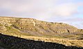 Brent Scar and Attermire Scar - geograph.org.uk - 290628.jpg 640 × 378; 97 KB
-
 Bridge to Yore House - geograph.org.uk - 188110.jpg 640 × 480; 123 KB
-
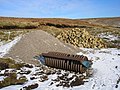 Building materials - geograph.org.uk - 322945.jpg 640 × 480; 131 KB
-
 Derelict Barn near Helwith Bridge - geograph.org.uk - 35240.jpg 640 × 480; 108 KB
-
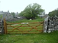 Gate toUpper Winskill Farm - geograph.org.uk - 1355598.jpg 640 × 480; 85 KB
-
 Gavel Gap - geograph.org.uk - 191151.jpg 640 × 480; 109 KB
-
 Goat Scar Lane - geograph.org.uk - 1357559.jpg 640 × 480; 88 KB
-
 Halton West - geograph.org.uk - 143924.jpg 640 × 480; 85 KB
-
 High Hill Lane - geograph.org.uk - 1366669.jpg 640 × 480; 77 KB
-
 Jubilee Cave, Langcliffe - geograph.org.uk - 1448572.jpg 640 × 480; 108 KB
-
 Lambert Lane From Hill High Lane - geograph.org.uk - 1366673.jpg 640 × 480; 86 KB
-
 Pastures East of Upper Winskill - geograph.org.uk - 1357543.jpg 640 × 480; 35 KB
-
 Ribble Way at Deep Dale - geograph.org.uk - 357462.jpg 640 × 426; 204 KB
-
 Road Junction - geograph.org.uk - 178680.jpg 640 × 480; 53 KB
-
 Road Junction - geograph.org.uk - 178695.jpg 640 × 480; 238 KB
-
 Something to do with sheep, Settle - geograph.org.uk - 1451889.jpg 640 × 479; 126 KB
-

-
 The Pennine Bridleway, Langcliffe - geograph.org.uk - 1448216.jpg 640 × 480; 146 KB
-
 The Ribble Way - geograph.org.uk - 1260036.jpg 640 × 480; 109 KB
-

-
 Wall - geograph.org.uk - 487802.jpg 640 × 425; 278 KB
-
 Bridleway junction - geograph.org.uk - 471733.jpg 640 × 480; 127 KB
-
 Gorbeck Road - 1 - geograph.org.uk - 29249.jpg 640 × 480; 70 KB
-
 Pennine Bridleway, above Lumbutts - geograph.org.uk - 513477.jpg 640 × 473; 110 KB
-
 Stockdale Farm - geograph.org.uk - 137865.jpg 640 × 480; 120 KB
-
 The Pennine Bridleway - geograph.org.uk - 41321.jpg 640 × 480; 81 KB


