Category:Penwyllt
hamlet in the county of Powys, Wales  | |||||
| Upload media | |||||
| Instance of | |||||
|---|---|---|---|---|---|
| Location | Powys, Wales | ||||
 | |||||
English: Penwyllt is a Welsh hamlet located in the upper Swansea Valley, to the east of the Black Mountain.
Subcategories
This category has only the following subcategory.
Media in category "Penwyllt"
The following 29 files are in this category, out of 29 total.
-
 Approaching disused quarries near Penwyllt - geograph.org.uk - 3210428.jpg 4,000 × 3,000; 3.08 MB
-
 Byfre Fechan valley - geograph.org.uk - 293435.jpg 640 × 480; 95 KB
-
 Cloud forming on Fan Gyhirych - geograph.org.uk - 270162.jpg 640 × 480; 48 KB
-
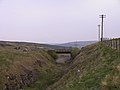
 Dismantled Railway - geograph.org.uk - 417584.jpg 640 × 480; 79 KB
-
 Disused railyard at Penwyllt Quarry - geograph.org.uk - 70668.jpg 640 × 473; 58 KB
-
 Eastern slopes of Fan Gyhirych - geograph.org.uk - 293440.jpg 640 × 480; 80 KB
-
 Former railway line near Penwyllt - geograph.org.uk - 3210444.jpg 4,000 × 3,000; 3.39 MB
-
 Former railway line near Penwyllt - geograph.org.uk - 3210448.jpg 4,000 × 3,000; 3.01 MB
-
 Former railway line near Penwyllt - geograph.org.uk - 3210454.jpg 4,000 × 3,000; 3.5 MB
-

-
 Industrial remains at Penwyllt - geograph.org.uk - 3210474.jpg 4,000 × 3,000; 3.63 MB
-
 Old lime kiln and the old Stump Inn, Penwyllt - geograph.org.uk - 3210441.jpg 4,000 × 3,000; 3.3 MB
-
 Pwll Byfre - geograph.org.uk - 604702.jpg 640 × 480; 73 KB
-
 Railway cutting near Penwyllt - geograph.org.uk - 429167.jpg 640 × 480; 42 KB
-
 Remains of the Penwyllt Dinas Silica Brickworks - geograph.org.uk - 3210464.jpg 4,000 × 3,000; 3.2 MB
-
 Remains of the Penwyllt Dinas Silica Brickworks - geograph.org.uk - 3210467.jpg 4,000 × 3,000; 3.66 MB
-
 Road junction to Penwyllt - geograph.org.uk - 589679.jpg 600 × 382; 210 KB
-

-
 Summit of Fan Fraith - geograph.org.uk - 257645.jpg 640 × 480; 92 KB
-
 Tree on Ogof Ffynnon Ddu Nature Reserve - geograph.org.uk - 589693.jpg 600 × 435; 178 KB
-
 Trig pillar on Fan Gyhirych - geograph.org.uk - 257640.jpg 640 × 480; 64 KB
-
 Vehicle track on Fan Gyhirych - geograph.org.uk - 293446.jpg 640 × 480; 113 KB
-
 Mountain track behind Fan Gyhirych - geograph.org.uk - 257644.jpg 480 × 640; 93 KB
-
 National Nature Reserve boundary - geograph.org.uk - 293070.jpg 640 × 480; 109 KB
-
-

-
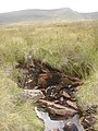
 Swallow hole - geograph.org.uk - 293434.jpg 480 × 640; 126 KB
-
 Upper northwest face of Fan Gyhirych - geograph.org.uk - 257643.jpg 639 × 385; 54 KB
-
 Waun Haffes - geograph.org.uk - 271167.jpg 640 × 480; 96 KB


