Category:Petrol stations in the London Borough of Barnet

Subcategories
This category has only the following subcategory.
B
Media in category "Petrol stations in the London Borough of Barnet"
The following 23 files are in this category, out of 23 total.
-
 BP Connect, Dollis Hill - geograph.org.uk - 1130628.jpg 640 × 427; 146 KB
-
 BP on Finchley Lane - geograph.org.uk - 1080187.jpg 640 × 402; 129 KB
-
 BP petrol station on Finchley Lane - geograph.org.uk - 4815761.jpg 1,600 × 1,200; 187 KB
-
 Clearing The Forecourt - geograph.org.uk - 1654230.jpg 640 × 404; 77 KB
-
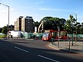 Demolished^ - geograph.org.uk - 493790.jpg 640 × 480; 104 KB
-
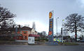
 Ex-Tex - geograph.org.uk - 187618.jpg 640 × 480; 105 KB
-
 Finchley Road at Henlys Corner - geograph.org.uk - 2260465.jpg 1,600 × 1,067; 381 KB
-
 Leopold Service Station - geograph.org.uk - 958845.jpg 640 × 401; 99 KB
-
 North Circular at Night - geograph.org.uk - 619703.jpg 558 × 413; 130 KB
-
 Petrol Station, Colindale - geograph.org.uk - 2198178.jpg 4,320 × 3,240; 4.05 MB
-
 Petrol station, The Hyde, London NW9 - geograph.org.uk - 2397383.jpg 4,320 × 3,240; 4.32 MB
-
 Shell East Barnet Road 02.JPG 4,000 × 3,000; 3.62 MB
-
 Shell East Barnet Road.JPG 3,000 × 4,000; 3.87 MB
-

-
 Shell petrol station on Barnet Road, Arkley - geograph.org.uk - 2713202.jpg 1,600 × 1,200; 603 KB
-
 Stirling Corner - geograph.org.uk - 130831.jpg 640 × 393; 72 KB
-
 Temple Fortune - The Co-operative. London NW11.jpg 3,072 × 2,304; 1.32 MB
-
 Tesco Express New Barnet.JPG 4,000 × 3,000; 4.06 MB
-
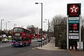
 Texaco garage on Watford Way, Hendon - geograph.org.uk - 3800969.jpg 2,218 × 1,608; 1.19 MB
-
 Texaco Service Station - geograph.org.uk - 1735160.jpg 640 × 419; 89 KB
-
 Total, Regent's Park Road N3 - geograph.org.uk - 2038792.jpg 640 × 480; 81 KB
-
 Uno Kitchens - geograph.org.uk - 1479668.jpg 640 × 395; 164 KB
-
 Vernon Court, Hendon Way - geograph.org.uk - 1554699.jpg 640 × 480; 52 KB


