Category:Pfarrhaus Lützelflüh
| Object location | | View all coordinates using: OpenStreetMap |
|---|
church residential building in Lützelflüh in the canton of Bern, Switzerland  | |||||
| Upload media | |||||
| Instance of | |||||
|---|---|---|---|---|---|
| Part of | |||||
| Location | Lützelflüh, Emmental administrative district, Emmental-Oberaargau administrative region, Bern, Switzerland | ||||
| Street address |
| ||||
| Heritage designation | |||||
 | |||||
Subcategories
This category has the following 3 subcategories, out of 3 total.
Media in category "Pfarrhaus Lützelflüh"
The following 7 files are in this category, out of 7 total.
-
 CH-NB - Lützelflüh - Collection Gugelmann - GS-GUGE-WEIBEL-D-83.tif 5,754 × 3,818, 2 pages; 47.01 MB
-
 Luetzelflueh Pfarrhaus 2.jpg 2,887 × 1,925; 5.26 MB
-
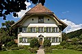 Luetzelflueh Pfarrhaus.jpg 2,735 × 1,824; 4.14 MB
-
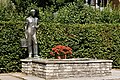 Luetzelflueh Ueli Brunnen.jpg 2,468 × 1,645; 5.08 MB
-
 Luetzelflueh-Brunnen.jpg 800 × 1,200; 1,001 KB
-
 Luetzelflueh-Pfarrhaus.jpg 1,200 × 800; 1,002 KB
-
 Lützelflüh Gotthelf Zentrum01.JPG 2,816 × 2,112; 1.22 MB


