Category:Pfarrkirche Hüttendorf
| Object location | | View all coordinates using: OpenStreetMap |
|---|
church building in Mistelbach, Austria   | |||||
| Upload media | |||||
| Instance of | |||||
|---|---|---|---|---|---|
| Location | Hüttendorf, Mistelbach, Mistelbach District, Lower Austria, Austria | ||||
| Heritage designation | |||||
 | |||||
Media in category "Pfarrkirche Hüttendorf"
The following 11 files are in this category, out of 11 total.
-
 Altar in der Kirche 1218 in A-2130 Hüttendorf.jpg 4,020 × 6,036; 3.15 MB
-
 Apsis in der Kirche 1218 in Hüttendorf.jpg 6,036 × 4,020; 2.12 MB
-
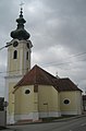
 Hüttendorf - Pfarrkirche hl. Barbara.jpg 590 × 799; 175 KB
-
 Hüttendorf-Kirche-01.jpg 2,200 × 1,650; 1.3 MB
-
 Hüttendorf-Kirche-02.jpg 1,450 × 2,200; 1.13 MB
-
 Kirche 1218 in A-2130 Hüttendorf.jpg 3,817 × 3,701; 1.36 MB
-
 Kirche 5353 Fastentuch in A-2130 Hüttendorf.jpg 3,952 × 4,371; 2.55 MB
-
 Kirche 5353 Orgel in A-2130 Hüttendorf.jpg 5,959 × 3,783; 2.12 MB
-
 Marienstatue in der Kirche 1218 in A-2130 Hüttendorf.jpg 3,713 × 5,368; 1.82 MB
-
 Seitenaltar in der Kirche 1218 in A-2130 Hüttendorf.jpg 4,020 × 5,518; 2.83 MB
-
 Treppenaufgang in der Kirche 1218 in A-2130 Hüttendorf.jpg 3,413 × 5,120; 2.25 MB


