Category:Pfarrkirche Hartmannsdorf
Pfarrkirche Hartmannsdorf
| This category shows the protected monument with the number 57373 in Austria. (Commons, de, Wikidata) |
| Object location | | View all coordinates using: OpenStreetMap |
|---|
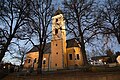
church building in Markt Hartmannsdorf, Austria  | |||||
| Upload media | |||||
| Instance of | |||||
|---|---|---|---|---|---|
| Named after | |||||
| Location | Markt Hartmannsdorf, Weiz District, Styria, Austria | ||||
| Heritage designation | |||||
 | |||||
Subcategories
This category has only the following subcategory.
P
Media in category "Pfarrkirche Hartmannsdorf"
The following 12 files are in this category, out of 12 total.
-
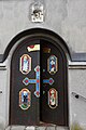 Eingang Pfarrkirche Markt Hartmannsdorf.JPG 3,853 × 5,779; 7.42 MB
-
 Kriegerdenkmal Markt Hartmannsdorf War Memorial.JPG 5,343 × 3,562; 6.51 MB
-
 Pfarrkirche Hartmannsdorf Taufbecken.JPG 6,000 × 4,000; 13.23 MB
-
 Pfarrkirche Markt Hartmannsdorf 1.JPG 4,000 × 6,000; 12.67 MB
-
 Pfarrkirche Markt Hartmannsdorf 2.JPG 4,000 × 6,000; 13.09 MB
-
 Pfarrkirche Markt Hartmannsdorf 3.JPG 4,000 × 6,000; 12.51 MB
-
 Pfarrkirche Markt Hartmannsdorf 4.JPG 4,000 × 6,000; 9.68 MB
-
 Pfarrkirche Markt Hartmannsdorf 5.JPG 6,000 × 4,000; 12.91 MB
-
 Pfarrkirche Markt Hartmannsdorf 6.JPG 6,000 × 4,000; 13.03 MB
-
 Pfarrkirche markt hartmannsdorf.JPG 2,736 × 3,648; 3.33 MB
-
 Pfarrkirche Markt Hartmannsdorf.JPG 6,000 × 4,000; 13.36 MB
-
 Taufbecken Pfarrkirche Hartmannsdorf.JPG 6,000 × 4,000; 13.39 MB


