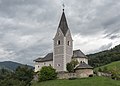
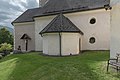
Category:Pfarrkirche St. Peter ob Radenthein
| Object location | | View all coordinates using: OpenStreetMap |
|---|
church building in Radenthein, Austria   | |||||
| Upload media | |||||
| Instance of | |||||
|---|---|---|---|---|---|
| Location | Radenthein, Spittal an der Drau District, Carinthia, Austria | ||||
| Heritage designation | |||||
 | |||||
Media in category "Pfarrkirche St. Peter ob Radenthein"
The following 24 files are in this category, out of 24 total.
-
 Kath. Pfarrkirche hl. Petrus 01.jpg 649 × 1,306; 487 KB
-
 Kath. Pfarrkirche hl. Petrus 02.jpg 549 × 1,480; 472 KB
-
 Kath. Pfarrkirche hl. Petrus 03.jpg 658 × 1,372; 299 KB
-
 Kath. Pfarrkirche hl. Petrus 04.jpg 1,483 × 909; 611 KB
-
 Kath. Pfarrkirche hl. Petrus.jpg 1,319 × 1,485; 949 KB
-
 Radenthein Sankt Peter gotischer Bau und Pfarkirche hl. Petrus 17092015 7503.jpg 7,360 × 4,912; 20.26 MB
-
 Radenthein Sankt Peter in Tweng Pfarrkirche 11092011 501.jpg 2,848 × 2,970; 907 KB
-
 Radenthein Sankt Peter in Tweng Pfarrkirche 12082007 25.jpg 1,560 × 1,896; 349 KB
-
 Radenthein Sankt Peter in Tweng Pfarrkirche Sankt Peter 17092015 7500.jpg 4,548 × 6,640; 12.16 MB
-
 Radenthein Sankt Peter in Tweng Pfarrkirche Sankt Peter 17092015 7501.jpg 4,323 × 6,763; 10.92 MB
-
 Radenthein Sankt Peter in Tweng Pfarrkirche Sankt Peter 17092015 7502.jpg 4,912 × 7,360; 13.84 MB
-
 Radenthein Sankt Peter in Tweng Pfarrkirche Sankt Peter 17092015 7504.jpg 4,458 × 6,139; 9.68 MB
-
 Radenthein Sankt Peter in Tweng Pfarrkirche Sankt Peter 17092015 7505.jpg 6,471 × 4,615; 9.91 MB
-
 Radenthein Sankt Peter in Tweng Pfarrkirche Sankt Peter 17092015 7544.jpg 6,147 × 4,467; 9.16 MB
-
 Radenthein Sankt Peter in Tweng Pfarrkirche Sankt Peter Chorschluss 17092015 7508.jpg 4,912 × 7,360; 18.04 MB
-
 Radenthein Sankt Peter in Tweng Pfarrkirche Sankt Peter Inneres 17092015 7519.jpg 7,360 × 4,912; 14.33 MB
-
 Radenthein Sankt Peter in Tweng Pfarrkirche Sankt Peter Inneres Empore 17092015 7522.jpg 7,360 × 4,912; 13.96 MB
-
 Radenthein Sankt Peter in Tweng Pfarrkirche Sankt Peter Kruzifix 17092015 7527.jpg 4,912 × 7,360; 20.1 MB
-
 Radenthein Sankt Peter in Tweng Pfarrkirche Sankt Peter Sakristei 17092015 7525.jpg 7,360 × 4,912; 16.07 MB
-
 Radenthein Sankt Peter in Tweng Pfarrkirche Sankt Peter Sakristei 17092015 7526.jpg 7,360 × 4,912; 16.71 MB
-
 Radenthein Sankt Peter in Tweng Pfarrkirche Sankt Peter Sakristei 17092015 7528.jpg 6,671 × 4,353; 9.29 MB
-
 Radenthein Sankt Peter in Tweng Pfarrkirche Sankt Peter Sonnenuhr 17092015 7517.jpg 4,972 × 4,432; 6.75 MB
-
 Radenthein Sankt Peter Pfarrkirche hl Petrus Chor 17092015 7520.jpg 4,912 × 7,360; 14.93 MB
-


