Category:Photographs by Colin Trainor
Images by Dr. Colin Trainor
Media in category "Photographs by Colin Trainor"
The following 193 files are in this category, out of 193 total.
-

-
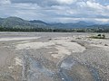
 A full Lake Laga, Baucau during a La Nina year, 26 Jul 2010.jpg 1,024 × 768; 148 KB
-
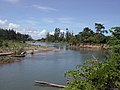
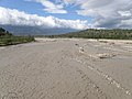 A muddy flooded braided stream west of Laga village.jpg 1,024 × 768; 126 KB
-

-

-
 Aquaculture salt and fishponds at Tibar, Dili Timor-Leste.jpg 1,024 × 768; 124 KB
-

-
 Bare grassy slopes near Ainaro-Same T-junction, Jul 2003.jpg 1,024 × 768; 131 KB
-
-
 Bridge over Laclo River at Manatuto, Mt Curi in background.jpg 1,024 × 768; 98 KB
-

-

-
-
 Cattle at Mount Leolaco 2.jpg 4,896 × 3,672; 5.2 MB
-
 Cattle at Mount Leolaco.jpg 4,896 × 3,672; 6.46 MB
-
 Cattle on Mt Tapo 2.jpg 4,896 × 3,672; 5.5 MB
-
 Cattle on Mt Tapo.jpg 4,896 × 3,672; 5.05 MB
-
 Central Lospalos intersection, Sep 2013.jpg 1,024 × 768; 216 KB
-
 Children at shallow freshwater lake at Hatudo, Jul 2003.jpg 1,024 × 768; 216 KB
-
 Close the police station at Bobonaro Village 2016.jpg 4,896 × 3,672; 4.64 MB
-
 Close to Mt Tapo.jpg 4,896 × 3,672; 8.25 MB
-
 Communications tower at Laleno, Lautem, Timor-Leste.jpg 768 × 1,024; 147 KB
-

-

-

-
 Degraded clay hills 2 km west of Secal, Baucau, 26 Jul 2010 (La Nina year).jpg 1,024 × 768; 170 KB
-
 Dry fallow ricefields in the mid dry season, Vemasse, 3 Aug 2008.jpg 1,024 × 768; 189 KB
-

-
 Entry to Indonesia from the Oecusse, Timor-Leste side.jpg 1,024 × 768; 213 KB
-

-

-
 Eucalyptus alba woodland along Adara-Beloi track, Atauro 30 Dec 2003.jpg 1,024 × 768; 295 KB
-

-

-

-
-

-

-

-
 Fishing in flooded Lake Iralalaro.jpg 1,024 × 683; 141 KB
-
 Flooded Lake Iralalaro view 4.jpg 1,024 × 768; 141 KB
-

-
 Grazing land and steep hills at Pante Makassar, Oecusse, 17 Sep 2009.jpg 1,024 × 768; 132 KB
-
 High water at Lake Laga, 15 Apr 2013 2.jpg 1,024 × 768; 115 KB
-
 Hundreds of waterbirds in distance on Lake Bemalae 21 Sep 2004.jpg 1,024 × 768; 100 KB
-
 Huts with Mt Leolaco behind.jpg 4,896 × 3,672; 5.6 MB
-

-
-
 Irasequiro River view near the crossing, Malahara, Lautem, Timor-Leste.jpg 1,024 × 768; 285 KB
-
 Laclo River crossing at Manatuto, 13 Apr 2013.jpg 1,024 × 768; 152 KB
-
 Laivai River estuary, Lautem, Timor-Leste (9 Nov 2004).jpg 1,024 × 768; 183 KB
-
 Laivai River view 27 Sep 2010.jpg 1,024 × 768; 62 KB
-
 Lake Be Malae view.jpg 1,024 × 683; 361 KB
-
 Lake Laga view and mangroves, Laga, Baucau, 27 Sep 2010.jpg 1,024 × 768; 183 KB
-
-

-
 Lake Lehumo wetland view, Ermera, Timor-Leste.jpg 1,024 × 768; 76 KB
-
 Lake Ran - the Central of three lakes at Com.jpg 1,024 × 768; 231 KB
-
 Lake Welada view, Manufahi (15 Jun 2005).jpg 1,024 × 768; 161 KB
-

-
 Laleia River and Casuarina woodland and savanna 13 Apr 2013.jpg 1,024 × 768; 141 KB
-
 Laleia River from bridge crossing, 13 Apr 2013.jpg 1,024 × 768; 83 KB
-
-
 Landscape view of Loes River estuary, Liquica, Timor-Leste, 19 Sep 2009.jpg 1,024 × 768; 81 KB
-
 Large Com lake, 3 Aug 2008 - sometimes waterbirds present.jpg 1,024 × 768; 168 KB
-

-

-

-

-

-

-

-
 Life in the clouds. traditional huts near Hatu Builico, Ainaro, Timor-Leste.jpg 1,024 × 768; 201 KB
-
 Loes River east of the bridge, Liquica, Timor-Leste, 22 Aug 2005.jpg 1,024 × 768; 157 KB
-
 Loes river estuary view.jpg 1,024 × 768; 173 KB
-
 Loihuno River quiet on 25 Jul 2010 before heavy rain.jpg 768 × 1,024; 194 KB
-

-
 Low rainfall grassy savanna suco Lifau (Laleia).jpg 1,024 × 768; 220 KB
-

-
 Low water level at Lake Bemalae and coloured algae on 21 Aug 2005.jpg 1,024 × 768; 142 KB
-

-
 Mainina sinkhole 1.jpg 1,024 × 768; 251 KB
-
 Mainina sinkhole 2.jpg 768 × 1,024; 316 KB
-

-
 Mangrove lined estuary east of Manatuto.jpg 1,024 × 768; 143 KB
-
 Mangrove lined Lagoon outlet for Lake Bemalae, 21 May 2005.jpg 1,024 × 768; 155 KB
-
 Mangrove patch behind Cristo Rei, 13 Apr 2013.jpg 1,024 × 768; 161 KB
-

-

-
 Many faces of Lake Tasitolu. high water from western ridge on 29 Apr 2005.jpg 1,024 × 768; 101 KB
-

-
 Mature mangrove tree (Avicennia marina) at edge of Lake Be Malae.jpg 1,024 × 768; 351 KB
-
 Mature trees along the Baucau-Ossu road, 15 Apr 2013.jpg 768 × 1,024; 255 KB
-

-
 Ministry of Agriculture and Fisheries, Forestry Office, Caicoli, Dili.jpg 1,024 × 768; 102 KB
-

-

-

-

-
 Mount Leolaco in the background.jpg 4,896 × 3,672; 3.93 MB
-
 Mount Loelaco mountain landscape views (1).jpg 4,896 × 3,672; 4.17 MB
-
 Mount Loelaco mountain landscape views (2).jpg 4,896 × 3,672; 5.11 MB
-
 Mount Loelaco mountain landscape views (3).jpg 4,896 × 3,672; 5.97 MB
-
 Mount Loelaco mountain landscape views (5).jpg 4,896 × 3,672; 4.7 MB
-
 Mount Loelaco mountain landscape views (6).jpg 3,672 × 4,896; 7.5 MB
-
 Mount Loelaco mountain landscape views (7).jpg 4,896 × 3,672; 7.68 MB
-
 Mount Loelaco mountain landscape views (8).jpg 4,896 × 3,672; 4.94 MB
-
 Mount Loelaco mountain landscape views, group of cattle grazing at around 1,200 m.jpg 4,896 × 3,672; 6.24 MB
-
 Mount Tapo 1.jpg 4,896 × 3,672; 4.15 MB
-
 Mount Tapo 2.jpg 4,896 × 3,672; 2.37 MB
-
 Mount Tapo 3.jpg 4,896 × 3,672; 2.85 MB
-
 Mount Tapo 4.jpg 4,896 × 3,672; 5.22 MB
-
 Mt Caelaco view 27 Sep 2010.jpg 768 × 1,024; 40 KB
-
 Mud volcano landscape at Oesilo, Oecusse District, Timor-Leste.jpg 1,024 × 768; 155 KB
-

-

-
 On Mt Tapo.jpg 4,896 × 3,672; 8.32 MB
-
 Panoramic view at Mt Leolaco.jpg 4,896 × 3,672; 4.67 MB
-

-
 Pigs near Mt Leolaco.jpg 4,896 × 3,672; 5.98 MB
-
 Plunge pool on tributory leading to Vero River, Tutuala, Lautem, Timor-Leste.jpg 768 × 1,024; 200 KB
-

-
 Police station at Bobonaro Village 2016.jpg 4,896 × 3,672; 4.68 MB
-
 Portuguese era ruins at Loiquero, Suco Mehara.jpg 1,024 × 768; 215 KB
-
-
-

-

-
-

-
 Rice harvest at Karabela, Baucau, 26 Jul 2010.jpg 1,024 × 768; 163 KB
-
 Rice harvest near Secal, 3 Aug 2008.jpg 1,024 × 768; 296 KB
-
-
 Ricefields and forested hills 13 km N of Venilale.jpg 1,024 × 768; 176 KB
-
 Ricefields at Manatuto with Mt Curi backdrop, 23 Apr 2006.jpg 1,024 × 768; 129 KB
-
 Ricefields past Seical.jpg 1,024 × 768; 99 KB
-
 Rio Ilsa.jpg 4,896 × 3,672; 5.15 MB
-
 Rocks on Mt Tapo.jpg 4,896 × 3,672; 5.11 MB
-

-

-
 Savanna and Casuarina lined braided channel of Laleia River, Laleia.jpg 1,024 × 768; 137 KB
-
 Savanna woodland 3 km west of Laleia, 13 Apr 2013.jpg 1,024 × 768; 152 KB
-
 Secondary forest and shrubland on Assalaino plateau.jpg 1,024 × 768; 190 KB
-

-
 Secondary tropical forest along a ravine and slopes south of Same, Jul 2003.jpg 1,024 × 768; 266 KB
-
 Seical River bridge crossing, 13 Apr 2013.jpg 1,024 × 768; 147 KB
-
 South Western slopes Mt Cablaque, Jul 2003.jpg 1,024 × 768; 151 KB
-

-
 Tall Casuarina forest along the Sahen River, Manufahi (15 Jun 2005).jpg 1,024 × 768; 166 KB
-
-
 The steep, knife-edged Mt Loelaco from the Maliana-Suai road, May 2005 2.jpg 1,024 × 768; 90 KB
-
 The steep, knife-edged Mt Loelaco from the Maliana-Suai road, May 2005.jpg 1,024 × 768; 120 KB
-
 The third Com lake, furthest from the main road, ocasionally has waterbirds.jpg 1,024 × 768; 221 KB
-
 Tono River estuary, Oecusse, 17 Sep 2009.jpg 1,024 × 768; 90 KB
-
 Tono River view to steep inland hills, Oecusse, 17 Sep 2009.jpg 1,024 × 768; 97 KB
-
-

-

-
 Tropical dry forest thickets, Daudere, Lautem, Timor-Leste.jpg 1,024 × 768; 229 KB
-
 Typical coastal savanna at Parlemento, Lautem, Timor-Leste (26 Mar 2006).jpg 1,024 × 768; 221 KB
-

-
 Vemasse rice crop ready to harvest, with dry forest on hills, 24 Mar 2006.jpg 1,024 × 768; 116 KB
-

-

-

-

-

-

-
-
-

-
 View to Mt Curi from Manatuto ricefields, Timor-Leste 13 Apr 2013.jpg 1,024 × 768; 139 KB
-
 View to Mt Curi from Sabaun area, Timor-Leste 13 Apr 2013.jpg 1,024 × 768; 191 KB
-
 View to Mt Manucoco.jpg 1,024 × 683; 406 KB
-
 View to Mt Tatamailau, Ainaro on a clear day.jpg 1,024 × 768; 155 KB
-
 View to Paitchau range from Assalaino plateau.jpg 1,024 × 768; 165 KB
-
 View to Paitchau Range from Tutuala, Lautem, at sunset (30 Oct 2004).jpg 1,024 × 768; 86 KB
-

-

-

-
 View towards Mt Caelaco, Maliana and Loes River, 27 Sep 2010.jpg 1,024 × 768; 50 KB
-
 View towards Timor from north of Maquili suco in south central Atauro.jpg 1,024 × 768; 189 KB
-
 View west along the Paitchau Range from near Tutuala, Lautem, Timor-Leste.jpg 1,024 × 768; 186 KB
-
-

-
 Water Buffalo at O-swamp.jpg 1,024 × 768; 304 KB
-

-
-

-

-

-

-


_Dili_Timor-Leste.jpg)

.jpg)


.jpg)


_and_Baro_Uai_River_(right),_27_Sep_2010.jpg)


.jpg)


.jpg)


.jpg)
.jpg)


.jpg)


_security_facility_on_east_side_of_Jaco_Island,_Lautem,_Timor-Leste_(2003).jpg)


.jpg)


,_mangrove_lined_mudflat_(usually_dry)_10_km_east_of_Manatutu,_provides_habitat_for_waterbirds.jpg)
,_Ermera,_Timor-Leste.jpg)


.jpg)


.jpg)
_Dili_Timor-Leste.jpg)

.jpg)


_of_Raumoko_River,_Daudere,_Lautem,_Timor-Leste_(23_Apr_2006)_2.jpg)


_at_edge_of_Lake_Be_Malae.jpg)


_Luro_subdistrict,_Lautem,_Timor-Leste.jpg)


.jpg)
.jpg)
.jpg)
.jpg)
.jpg)
.jpg)
.jpg)


.jpg)


_Dili_Timor-Leste_2.jpg)


_at_a_recent_teak_plantation,_Lore,_Lautem,_Timor-Leste.jpg)
.jpg)


.jpg)


.jpg)


.jpg)


.jpg)


.jpg)


.jpg)
_with_Jaco_Island_to_left.jpg)


,_Tutuala_village,_with_Paitchau_Range_background,_Lautem,_Timor-Leste.jpg)


.jpg)


.jpg)

.jpg)


.jpg)


.jpg)

.jpg)


