Category:Photos by VIIRS (Suomi NPP)
Media in category "Photos by VIIRS (Suomi NPP)"
The following 166 files are in this category, out of 166 total.
-
 "Cloud Streets" Over the Great Lakes (NESDIS 2017-12-27).jpg 1,920 × 1,080; 523 KB
-
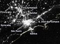 Samerica vir 2012202 lrg.jpg 523 × 382; 103 KB
-
 2016FortMcMurrayWildfireNASA2.png 985 × 681; 286 KB
-
 2020augderecho-suomi-outages-animated.gif 1,200 × 601; 2.06 MB
-
 A Big Bloom in the Barents Sea (NESDIS 2016-07-08).png 1,920 × 1,080; 924 KB
-
 A return to below-normal snowfall in the Sierra Nevada in 2018 (NESDIS 2018-02-08).png 1,920 × 1,080; 3.12 MB
-
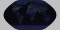
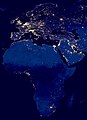 Africa and Eurasia at night 2012.jpg 2,720 × 3,760; 1.46 MB
-
 Africa from low orbiting satellite Suomi NPP.jpg 11,500 × 11,500; 11.04 MB
-

-
 Alberta Wildfire 2016-05-03 2025Z.jpg 536 × 408; 37 KB
-
 Alberta Wildfire 2016-05-04 2005Z.jpg 536 × 672; 90 KB
-
 Alberta Wildfire 2016-05-05 1945Z.jpg 672 × 536; 127 KB
-
 Alberta Wildfire 2016-05-06 1930Z.jpg 2,672 × 3,472; 2.42 MB
-
 Alberta Wildfire 2016-05-16 1940Z.jpg 1,608 × 1,208; 340 KB
-
 Alberta Wildfires 2016-05-15 2000Z.jpg 3,336 × 4,272; 3.09 MB
-
 Amazon River Spills into the Atlantic Ocean (NESDIS 2017-08-03).jpg 1,920 × 1,080; 848 KB
-
 AMS in New Orleans, Louisiana (24582580726).png 2,048 × 1,152; 3.3 MB
-
 An Oasis in the Sahara (NESDIS 2016-12-02).png 1,920 × 1,080; 3.83 MB
-
 Anvil Clouds over the Bay of Bengal (NESDIS 2019-06-26).png 1,920 × 1,080; 3.38 MB
-
 Area and Volume Contrast in Central Asia Lakes (NESDIS 2017-11-09).jpg 1,920 × 1,080; 483 KB
-
 Australia vir 2016007 lrg.jpg 2,272 × 1,736; 781 KB
-
 Australia- Fires Burn While the Seas Swirl (NESDIS 2013-06-27).png 1,920 × 1,080; 1.13 MB
-
 Before and After the California Wildfires (NESDIS 2017-10-23).png 1,920 × 1,080; 1.25 MB
-
 Bitterly Cold Morning Seen at Night (NESDIS 2015-01-08).png 2,048 × 1,152; 3.74 MB
-
 Black Body Friday (NESDIS 2017-11-24).jpg 1,920 × 1,080; 423 KB
-
 Black Marble - City Lights 2012 (8246892319).jpg 1,920 × 1,080; 155 KB
-
 BlackMarble20161km.jpg 43,200 × 21,600; 266.4 MB
-
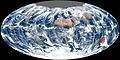
 Blue Marble 2012 - 'White Marble' Arctic View (7394700302).jpg 11,000 × 11,000; 11.21 MB
-
 Blue Marble, Eastern Hemisphere March 2014 (14990033062).jpg 3,840 × 2,160; 1.16 MB
-
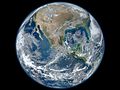 Blue Marble.jpg 1,600 × 1,200; 275 KB
-
 Burn Scars from the Oklahoma Wildfires (NESDIS 2018-04-16).png 1,920 × 1,080; 2.68 MB
-
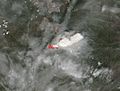
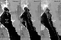
 Calbuco Volcano erupting in southern Chile for the first time since 1972 (2268-647).jpg 2,048 × 1,152; 285 KB
-
 California Wildfire Smoke Wrapped Up Into an Approaching Storm (NESDIS 2017-12-12).jpg 1,920 × 1,080; 695 KB
-
 City Lights 2012 - Flat map crop.jpg 11,358 × 6,075; 5.11 MB
-
 City Lights 2012 - Flat map.jpg 12,150 × 6,075; 2.64 MB
-
 Clear Skies Over Greece and the Aegean Sea (NESDIS 2018-04-05).png 1,920 × 1,080; 2.77 MB
-
 Clear Skies Over the Saint Lawrence Seaway (NESDIS 2018-01-25).jpg 1,920 × 1,080; 709 KB
-
 Clear skies reveal the snow-covered European Alps (NESDIS 2018-01-31).jpg 1,920 × 1,080; 579 KB
-
 Clouds Break Over the Remote Kerguelen Islands (NESDIS 2018-12-03).jpg 1,920 × 1,080; 692 KB
-
 Colorful Multispectral Imagery of the Aral Sea (24270793842).jpg 1,920 × 1,080; 608 KB
-
 Composite map of the world 2012.jpg 3,600 × 1,800; 776 KB
-
 Cumulus Cloud Rows over the South (NESDIS 2018-02-16).png 1,920 × 1,080; 7.93 MB
-
 Current Ice Cover on the Great Lakes (NESDIS 2018-02-13).png 1,920 × 1,080; 3.96 MB
-
 Dust storm 2016-08-16 1545Z.jpg 12,008 × 7,736; 17.95 MB
-
 Dust Storm Over the Red Sea (NESDIS 2018-04-02).png 1,920 × 1,080; 2.78 MB
-
 Dust Storm Red Sea Suomi NPP VIIRS July 25 2016 (28515744541).jpg 1,530 × 2,048; 1.47 MB
-
 Dust Swirls in the Taklamakan Desert (NESDIS 2013-09-27).png 1,920 × 1,080; 3.32 MB
-
 Earth from Orbit- Rope Clouds (NESDIS 2023-02-02 20190118 RopeCloud).gif 1,283 × 734; 1.36 MB
-
 East Coast Blizzard 2016 (25999390906).png 2,048 × 1,152; 3.81 MB
-
 Eastern US storm Aug 12 2014 Suomi NPP.png 2,048 × 1,152; 4.4 MB
-
 ErdebeiNacht2Hölzel.png 1,878 × 940; 1.1 MB
-
 Everglades - Green earth.png 1,920 × 1,080; 1.13 MB
-
 Fires in the Northwest Territories, Canada (NESDIS 2017-08-15).jpg 1,920 × 1,080; 692 KB
-
 First Global Image from VIIRS (6538068229).jpg 3,360 × 1,680; 2.4 MB
-
 Fourth March Nor'easter Departs the East Coast (NESDIS 2018-03-22).png 1,920 × 1,080; 7.93 MB
-
 Full Moon Shines Bright on Black Friday (NESDIS 2018-11-23).png 1,486 × 826; 1.31 MB
-
 Glacial dust streams into the Gulf of Alaska (NESDIS 2017-11-16).png 1,920 × 1,080; 1.09 MB
-
Green- Vegetation on Our Planet (Spinning Earth).webm 1 min 14 s, 1,280 × 720; 8.38 MB
-
Green- Vegetation on Our Planet (Tour of Earth).webm 5 min 16 s, 1,280 × 720; 55.58 MB
-
 Happy Camp Complex Fire 2014-09-03 2030Z EVL.png 2,048 × 1,152; 2.81 MB
-
 Herbal Earth - Eastern Hemisphere (9083656321).jpg 800 × 450; 143 KB
-
 High resolution image of King Fire (2268-636).jpg 2,048 × 1,152; 647 KB
-
 High Resolution Thermal Imagery of the California Wildfires (NESDIS 2017-10-11).png 1,920 × 1,080; 1.1 MB
-
 Houston bmhd 2021038 lrg Feb 7 2021.jpg 4,381 × 3,593; 2.74 MB
-
 Houston bmhd 2021047 lrg Feb 16 2021.jpg 4,381 × 3,593; 2.58 MB
-
 Huge Sandstorm Blows Across Saudi Arabia and Iraq (NESDIS 2017-10-30).png 1,920 × 1,080; 1.12 MB
-
 Iran - Green earth.png 1,920 × 1,080; 1.04 MB
-
 Iraq - Green earth.png 1,920 × 1,080; 3.17 MB
-

-
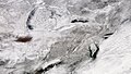
 January 2016 United States winter storm aftermath 2016-01-24 0655Z.jpg 2,408 × 3,136; 1.43 MB
-
 Lake Nasser, Egypt (NESDIS 2017-11-28).jpg 1,920 × 1,080; 583 KB
-
 Large Eruption on Mount Etna (NESDIS 2015-12-10).png 1,920 × 1,080; 2.62 MB
-
 Looking at Earth in a Different Light (NESDIS 2016-04-22).png 1,000 × 365; 485 KB
-
 Lunar Eclipse 2017-08-07 1900Z.jpg 2,276 × 3,777; 1.46 MB
-
 Map of Australia night sky 2016.jpg 5,717 × 4,250; 7.41 MB
-
 March 2014 nor'easter 2014-03-26.jpg 6,255 × 6,255; 13.85 MB
-
 Marie 2014-08-24 VIIRS.jpg 2,700 × 3,600; 2.92 MB
-
 Mati listrik Jawa 2019-08 VIIRS.gif 750 × 600; 949 KB
-
 Mayon Volcano Erupts in the Philippines (NESDIS 2018-01-29).jpg 1,920 × 1,080; 276 KB
-
 MississippiDelta - Green earth.png 1,920 × 1,080; 3.12 MB
-
 Monsoon Rains Swell the Rivers and Wetlands of Bangladesh (NESDIS 2017-08-20).png 1,920 × 1,080; 1.39 MB
-
 Multi-spectral Imagery of the Volga River Delta (NESDIS 2017-08-11).jpg 1,920 × 1,080; 581 KB
-
 NASA satellite view of Southern Ocean phytoplankton bloom (crop).jpg 841 × 598; 605 KB
-
 NASA satellite view of Southern Ocean phytoplankton bloom.jpg 1,740 × 2,545; 2.23 MB
-
 NASA Suomi NPP Satellite Sees Atmospheric Aerosols, Dust and Clouds (8033711634).png 1,440 × 720; 2.07 MB
-
 NASA's NPP Satellite Acquires First VIIRS Image (6385182023).jpg 5,989 × 5,892; 7.66 MB
-
 NASA's NPP Satellite Acquires First VIIRS Image (6385184555).jpg 3,111 × 5,155; 13.48 MB
-
 NASA.EOS.79810.Suomi NPP night bakken.vir 2012317.jpg 720 × 480; 153 KB
-
 Nebraska - Green earth.png 1,920 × 1,080; 3.85 MB
-
 New Analysis of Ocean Color for World Ocean Day (NESDIS 2015-06-08).png 1,920 × 1,080; 2.26 MB
-
 Night lights 2012-the black marbel.jpg 1,920 × 1,080; 146 KB
-
 NileDelta - Green earth.png 1,920 × 1,080; 2.46 MB
-
 Nor'easter Pounds New England (16196567038).jpg 2,500 × 2,500; 3.93 MB
-
 North Africa and Europe from Suomi NPP - NASA Earth Observatory.jpg 10,000 × 10,000; 8.97 MB
-
 North America from low orbiting satellite Suomi NPP.jpg 8,000 × 8,000; 16.43 MB
-
 North India dust vir 2018165 large.jpg 6,997 × 4,665; 24 MB
-
 North India dust vir 2018165.jpg 720 × 480; 388 KB
-
 Northern Lights From Over the North Pole (NESDIS 2024-05-15 nhem-aurora-labels).png 1,142 × 856; 1.08 MB
-
 Rare Hybrid Tropical Storm in the Mediterranean Sea (NESDIS 2017-11-20).jpg 1,920 × 1,080; 555 KB
-
 Record April Heat Engulfs Europe (NESDIS 2018-04-23).png 1,920 × 1,080; 4.05 MB
-
 Record February Warmth in Europe (NESDIS 2019-02-28).png 1,920 × 1,080; 3.3 MB
-

-
 Russian Volcano Spews Ash Over the Pacific (NESDIS 2019-11-15).jpg 1,920 × 1,080; 1.44 MB
-
 Sahara Sand Dirties Eastern Europe's Snow (NESDIS 2018-03-26).png 1,920 × 1,080; 3.22 MB
-
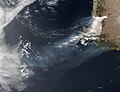
 Saharan Dust Over Eastern Atlantic Ocean (24083379000).jpg 2,048 × 1,152; 362 KB
-

-
 Santa Ana Winds Fuel Southern California Wildfires (NESDIS 2017-12-06).jpg 1,920 × 1,080; 477 KB
-
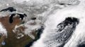
 Sea of Japan polar low 2015-11-26 0450Z.jpg 3,400 × 2,550; 3.46 MB
-
 Sea of Japan polar low 2018-01-11 0340Z.jpg 4,000 × 3,000; 3.6 MB
-
 Sediment Flows along the Mississippi River Delta (NESDIS 2018-04-18).png 1,280 × 720; 1.45 MB
-
 Ship Tracks Off the Coast of the Iberian Peninsula (NESDIS 2018-01-16).jpg 1,920 × 1,080; 741 KB
-
 Siberian Smoke Swirls Over Alaskan Coast (NESDIS 2020-07-30 jpss730logo).gif 560 × 364; 1.65 MB
-
 Siberiaweek25 - Green earth.png 1,920 × 1,080; 3.1 MB
-
 Siberiaweek30 - Green earth.png 1,920 × 1,080; 3.1 MB
-
 Smog Blankets Upper Indus-Ganga Plain (NESDIS 2017-11-02).png 1,920 × 1,080; 1.24 MB
-
 Smog in Eastern China (25752492040).png 2,048 × 1,152; 2.65 MB
-
 Snow Blankets Eastern North America (NESDIS 2018-03-18).png 1,920 × 1,080; 3.94 MB
-
 Snow Blankets New England (NESDIS 2018-01-11).jpg 1,920 × 1,080; 497 KB
-
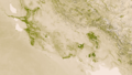
 Southern Africa 2017 04 19 (33299354754).jpg 4,146 × 4,144; 4.41 MB
-
 Suomi NPP in PlanetMaker (16797628149).jpg 1,920 × 947; 278 KB
-

-

-
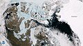
 Suomi NPP sees the Northwest Passage (NESDIS 2016-08-16).png 2,048 × 1,152; 3.97 MB
-
 Suomi NPP Watches Decker Fire in Colorado (NESDIS 2019-10-03).jpg 1,280 × 720; 552 KB
-
 Suomi-NPP Sees Heat from Woodbury Fire (NESDIS 2019-06-19).jpg 1,920 × 1,080; 894 KB
-
 Suomi-NPP Spies Grass Fires in Kansas (NESDIS 2020-03-31).jpg 1,920 × 1,080; 938 KB
-
 Swirling Ice Eddies in the Labrador Sea (NESDIS 2018-03-12).png 1,920 × 1,080; 7.93 MB
-
 The Air Mountains (NESDIS 2014-10-24).png 1,920 × 1,080; 3.23 MB
-
 The Aral Sea (NESDIS 2016-04-04).png 1,920 × 1,080; 3.07 MB
-
 The Carpathian Mountains (NESDIS 2017-10-31).png 1,920 × 1,080; 1.57 MB
-
 The Caspian Sea (NESDIS 2015-09-15).png 1,920 × 1,080; 2.72 MB
-
 The Chesapeake Bay - NOAA Monitors a Critical Habitat (NESDIS 2017-11-17).png 1,920 × 1,080; 1.05 MB
-

-
 The High Atlas Mountains, Separating Morocco & Algeria (NESDIS 2017-12-07).jpg 1,920 × 1,080; 798 KB
-
 The Mississippi River Delta (NESDIS 2016-10-08).png 1,920 × 1,080; 3.84 MB
-
 The Nile River (NESDIS 2016-02-16).png 1,920 × 1,080; 2.63 MB
-
 The Road to Dushanbe (NESDIS 2017-10-26).png 1,920 × 1,080; 1.38 MB
-

-
 The Tibesti Mountains (NESDIS 2013-01-13).png 2,048 × 1,152; 4.86 MB
-
 The Volga River Delta and Northern Caspian Sea (NESDIS 2018-04-10).png 1,920 × 1,080; 3 MB
-
 The Zambezi River (NESDIS 2015-06-16).png 1,920 × 1,080; 4.19 MB
-
 Thermal Satellite Imagery shows Variations in Northeast U S (NESDIS 2016-09-13).png 1,920 × 1,080; 1.11 MB
-
 Thermal Satellite Imagery Shows Variations in the Northeast U S (NESDIS 2016-09-13).png 1,920 × 1,080; 2.88 MB
-
 Thomas Fire Now Third-largest in California History (NESDIS 2017-12-18).jpg 1,920 × 1,080; 395 KB
-

-
 Tropical Cyclone Intensifies in the Coral Sea (NESDIS 2019-03-18).jpg 1,920 × 1,080; 509 KB
-
 Tropical Storm Rina in the Central Atlantic Ocean (NESDIS 2017-11-08).jpg 1,920 × 1,080; 559 KB
-
 Twin polar lows 2016-02-26 0425Z.jpg 1,800 × 2,400; 1.58 MB
-
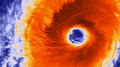 Typhoon Champi Develops Massive Eye (NESDIS 2015-10-22).png 2,048 × 1,152; 2.95 MB
-
 United States 2016-01-22 0730Z.jpg 2,408 × 3,136; 926 KB
-
 Unusual Early-Season Snowfall in the South (NESDIS 2017-12-11).jpg 1,920 × 1,080; 565 KB
-
 US East Coast VIR 2011326 large.jpg 5,986 × 5,947; 4.3 MB
-
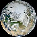 View of Earth showing the Arctic, Europe, and Asia.jpg 12,000 × 12,000; 36.77 MB
-
 VIIRS Aurora Borealis under North Pole.jpg 1,142 × 856; 380 KB
-
 VIIRS Data Captures Raging Wildfires in California (NESDIS 2017-10-10).png 1,920 × 1,080; 1.15 MB
-

-
 VIIRS First Light - NASA Earth Observatory.jpg 720 × 720; 271 KB
-
 VIIRS view of the 2021 Suez Canal obstruction.jpg 720 × 480; 80 KB
-
 Von Kármán Vortex off the Southern California Coast (NESDIS 2018-02-05).jpg 1,280 × 720; 216 KB
-
 Wildfire in Fort McMurray, Alberta, Canada May 25th 2016 (26649348513).jpg 1,753 × 2,048; 1.96 MB
-
 Winter Storm Brings Snow, Whiteout Conditions to the Central U S (NESDIS 2018-01-23).jpg 1,920 × 1,080; 633 KB
-
 Winter storm exiting the East Coast of the United States (2268-644).jpg 2,040 × 1,148; 504 KB
-

-
-
 Yukon - Green earth.png 1,920 × 1,080; 4.34 MB
-
 Техасский кризис 2021 года.jpg 981 × 406; 159 KB
.jpg)


.png)
.png)


.png)


.jpg)
.png)
.png)
.png)
.jpg)

.png)
.png)
.png)
.jpg)
.jpg)

.jpg)
.jpg)

.png)
.jpg)
.jpg)


.jpg)
.jpg)

.png)
.png)

.png)
.jpg)
.png)
.gif)
.png)


.jpg)
.jpg)
.png)
.png)
.png)

.jpg)
.jpg)
.png)


.png)


.png)

.jpg)
.png)


.jpg)

.png)
.jpg)
.jpg)

.png)
.jpg)
.jpg)


.png)


.jpg)


.png)
.jpg)
.png)
.png)
.gif)
.jpg)
.png)
.jpg)
.jpg)
.jpg)


.png)
.jpg)
.gif)


.png)
.jpg)
.jpg)
.png)
.png)
.png)
.jpg)
.jpg)
.jpg)
.png)
.png)
.png)
.png)
.png)
.png)
.jpg)
.jpg)
.png)
.png)
.png)
.png)
.png)
.png)
.png)
.png)
.jpg)
.png)
.jpg)
.jpg)

.png)

.jpg)


.png)
.jpg)


.jpg)
.jpg)
.jpg)
.jpg)
.gif)


.png)
.jpg)
.jpg)
.png)
.png)
.png)
.jpg)
_captured_a_fairly_clear_view_ofportions_of_the_eastern_United_States_(2268-639).jpg)