Category:Photos by the Advanced Baseline Imager
Media in category "Photos by the Advanced Baseline Imager"
The following 25 files are in this category, out of 25 total.
-
 180913-N-N0101-110 (43975292874).jpg 1,392 × 1,390; 510 KB
-
2018 Bomb Cyclone Blizzard - Center of the Storm Satellite Imagery January 4, 2018.webm 4.2 s, 1,440 × 1,080; 3.81 MB
-
 Alberto 2018-05-28 0440Z.jpg 500 × 500; 54 KB
-
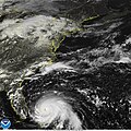
 An infrared satellite image of Hurricane Florence. (43706955545).jpg 1,400 × 1,000; 383 KB
-
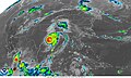
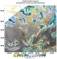 An infrared satellite image of Tropical Storms (42785420790).jpg 2,037 × 2,095; 521 KB
-
 Dorian 2019-08-31 1540Z.jpg 1,200 × 1,500; 1.16 MB
-
 Dorian 2019-09-01 1403Z.jpg 4,000 × 4,000; 2.64 MB
-
 Dorian 2019-09-01 1530Z.jpg 1,600 × 2,000; 2.56 MB
-
 Dorian 2019-09-01 1840Z.jpg 1,400 × 1,700; 1.74 MB
-
 Dorian 2019-09-01 2200Z (alternate).jpg 1,600 × 2,000; 1.98 MB
-
 Eclipse from Space - GOES Full Disk (35911846123).jpg 1,280 × 720; 323 KB
-
 Final Pre-Operational GOES-16 Image (25001901108).jpg 1,109 × 660; 234 KB
-
 First Full Disk ABI Image from GOES-17 (28600286188).jpg 10,848 × 10,688; 78.22 MB
-
 GOES 16 Advanced Baseline Imager multi-channel of North America 20170115 1807.png 2,406 × 1,526; 4.3 MB
-
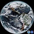 GOES 16 Full Western Hemisphere 20170115 1807.jpg 10,848 × 10,824; 26.89 MB
-
 GOES East Sees Swollen Rivers After Hurricane Florence (44780683742).jpg 1,920 × 1,080; 299 KB
-
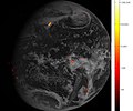 GOES-16 first GLM data.jpg 928 × 775; 87 KB
-

-
 GOES-17 Data Now Available Through GRB (42521853550).jpg 1,200 × 900; 211 KB
-
 GOES-17 Imagery from all 16 of the Advanced Baseline Imager's Channels (43904871081).gif 1,926 × 1,206; 1.39 MB
-
 GOES-18 full disk GeoColor image from May 5, 2022.png 9,896 × 10,002; 128.71 MB
-
 January 27 west coast storm complex.jpg 2,500 × 1,500; 727 KB
-
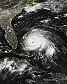
 Laura 2020-08-27 0616Z.jpg 2,500 × 1,500; 513 KB
-
 NOAA Shares First Infrared Imagery from GOES-17 (43904870711).gif 1,280 × 960; 381 KB
-
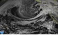
 Satellite image of water vapor over Northern rockies March 19, 2020.jpg 1,200 × 1,200; 254 KB
.jpg)

.jpg)
.jpg)


.jpg)
.jpg)
.jpg)
.jpg)


.jpg)

.jpg)
.jpg)
.gif)


.gif)
