Category:Photos from Panoramio ID 4847496

Media in category "Photos from Panoramio ID 4847496"
The following 41 files are in this category, out of 41 total.
-
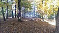
 360 panoramic of the clearing - panoramio.jpg 12,288 × 1,336; 3.54 MB
-
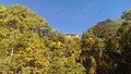
 A ledge at Mount Yonah - panoramio.jpg 7,168 × 3,584; 6.63 MB
-
 A water source on the trail - panoramio.jpg 2,688 × 1,520; 2.04 MB
-
 Beach at Red Top - panoramio.jpg 2,688 × 1,520; 1.76 MB
-
 Blood mountain on the east side - panoramio.jpg 6,264 × 4,148; 8.62 MB
-
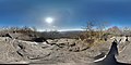 Blood Mountain Photosphere - panoramio.jpg 7,168 × 3,584; 7.36 MB
-
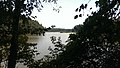 Chattahoochee river from Gold Branch - panoramio (1).jpg 2,688 × 1,520; 1.51 MB
-
 Chattahoochee river from Gold Branch - panoramio (2).jpg 2,688 × 1,520; 1.66 MB
-
 Chattahoochee river from Gold Branch - panoramio.jpg 2,688 × 1,520; 1.89 MB
-
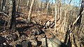 Freeman Trail Terrain - panoramio.jpg 2,688 × 1,520; 2.26 MB
-
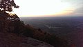 From Mount Yonah at sunrise - panoramio.jpg 2,688 × 1,520; 818 KB
-
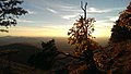 From Mount Yonah at sunset - panoramio.jpg 2,688 × 1,520; 1.41 MB
-
 Gold Branch Photosphere - panoramio.jpg 6,144 × 3,072; 8.74 MB
-
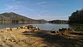
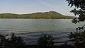 Lake from Red Top Mountain Picnic - panoramio.jpg 2,688 × 1,520; 1.57 MB
-
 Mount Yonah at sunset - panoramio.jpg 6,292 × 4,128; 4.51 MB
-
 Mount Yonah clearing mid way up the trail - panoramio.jpg 2,688 × 1,520; 2.15 MB
-
 Mount Yonah from the parking lot - panoramio.jpg 2,688 × 1,520; 1.97 MB
-
 Mount Yonah sunrise photosphere - panoramio.jpg 7,168 × 3,584; 4.67 MB
-
 Mount Yonah Trail looking up - panoramio.jpg 2,688 × 1,520; 2.52 MB
-
 Mount Yonah Trail view from first clearing - panoramio.jpg 5,912 × 4,202; 5.8 MB
-
 Mount Yonah Trail, ankles beware - panoramio.jpg 2,688 × 1,520; 1.95 MB
-
 Near the top of Blood Mountain - panoramio.jpg 6,252 × 4,088; 7.3 MB
-
 On the trail in the fog - panoramio.jpg 2,688 × 1,520; 1.31 MB
-
 On the trail in the rain - panoramio.jpg 2,688 × 1,520; 1.64 MB
-
 Pine Mountain Above Fatman Squeeze - panoramio.jpg 2,688 × 1,520; 2.1 MB
-
 Pine Mountain Mossy Rocks - panoramio.jpg 2,688 × 1,520; 2.2 MB
-
 Pine Mountain Path - panoramio.jpg 2,688 × 1,520; 1.96 MB
-
 Pine Mountain West Loop - panoramio.jpg 2,688 × 1,520; 1.86 MB
-
 Red Top Mountain Playground and Picnic - panoramio (1).jpg 2,688 × 1,520; 1.96 MB
-
 Red Top Mountain Playground and Picnic - panoramio.jpg 2,688 × 1,520; 2.08 MB
-
 Ruined car - panoramio.jpg 2,688 × 1,520; 1.62 MB
-
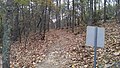
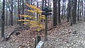
 Signpost for Freeman-AT west intersection. - panoramio.jpg 2,688 × 1,520; 2.25 MB
-
 Slaughter Mountain - panoramio (2).jpg 2,688 × 1,520; 2.84 MB
-
 Small place to rest on Blood Mountain - panoramio.jpg 6,234 × 4,168; 8.49 MB
-
 Start of the Redtop Iron Trail - panoramio.jpg 2,688 × 1,520; 1.81 MB
-
 Sunset on Lake Allatoona - panoramio.jpg 2,688 × 1,520; 1.23 MB
-
 The bald at the top of Mount Yonah - panoramio.jpg 2,688 × 1,520; 1.43 MB
-
 The path towards the Woods Hole shelter - panoramio.jpg 2,688 × 1,520; 2.32 MB
-
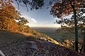
 The view from Freeman-AT east intersection - panoramio.jpg 2,688 × 1,520; 2.59 MB
-
 View from the trail - panoramio.jpg 2,688 × 1,520; 1.01 MB
-
 White County, GA, USA - panoramio.jpg 2,688 × 1,520; 1.45 MB


.jpg)
.jpg)


.jpg)


.jpg)


